Enable Location

We need your location to show you interesting places around you

Discover nearby places

Find interesting locations and hidden gems around you

Precise directions

Get accurate directions and distances to places

Your location is never shared with other users. It's only used when you tap the location button.

Juan de Fuca Marine Trail

Log in to your account

Start exploring — it's free

Trusted by 63,798 travelers worldwide

Continue with Google
Continue with Apple
or

We will send you a code to connect

By continuing, you accept our Terms and Conditions and our Privacy Policy

Check your inbox

We've sent a pincode in your inbox. Please enter the code below.

Juan de Fuca Marine Trail
Discussion Reviews 1 Photos 1 Collections
14k Popularity

Juan de Fuca Marine Trail, Coastal trail in Juan de Fuca Provincial Park, Canada

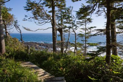
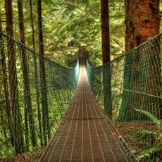
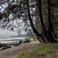
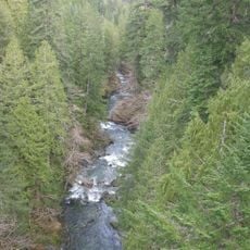
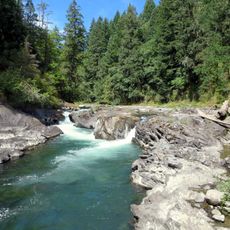
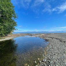
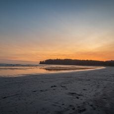
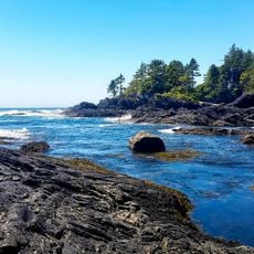
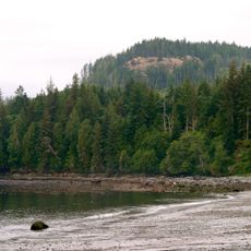
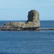
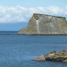
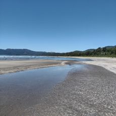
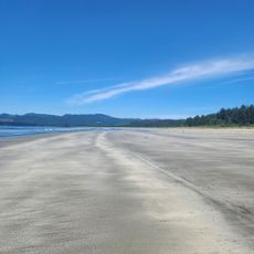
The Juan de Fuca Marine Trail is a coastal path stretching roughly 47 kilometers along Vancouver Island's southwestern shore, linking China Beach with Botanical Beach through varied terrain. The route passes through temperate rainforest, open coastline, rocky outcrops, sand beaches, and tidal pools that define the landscape.

The path originated as a rescue route in an area known as the Pacific Graveyard due to frequent shipwrecks. It was later developed into a hiking trail and is now managed by Parks Canada.

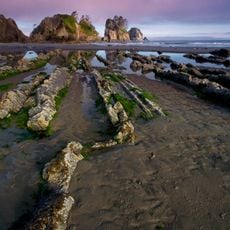
Marine research at Botanical Beach began in 1901 when the University of Minnesota established the first Pacific Northwest marine research station in this location.

The trail allows day hikes and multi-day backpacking trips without advance reservations. Pay attention to tide schedules, as some sections become impassable at high tide.

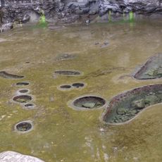
Multiple tide pools and rocky plateaus along the trail host a diverse marine ecosystem visible at low tide. These shallow water pockets reveal starfish, sea anemones, and other invertebrates normally hidden underwater.

The community of curious travelers

AroundUs brings together thousands of curated places, local tips, and hidden gems, enriched daily by 60,000 contributors worldwide.

Start exploring
Location
Juan de Fuca
GPS coordinates
48.46834,-124.23914
Latest update
December 6, 2025 16:02
British Columbia: The list of the most impressive landscapes from the Pacific to the Rockies

British Columbia shows its natural sights from the Pacific coast to the rocky peaks, with hot springs, ancient forests, and stunning fjords to explore.

Reviews
Share your experience

No review yet

Discussions
Start a discussion...

No discussion yet

« Juan de Fuca Marine Trail - Coastal trail in Juan de Fuca Provincial Park, Canada » is provided by Around Us (aroundus.com). Images and texts are derived from Wikimedia project under a Creative Commons license. You are allowed to copy, distribute, and modify copies of this page, under the conditions set by the license, as long as this note is clearly visible.

Discover hidden gems everywhere you go!

From secret cafés to breathtaking viewpoints, skip the crowded tourist spots and find places that match your style. Our app makes it easy with voice search, smart filtering, route optimization, and insider tips from travelers worldwide. Download now for the complete mobile experience.

Around Us App Screenshot

A unique approach to discovering new places

Le Figaro

All the places worth exploring

France Info

A tailor-made excursion in just a few clicks

20 Minutes

Around Us
Travel Guide & Maps
Download

Send to your phone

QR Code
1

Open the camera app on your mobile.

2

Point at the QR code with your camera. A notification will appear.

3

Tap the notification to open the link.