Mount Fitzgerald, Mountain summit in British Columbia, Canada.
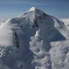
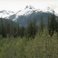
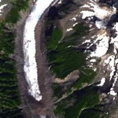
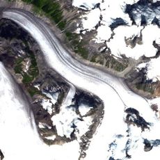
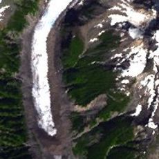
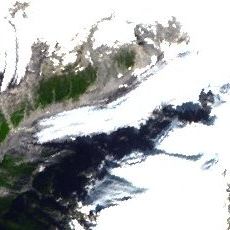
Mount Fitzgerald is a mountain summit located in the Pacific Ranges of British Columbia, rising to approximately 2,641 meters. The peak sits in a remote area east of Rivers Inlet within a region of alpine terrain and volcanic landscape.
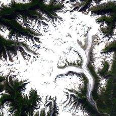
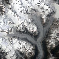
The mountain forms the northern edge of Silverthrone Caldera, shaped by volcanic activity in the Cascade Volcanic Arc. This geological formation resulted from ancient volcanism that also shaped the broader landscape of the region.
The mountain sits within traditional First Nations territories where Indigenous peoples maintain deep connections to the land. Local communities have long understood this landscape as part of their cultural heritage and identity.
Accessing this peak requires advanced mountaineering equipment and wilderness navigation skills due to its remote location. Visitors should prepare for harsh alpine conditions, unpredictable weather, and limited access during winter months.
The peak sits on the edge of a volcanic caldera with distinctive rock formations visible from several vantage points. This unusual position creates intricate geological patterns that make the terrain notably complex for climbing.
Location: British Columbia
Elevation above the sea: 2,641 m
GPS coordinates: 51.51720,-126.06551
Latest update: December 14, 2025 18:40
Mount Waddington
57.9 km
Monarch Mountain
44.6 km
Hunlen Falls
86.8 km
Mount Silverthrone
3.3 km
Canadian Cascade Arc
3.5 km
Mount Tiedemann
59.1 km
Sir Alexander Mackenzie Provincial Park
136.1 km
Monarch Icefield
48.2 km
Ha-Iltzuk Icefield
15.2 km
Homathko Icefield
112.4 km
Klinaklini Glacier
20.2 km
Salmon River
148.4 km
Scarlett Point Lighthouse
130.4 km
Southgate River
133.8 km
Penrose Island Marine Provincial Park
115.8 km
Echo Bay Marine Provincial Park
90.4 km
Broughton Archipelago Marine Provincial Park
102.4 km
Kingcome River
41.4 km
Pashleth Glacier
10.6 km
Kingcome Glacier
18.8 km
Franklin Glacier
54.8 km
Trudel Glacier
15.4 km
Addenbroke Island light station
124.8 km
Tweedsmuir Provincial Park
114.4 km
Egg Island Lighthouse
126.4 km
Franklin River
55.3 km
Pine Island Lighthouse
130.6 km
Pulteney Point Lighthouse
124.7 kmVisited this place? Tap the stars to rate it and share your experience / photos with the community! Try now! You can cancel it anytime.
Discover hidden gems everywhere you go!
From secret cafés to breathtaking viewpoints, skip the crowded tourist spots and find places that match your style. Our app makes it easy with voice search, smart filtering, route optimization, and insider tips from travelers worldwide. Download now for the complete mobile experience.
A unique approach to discovering new places❞
— Le Figaro
All the places worth exploring❞
— France Info
A tailor-made excursion in just a few clicks❞
— 20 Minutes