Chest opened
+${chestReward.xp} XP
Explorer
NOUVEAU ×${chestReward.collectible.quantity}
tapez pour fermer
Chest locked

Open chests in the app

Around Us is built for your phone — chests unlock when you walk, explore and capture nearby places.

Enable Location

We need your location to show you interesting places around you

Discover nearby places

Find interesting locations and hidden gems around you

Precise directions

Get accurate directions and distances to places

Your location is never shared with other users. It's only used when you tap the location button.

Rattlesnake Lake

Log in to your account

Start exploring — it's free

Trusted by 72,935 travelers worldwide

Continue with Google
Continue with Apple
or

We will send you a code to connect

By continuing, you accept our Terms and Conditions and our Privacy Policy

Check your inbox

We've sent a pincode in your inbox. Please enter the code below.

Rattlesnake Lake
Discussion Reviews 1 Photos
11.4k Popularity

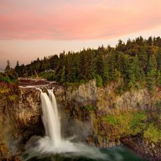
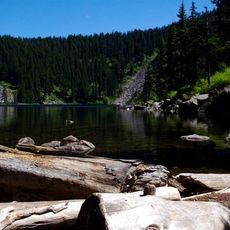
Rattlesnake Lake, Natural lake in King County, United States.

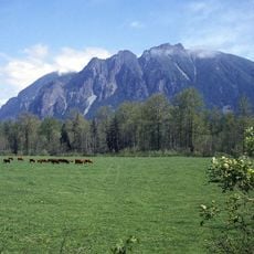
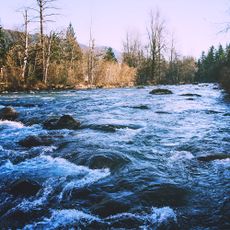
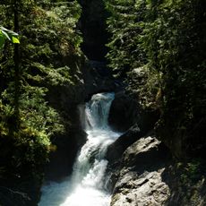
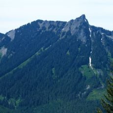
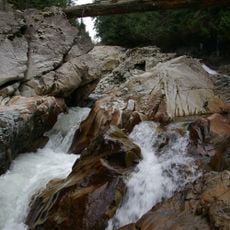
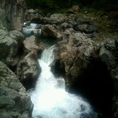
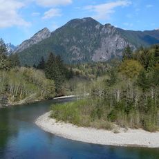
Rattlesnake Lake is a spring-fed body of water in King County that reflects the surrounding mountain ridges and forests. The lake sits at an elevation where you can see the Cedar River watershed feed into it, creating clear waters throughout the year.

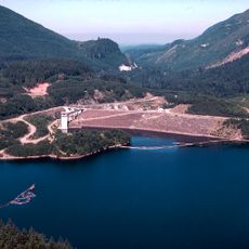
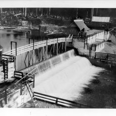
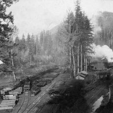
The lake was developed in the early 1900s as part of Seattle's water supply system, storing water from the Cedar River watershed for the city. It later became a nature preserve and recreational area, shifting from purely utilitarian use to supporting both conservation and public enjoyment.

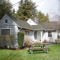
The education center near the shore shares displays about water management and how this lake connects the region's mountains to the communities below. People come here to understand the relationship between the water and the land around them.

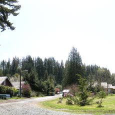
The lake is accessible from the developed east shore area where you will find parking, restrooms, and facilities for small boats. Plan your visit during dry weather when the trails and viewing areas are in the best condition.

The water level drops noticeably through the summer months as snowmelt from the mountains decreases, revealing different shorelines as the season progresses. This shift happens so regularly that the shape of the lake's edge changes throughout the year.

The community of curious travelers

AroundUs brings together thousands of curated places, local tips, and hidden gems, enriched daily by 60,000 contributors worldwide.

Start exploring
Location
GPS coordinates
47.43030,-121.77300
Latest update
December 8, 2025 13:41
Around this place
Snoqualmie Falls
United States of America

Snoqualmie Falls

13.3 km
Mount Si
United States of America

Mount Si

8.9 km
Snoqualmie Falls Hydroelectric Plant
United States of America

Snoqualmie Falls Hydroelectric Plant

13.7 km
Northwest Railway Museum
United States of America

Northwest Railway Museum

11.6 km
Kanaskat-Palmer State Park
United States of America

Kanaskat-Palmer State Park

15.9 km
Selleck, Washington
United States of America

Selleck, Washington

9.3 km
Howard A. Hanson Dam
United States of America

Howard A. Hanson Dam

17 km
Olallie State Park
United States of America

Olallie State Park

9.1 km
Twin Falls
United States of America

Twin Falls

6 km
Bandera Mountain
United States of America

Bandera Mountain

17.7 km
McClellan Butte
United States of America

McClellan Butte

11.6 km
Camp North Bend
United States of America

Camp North Bend

5.3 km
Weeks Falls
United States of America

Weeks Falls

9.6 km
Seattle Municipal Light and Power Plant
United States of America

Seattle Municipal Light and Power Plant

1.4 km
Fantastic Falls
United States of America

Fantastic Falls

12.4 km
Messenger of Peace Chapel Car
United States of America

Messenger of Peace Chapel Car

9.9 km
The Pulpit
Canada

The Pulpit

19.5 km
North Bend Ranger Station
United States of America

North Bend Ranger Station

6.6 km
Middle Twin Falls
United States of America

Middle Twin Falls

6.1 km
Eagle Gorge
United States of America

Eagle Gorge

18.8 km
Upper Twin Falls
United States of America

Upper Twin Falls

6 km
Fall City Masonic Hall
United States of America

Fall City Masonic Hall

17.6 km
Mount Si Golf Course
United States of America

Mount Si Golf Course

9.8 km
Our Lady of Sorrows (Snoqualmie)
United States of America

Our Lady of Sorrows (Snoqualmie)

11.1 km
Snoqualmie Falls Hydroelectric Museum
United States of America

Snoqualmie Falls Hydroelectric Museum

13 km
North Bend Theatre
United States of America

North Bend Theatre

7.4 km
North Bend Library
United States of America

North Bend Library

7.5 km
Washington State Route 202 Bridge over the Snoqualmie River
United States of America

Washington State Route 202 Bridge over the Snoqualmie River

17.6 km
Show the full map
Reviews
Share your experience

No review yet

Discussions
Start a discussion...

No discussion yet

« Rattlesnake Lake - Natural lake in King County, United States » is provided by Around Us (aroundus.com). Images and texts are derived from Wikimedia project under a Creative Commons license. You are allowed to copy, distribute, and modify copies of this page, under the conditions set by the license, as long as this note is clearly visible.

Discover hidden gems everywhere you go!

From secret cafés to breathtaking viewpoints, skip the crowded tourist spots and find places that match your style. Our app makes it easy with voice search, smart filtering, route optimization, and insider tips from travelers worldwide. Download now for the complete mobile experience.

Around Us App Screenshot

A unique approach to discovering new places

Le Figaro

All the places worth exploring

France Info

A tailor-made excursion in just a few clicks

20 Minutes

Around Us
Travel Guide & Maps
Download

Send to your phone

QR Code
1

Open the camera app on your mobile.

2

Point at the QR code with your camera. A notification will appear.

3

Tap the notification to open the link.