Enable Location

We need your location to show you interesting places around you

Discover nearby places

Find interesting locations and hidden gems around you

Precise directions

Get accurate directions and distances to places

Your location is never shared with other users. It's only used when you tap the location button.

Mission Santa Barbara

Log in to your account

Start exploring — it's free

Trusted by 61,324 travelers worldwide

Continue with Google
Continue with Apple
or

We will send you a code to connect

By continuing, you accept our Terms and Conditions and our Privacy Policy

Check your inbox

We've sent a pincode in your inbox. Please enter the code below.

Mission Santa Barbara, Spanish mission station in Santa Barbara County, United States

Description

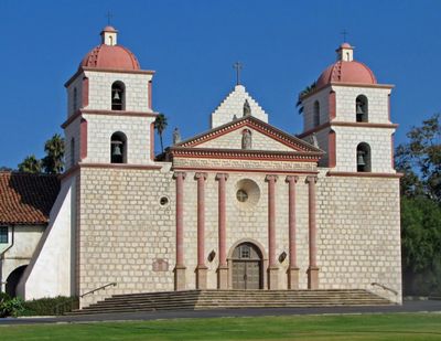
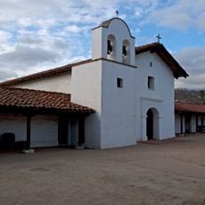
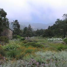
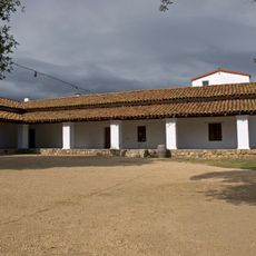
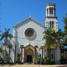
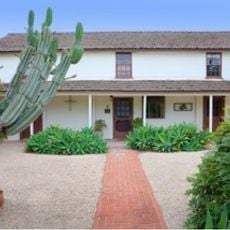
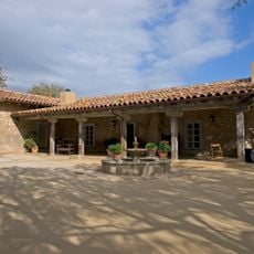
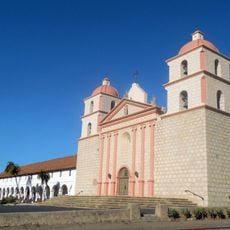
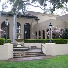
Mission Santa Barbara is a Spanish mission station in Santa Barbara County, California, positioned on a hill above the city. The complex consists of a church with two bell towers, an interior courtyard with a fountain, cloister buildings, and an expansive garden area with olive trees and palms.

History

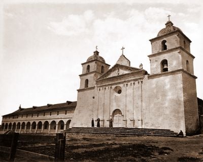
Franciscan priest Fermín Lasuén founded this mission in 1786 as the tenth establishment in the California mission chain. A severe earthquake destroyed parts of the complex in 1812, after which the current stone church with reinforced construction was built.

Culture

The church carries the title "Queen of the Missions" and displays a neoclassical facade that imitates Roman temples, bringing a European architectural style to early California. The cemetery holds graves of Chumash congregation members alongside early Spanish settlers, reflecting the encounters and tensions of that era.

Practical

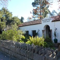
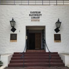
A museum next to the church displays objects from the mission period and explains daily life during Spanish colonial times. The gardens and cemetery can be visited freely, while entry to the church interior and museum typically requires an admission contribution.

Did you know?

An underground aqueduct system from the late 18th century supplied the mission with water from a nearby creek and still partly functions today. The stone fountain in the courtyard was built by Chumash workers under the guidance of Spanish master masons and shows a blend of indigenous and European craft techniques.

Inception
1722
GPS coordinates
34.43830,-119.71400
Latest update
December 13, 2025 17:11

AroundUs brings together thousands of curated places, local tips, and hidden gems, enriched daily by 60,000 contributors worldwide. Discover all places nearby (Santa Barbara County).

Around this place
Moreton Bay Fig Tree
United States of America

Moreton Bay Fig Tree

3.3 km
Presidio of Santa Barbara
United States of America

Presidio of Santa Barbara

2.3 km
Santa Barbara Bowl
United States of America

Santa Barbara Bowl

2 km
Santa Barbara County Courthouse
United States of America

Santa Barbara County Courthouse

1.9 km
Santa Barbara Museum of Natural History
United States of America

Santa Barbara Museum of Natural History

305 m
Karpeles Manuscript Library Museums
United States of America

Karpeles Manuscript Library Museums

1.9 km
Santa Barbara Museum of Art
United States of America

Santa Barbara Museum of Art

1.9 km
Santa Barbara Botanic Garden
United States of America

Santa Barbara Botanic Garden

1.8 km
Casa de la Guerra
United States of America

Casa de la Guerra

2.4 km
Lobero Theatre
United States of America

Lobero Theatre

2.3 km
Rafael Gonzalez House
United States of America

Rafael Gonzalez House

2.3 km
Our Lady of Sorrows Church
United States of America

Our Lady of Sorrows Church

1.5 km
Arlington Theatre
United States of America

Arlington Theatre

2.8 km
United States of America

Covarrubias Adobe

2.6 km
Casa Dolores
United States of America

Casa Dolores

2.3 km
Santa Barbara Historical Museum
United States of America

Santa Barbara Historical Museum

2.4 km
Allan Herschell 3-Abreast Carousel
United States of America

Allan Herschell 3-Abreast Carousel

3.7 km
The Wolf Museum of Exploration and Innovation
United States of America

The Wolf Museum of Exploration and Innovation

3.4 km
Paseo de la Guerra
United States of America

Paseo de la Guerra

2.4 km
Santa Barbara Mission-Archive Library
United States of America

Santa Barbara Mission-Archive Library

47 m
Hill-Carrillo Adobe
United States of America

Hill-Carrillo Adobe

2.1 km
Janssens-Orella-Birk Building
United States of America

Janssens-Orella-Birk Building

2.1 km
Trinity Episcopal Church
United States of America

Trinity Episcopal Church

1.4 km
Rocky Nook Park
United States of America

Rocky Nook Park

577 m
Granada Theater
United States of America

Granada Theater

1.8 km
A.C. Postel Memorial Rose Garden
United States of America

A.C. Postel Memorial Rose Garden

225 m
Rattlesnake Canyon Bridge
United States of America

Rattlesnake Canyon Bridge

2.9 km
Santa Barbara Public Library
United States of America

Santa Barbara Public Library

1.9 km
Show the full map
« Mission Santa Barbara - Spanish mission station in Santa Barbara County, United States » is provided by Around Us (aroundus.com). Images and texts are derived from Wikimedia project under a Creative Commons license. You are allowed to copy, distribute, and modify copies of this page, under the conditions set by the license, as long as this note is clearly visible.

Discover hidden gems everywhere you go!

From secret cafés to breathtaking viewpoints, skip the crowded tourist spots and find places that match your style. Our app makes it easy with voice search, smart filtering, route optimization, and insider tips from travelers worldwide. Download now for the complete mobile experience.

Around Us App Screenshot

A unique approach to discovering new places

Le Figaro

All the places worth exploring

France Info

A tailor-made excursion in just a few clicks

20 Minutes

Around Us
Travel Guide & Maps
Download

Send to your phone

QR Code
1

Open the camera app on your mobile.

2

Point at the QR code with your camera. A notification will appear.

3

Tap the notification to open the link.