Enable Location

We need your location to show you interesting places around you

Discover nearby places

Find interesting locations and hidden gems around you

Precise directions

Get accurate directions and distances to places

Your location is never shared with other users. It's only used when you tap the location button.

Bakersfield

Log in to your account

Start exploring — it's free

Trusted by 62,631 travelers worldwide

Continue with Google
Continue with Apple
or

We will send you a code to connect

By continuing, you accept our Terms and Conditions and our Privacy Policy

Check your inbox

We've sent a pincode in your inbox. Please enter the code below.

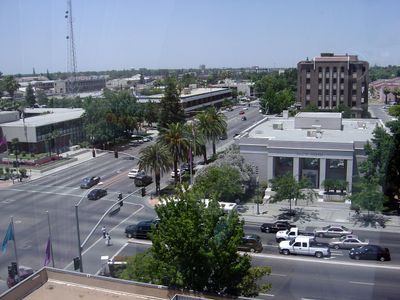
Bakersfield, County seat in San Joaquin Valley, United States

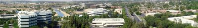
This city sits at the southern end of California's Central Valley at about 400 feet above sea level. It covers roughly 150 square miles and is crossed by the Kern River, which flows down from the Sierra Nevada mountains.

The arrival of the Southern Pacific Railroad in 1874 transformed a small settlement into a major transport hub. Over the following decades, the population grew rapidly as oil fields were developed and irrigation systems brought agriculture to the valley floor.

Local musicians continue to play the raw electric country sound that was born in the city's clubs and bars decades ago. On weekends, dance floors fill with people who come to hear live music and enjoy the down-to-earth atmosphere.

Most places of interest are spread along wide main roads and are best reached by car. Summer temperatures regularly climb above 90 degrees Fahrenheit (32 degrees Celsius), so plan visits for early morning or late afternoon.

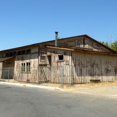
Oil pumps often stand right next to fruit orchards and cotton fields, an unusual mix of industry and agriculture. You can see the nodding pump jacks even in residential neighborhoods, where they have been part of the everyday landscape for generations.

The community of curious travelers

AroundUs brings together thousands of curated places, local tips, and hidden gems, enriched daily by 60,000 contributors worldwide.

Start exploring
Location
Inception
1869
Elevation above the sea
123 m
GPS coordinates
35.37387,-119.01946
Latest update
December 14, 2025 19:16
The top 50 US cities by population, from New York to Arlington

From New York to Arlington, discover the 50 cities that shape America, from California's tech centers to the historic strongholds of the east coast, passing through the energy hubs of Texas.

Around this place
Weedpatch Camp
United States of America

Weedpatch Camp

12.8 km
Buck Owens Crystal Palace
United States of America

Buck Owens Crystal Palace

2.5 km
Kevin Harvick's Kern Raceway
United States of America

Kevin Harvick's Kern Raceway

12.2 km
Memorial Stadium
United States of America

Memorial Stadium

5.9 km
California Living Museum
United States of America

California Living Museum

13.8 km
Kern County Museum
United States of America

Kern County Museum

2.1 km
Beale Memorial Clock Tower
United States of America

Beale Memorial Clock Tower

2.1 km
Bakersfield City Hall
United States of America

Bakersfield City Hall

122 m
Bakersfield Museum of Art
United States of America

Bakersfield Museum of Art

1 km
Bakersfield California Building
United States of America

Bakersfield California Building

126 m
Buena Vista Museum of Natural History
United States of America

Buena Vista Museum of Natural History

436 m
Baker Branch Library
United States of America

Baker Branch Library

2.9 km
Tevis Block
United States of America

Tevis Block

327 m
United States of America

Rio Bravo Country Club

16.8 km
Jastro Building
United States of America

Jastro Building

344 m
Kern County Chamber of Commerce Building
United States of America

Kern County Chamber of Commerce Building

2.2 km
Kern Veterans Memorial
United States of America

Kern Veterans Memorial

1 km
United States of America

Hopper Mountain National Wildlife Refuge Complex

21.6 km
Alano Club Of Bakersfield
United States of America

Alano Club Of Bakersfield

1.9 km
United States of America

Metropolitan Recreation Center

2.4 km
United States of America

Di Giorgio County Park

25.5 km
United States of America

Westwood Park

7.8 km
United States of America

Kern River Golf Course

16 km
United States of America

Father Garces Monument

17.6 km
United States of America

Sundale Country Club

5.7 km
United States of America

Bakersfield observatory

10.4 km
Beale Memorial Library
United States of America

Beale Memorial Library

878 m
United States of America

Stars Theater

339 m
Show the full map
« Bakersfield - County seat in San Joaquin Valley, United States » is provided by Around Us (aroundus.com). Images and texts are derived from Wikimedia project under a Creative Commons license. You are allowed to copy, distribute, and modify copies of this page, under the conditions set by the license, as long as this note is clearly visible.

Discover hidden gems everywhere you go!

From secret cafés to breathtaking viewpoints, skip the crowded tourist spots and find places that match your style. Our app makes it easy with voice search, smart filtering, route optimization, and insider tips from travelers worldwide. Download now for the complete mobile experience.

Around Us App Screenshot

A unique approach to discovering new places

Le Figaro

All the places worth exploring

France Info

A tailor-made excursion in just a few clicks

20 Minutes

Around Us
Travel Guide & Maps
Download

Send to your phone

QR Code
1

Open the camera app on your mobile.

2

Point at the QR code with your camera. A notification will appear.

3

Tap the notification to open the link.