Palmdale, Charter city in Antelope Valley, Los Angeles County, United States
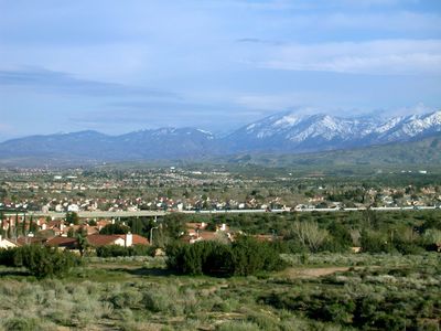
Palmdale is a charter city in the southern Antelope Valley within Los Angeles County, California. It covers roughly 275 square kilometers (106 square miles) of desert terrain, with the San Gabriel Mountains forming a natural boundary to the south.
German Lutheran immigrants established a settlement called Palmenthal here in 1886. The founding group named the place after what they believed were palm trees, though they were actually looking at Joshua trees.
The name reflects a case of botanical confusion when early German settlers mistook Joshua trees for palms. This mix-up continues to shape how the city presents itself, connecting desert surroundings to an idea borrowed from warmer coastal regions.
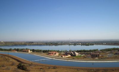
The California Aqueduct runs through the area, bringing water to support farming and residential neighborhoods. Access to the city follows major highways that link the desert region with surrounding counties.
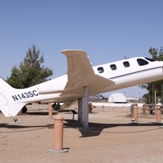
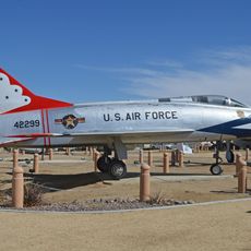
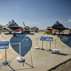
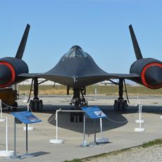
The local airport serves as a major site for aerospace companies that assemble aircraft and test electronic systems. This presence gives the desert city an industrial dimension not immediately apparent from the surrounding landscape.
Location: Los Angeles County
Inception: 1886
Elevation above the sea: 810 m
Shares border with: Lancaster, Littlerock
Website: http://cityofpalmdale.org
GPS coordinates: 34.57943,-118.11646
Latest update: December 4, 2025 19:00
Antelope Valley California Poppy Reserve State Natural Reserve
30.4 km
Shambala Preserve
19.9 km
Devil's Punchbowl
31.1 km
Scaled Composites Triumph
3.7 km
Joe Davies Heritage Airpark
3.7 km
Shea's Castle
28.6 km
Bouquet Reservoir
24.1 km
Antelope Valley Indian Museum State Historic Park
25.8 km
Saddleback Butte State Park
30.9 km
Big Tujunga Dam
32.5 km
Dry Town Water Park
5.7 km
Littlerock Dam
13.6 km
Strawberry Peak
33 km
Vetter Mountain
32.5 km
Waterman Mountain
31.7 km
Fairmont Butte
32.7 km
Western Hotel
13.4 km
Stony Ridge Observatory
32.8 km
Willow Springs Canyon
26.2 km
Vasquez Rocks
21.5 km
Blackbird Airpark
3.8 km
Moah:cedar
13.3 km
Elyze Clifford Interpretive Center
12.1 km
Century Circle
34.5 km
Blackbird Airpark
3.8 km
Vasquez Rocks Park
21.4 km
Armstrong Aircraft Operations Facility
5.1 km
Vetter Mountain Lookout
32.5 kmReviews
Visited this place? Tap the stars to rate it and share your experience / photos with the community! Try now! You can cancel it anytime.
Discover hidden gems everywhere you go!
From secret cafés to breathtaking viewpoints, skip the crowded tourist spots and find places that match your style. Our app makes it easy with voice search, smart filtering, route optimization, and insider tips from travelers worldwide. Download now for the complete mobile experience.
A unique approach to discovering new places❞
— Le Figaro
All the places worth exploring❞
— France Info
A tailor-made excursion in just a few clicks❞
— 20 Minutes