Enable Location

We need your location to show you interesting places around you

Discover nearby places

Find interesting locations and hidden gems around you

Precise directions

Get accurate directions and distances to places

Your location is never shared with other users. It's only used when you tap the location button.

Thomas Leavitt House

Log in to your account

Start exploring — it's free

Trusted by 61,990 travelers worldwide

Continue with Google
Continue with Apple
or

We will send you a code to connect

By continuing, you accept our Terms and Conditions and our Privacy Policy

Check your inbox

We've sent a pincode in your inbox. Please enter the code below.

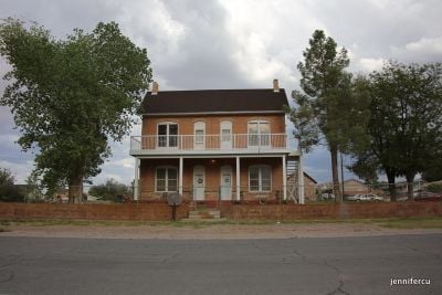
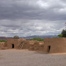
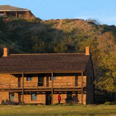
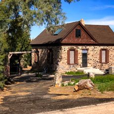
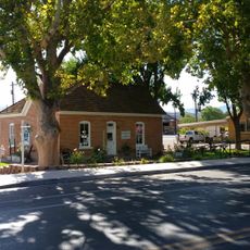
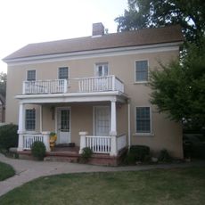
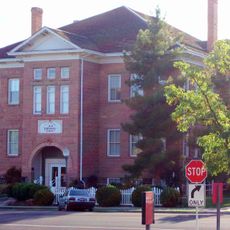
Thomas Leavitt House, Historic residence at First West Street in Bunkerville, Nevada.

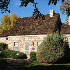
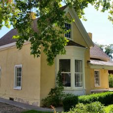
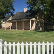
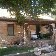
The Thomas Leavitt House is a two-story brick building with several exterior doors and large wooden porches framing its walls. The grounds include an original stone granary and small outbuildings that remain intact today.

The building was constructed in 1895 by Thomas Dudley Leavitt during the early growth of Bunkerville. It gained recognition on the National Register of Historic Places for its architectural importance to the region.

The house shows a design typical of Mormon settlements, with its T-shaped form and multiple doors that allowed extended family groups to live together under one roof. This layout is still visible today and reflects how families shared the space.

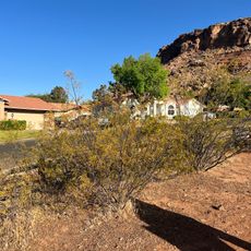
The house sits on First West Street in Bunkerville and is accessible from the local street network. The outbuildings on the grounds can be viewed from outside.

The property once housed two families and a total of 22 children, showing how large family groups lived together in this era. Honey locust trees that still grow on the grounds are original plantings from that time and shape the landscape today.

The community of curious travelers

AroundUs brings together thousands of curated places, local tips, and hidden gems, enriched daily by 60,000 contributors worldwide.

Start exploring
Location
GPS coordinates
36.77083,-114.12694
Latest update
December 14, 2025 18:11
Around this place
Valley of Fire State Park
United States of America

Valley of Fire State Park

51.8 km
St. George Utah Temple
United States of America

St. George Utah Temple

61.1 km
Double Negative
United States of America

Double Negative

26 km
Virgin River Gorge
United States of America

Virgin River Gorge

29.1 km
Lost City Museum
United States of America

Lost City Museum

38.6 km
Warm Springs Natural Area
United States of America

Warm Springs Natural Area

52.8 km
Beaver Dam Wash National Conservation Area
United States of America

Beaver Dam Wash National Conservation Area

36.5 km
United States of America

Black Rock

48.9 km
Moapa Valley National Wildlife Refuge
United States of America

Moapa Valley National Wildlife Refuge

53.1 km
Jacob Hamblin House
United States of America

Jacob Hamblin House

57.9 km
United States of America

Webb Hill

59.1 km
Paiute Wilderness
United States of America

Paiute Wilderness

27.7 km
St. George Children's Museum
United States of America

St. George Children's Museum

61.1 km
Parley Hunt House
United States of America

Parley Hunt House

1.1 km
Sand Hollow Wash Bridge
United States of America

Sand Hollow Wash Bridge

13 km
Yellow Knolls
United States of America

Yellow Knolls

41.2 km
George and Bertha Graff House
United States of America

George and Bertha Graff House

58.5 km
Wallace Blake House
United States of America

Wallace Blake House

55.8 km
Hans George Hafen House
United States of America

Hans George Hafen House

58.3 km
William F. Butler House
United States of America

William F. Butler House

60.6 km
Davidson Peak
United States of America

Davidson Peak

22.5 km
Frederick, Jr., and Mary F. Reber House
United States of America

Frederick, Jr., and Mary F. Reber House

58 km
Lost City Museum-Archaeology
United States of America

Lost City Museum-Archaeology

38.7 km
Frederick and Anna Maria Reber House
United States of America

Frederick and Anna Maria Reber House

58.4 km
Bloomington Petroglyph Park
United States of America

Bloomington Petroglyph Park

55.3 km
Little Finland
United States of America

Little Finland

36.7 km
Main Building of Dixie College
United States of America

Main Building of Dixie College

61.2 km
Little Black Mountain Petroglyph Site
United States of America

Little Black Mountain Petroglyph Site

60.4 km
Show the full map
« Thomas Leavitt House - Historic residence at First West Street in Bunkerville, Nevada » is provided by Around Us (aroundus.com). Images and texts are derived from Wikimedia project under a Creative Commons license. You are allowed to copy, distribute, and modify copies of this page, under the conditions set by the license, as long as this note is clearly visible.

Discover hidden gems everywhere you go!

From secret cafés to breathtaking viewpoints, skip the crowded tourist spots and find places that match your style. Our app makes it easy with voice search, smart filtering, route optimization, and insider tips from travelers worldwide. Download now for the complete mobile experience.

Around Us App Screenshot

A unique approach to discovering new places

Le Figaro

All the places worth exploring

France Info

A tailor-made excursion in just a few clicks

20 Minutes

Around Us
Travel Guide & Maps
Download

Send to your phone

QR Code
1

Open the camera app on your mobile.

2

Point at the QR code with your camera. A notification will appear.

3

Tap the notification to open the link.