Chest opened
+${chestReward.xp} XP
Explorer
NOUVEAU ×${chestReward.collectible.quantity}
tapez pour fermer
Chest locked

Open chests in the app

Around Us is built for your phone — chests unlock when you walk, explore and capture nearby places.

Enable Location

We need your location to show you interesting places around you

Discover nearby places

Find interesting locations and hidden gems around you

Precise directions

Get accurate directions and distances to places

Your location is never shared with other users. It's only used when you tap the location button.

Log in to your account

Start exploring — it's free

Trusted by 72,886 travelers worldwide

Continue with Google
Continue with Apple
or

We will send you a code to connect

By continuing, you accept our Terms and Conditions and our Privacy Policy

Check your inbox

We've sent a pincode in your inbox. Please enter the code below.

Truckee Meadows
Discussion Reviews Photo
13.2k Popularity

Truckee Meadows, Valley plain in Northern Nevada, United States

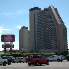
Truckee Meadows is a valley floor bordered by distinct mountain ridges, including the Carson Range, Virginia Range, and Peavine Peak. The landscape sits as a broad basin where urban centers like Reno and Sparks developed alongside remaining open grasslands and lower-lying terrain.

The Washoe people inhabited this region for generations before 1857, when rancher Peleg Brown introduced large-scale farming and established the Damonte Ranch. This marked the beginning of European settlement and the gradual transformation of the landscape from natural grasslands to agricultural use.

The name "Truckee" comes from the Washoe word "trokay," meaning river or creek. This valley held deep significance for the Washoe people who inhabited and shaped this landscape.

The valley is best explored by car since the region spreads across different communities separated by open space. Walking trails exist in peripheral areas and along creeks, allowing closer views of the natural features and mountain backdrop.

The Steamboat Creek area supports a mix of native plants like wild rye, rushes, cottonwoods, and willows that thrive in wet conditions. These riparian zones create a distinct green corridor that contrasts sharply with the surrounding dry mountain terrain.

The community of curious travelers

AroundUs brings together thousands of curated places, local tips, and hidden gems, enriched daily by 60,000 contributors worldwide.

Start exploring
Location
GPS coordinates
39.46074,-119.76352
Latest update
December 7, 2025 20:41
Around this place
Nugget Casino Resort
United States of America

Nugget Casino Resort

8.2 km
Pioneer Center for the Performing Arts
United States of America

Pioneer Center for the Performing Arts

8.1 km
Washoe County Library
United States of America

Washoe County Library

7.9 km
Greystone Castle
United States of America

Greystone Castle

7.6 km
Washoe County Courthouse
United States of America

Washoe County Courthouse

7.9 km
Luella Garvey House
United States of America

Luella Garvey House

8.2 km
Lake Mansion
United States of America

Lake Mansion

3.3 km
Peleg Brown Ranch
United States of America

Peleg Brown Ranch

5.6 km
Veterans Memorial School
United States of America

Veterans Memorial School

6.6 km
Glendale School
United States of America

Glendale School

3.3 km
Reno National Bank-First Interstate Bank
United States of America

Reno National Bank-First Interstate Bank

8 km
Levy House
United States of America

Levy House

7.8 km
Mount Rose Elementary School
United States of America

Mount Rose Elementary School

7.5 km
Veterans of Foreign Wars Building
United States of America

Veterans of Foreign Wars Building

4.4 km
Vachina Apartments-California Apartments
United States of America

Vachina Apartments-California Apartments

8 km
Field Matron's Cottage
United States of America

Field Matron's Cottage

7.7 km
Newlands Historic District
United States of America

Newlands Historic District

7.9 km
Tyson House
United States of America

Tyson House

8 km
W.E. Barnard House
United States of America

W.E. Barnard House

7.5 km
Southside School
United States of America

Southside School

7.8 km
Charles H. Burke House
United States of America

Charles H. Burke House

7.8 km
Joseph Giraud House
United States of America

Joseph Giraud House

7.9 km
McCarthy-Platt House
United States of America

McCarthy-Platt House

7.3 km
Nortonia Boarding House
United States of America

Nortonia Boarding House

8 km
William J. Graham House
United States of America

William J. Graham House

8 km
Patrick Ranch House
United States of America

Patrick Ranch House

7.4 km
J. Clarence Kind House
United States of America

J. Clarence Kind House

8.1 km
High Sierra Lanes
United States of America

High Sierra Lanes

4.5 km
Show the full map
Reviews
Share your experience

No review yet

Discussions
Start a discussion...

No discussion yet

« Truckee Meadows - Valley plain in Northern Nevada, United States » is provided by Around Us (aroundus.com). Images and texts are derived from Wikimedia project under a Creative Commons license. You are allowed to copy, distribute, and modify copies of this page, under the conditions set by the license, as long as this note is clearly visible.

Discover hidden gems everywhere you go!

From secret cafés to breathtaking viewpoints, skip the crowded tourist spots and find places that match your style. Our app makes it easy with voice search, smart filtering, route optimization, and insider tips from travelers worldwide. Download now for the complete mobile experience.

Around Us App Screenshot

A unique approach to discovering new places

Le Figaro

All the places worth exploring

France Info

A tailor-made excursion in just a few clicks

20 Minutes

Around Us
Travel Guide & Maps
Download

Send to your phone

QR Code
1

Open the camera app on your mobile.

2

Point at the QR code with your camera. A notification will appear.

3

Tap the notification to open the link.