Enable Location

We need your location to show you interesting places around you

Discover nearby places

Find interesting locations and hidden gems around you

Precise directions

Get accurate directions and distances to places

Your location is never shared with other users. It's only used when you tap the location button.

Blauen

Log in to your account

Start exploring — it's free

Trusted by 61,908 travelers worldwide

Continue with Google
Continue with Apple
or

We will send you a code to connect

By continuing, you accept our Terms and Conditions and our Privacy Policy

Check your inbox

We've sent a pincode in your inbox. Please enter the code below.

Blauen

Blauen, Mountain summit in Black Forest, Germany

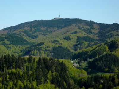
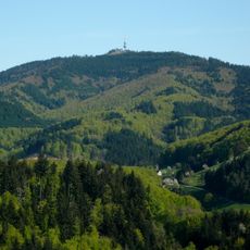
Hochblauen is a mountain in Baden-Württemberg that rises to 1,165 meters and is shared by the municipalities of Schliengen, Malsburg-Marzell, and Badenweiler. The summit features an open plateau with far-reaching views across the southern Upper Rhine Valley and surrounding Black Forest landscape.

The mountain was documented as Blauwen in 14th-century texts and later appeared in Matthäus Merian's geographical work from the 17th century. These early references show the site has held geographic importance for many centuries.

The summit serves as a popular gathering place for hikers and nature enthusiasts throughout the region. The open landscape at the top creates a space where visitors come together to enjoy views and connect with the natural surroundings.

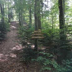
Several hiking trails lead to the summit from different starting points with varying difficulty levels. A road up the mountain allows visitors to reach the top by car if they prefer not to walk.

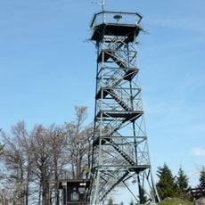
A steel lattice observation tower built in 1895 stands at the summit and underwent major restoration in 1984. The tower provides visitors with an additional viewing platform and reflects how the site has been used over time.

The community of curious travelers

AroundUs brings together thousands of curated places, local tips, and hidden gems, enriched daily by 60,000 contributors worldwide.

Start exploring
Elevation above the sea
1,165 m
GPS coordinates
47.77733,7.70124
Latest update
December 7, 2025 20:40
« Blauen - Mountain summit in Black Forest, Germany » is provided by Around Us (aroundus.com). Images and texts are derived from Wikimedia project under a Creative Commons license. You are allowed to copy, distribute, and modify copies of this page, under the conditions set by the license, as long as this note is clearly visible.

Discover hidden gems everywhere you go!

From secret cafés to breathtaking viewpoints, skip the crowded tourist spots and find places that match your style. Our app makes it easy with voice search, smart filtering, route optimization, and insider tips from travelers worldwide. Download now for the complete mobile experience.

Around Us App Screenshot

A unique approach to discovering new places

Le Figaro

All the places worth exploring

France Info

A tailor-made excursion in just a few clicks

20 Minutes

Around Us
Travel Guide & Maps
Download

Send to your phone

QR Code
1

Open the camera app on your mobile.

2

Point at the QR code with your camera. A notification will appear.

3

Tap the notification to open the link.