Upper Sandy Tank, reservoir in Navajo County, Arizona, United States of America
Location: Arizona
Location: Navajo County
GPS coordinates: 34.58214,-111.20068
Latest update: November 23, 2025 05:40

Blue Ridge Reservoir
3.7 km
Discovery Channel Telescope
27.1 km
Fossil Springs Wilderness
34.7 km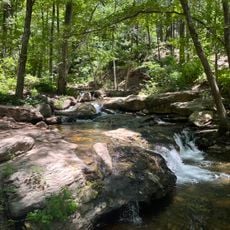
Horton Creek Trail #285
27.7 km
Buck Mountain Lookout Tower
21.8 km
Diamond Point Lookout Cabin
32.8 km
Promontory Butte Lookout Complex
29.5 km
Moqui Lookout Cabin
3.5 km
Battle of Big Dry Wash Historical Monument
4.4 km
Alcatraz Point
21.3 km
Moqui Lookout
3.5 km
Burnt Point
19.3 km
Baker Butte
21.8 km
Sand Point
28.4 km
Myrtle Point
23.7 km
Milk Ranch Point
28.3 km
Hi View Point
18.3 km
Leonard Point
15.3 km
Promontory Butte
29.9 km
Scenic viewpoint
26.5 km
Horseshoe Vista
25.7 km
High View Point
18.2 km
Scenic viewpoint
18.2 km
Scenic viewpoint
21.2 km
Hi View Point
18.3 km
Waterfall
32.7 km
Waterfall
32.7 km
Waterfall
32.6 kmReviews
Visited this place? Tap the stars to rate it and share your experience / photos with the community! Try now! You can cancel it anytime.
Discover hidden gems everywhere you go!
From secret cafés to breathtaking viewpoints, skip the crowded tourist spots and find places that match your style. Our app makes it easy with voice search, smart filtering, route optimization, and insider tips from travelers worldwide. Download now for the complete mobile experience.

A unique approach to discovering new places❞
— Le Figaro
All the places worth exploring❞
— France Info
A tailor-made excursion in just a few clicks❞
— 20 Minutes