Kasha-Katuwe Tent Rocks National Monument, Geological formation and nature reserve in New Mexico, US
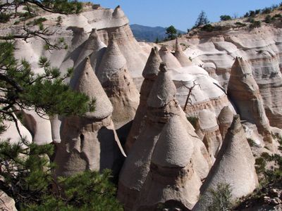
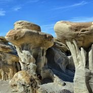
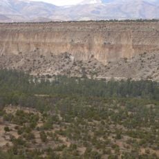
Kasha-Katuwe Tent Rocks is a natural monument in northeastern New Mexico featuring hundreds of cone-shaped rock formations made of volcanic tuff and ash deposits. These light-colored structures were created through erosion over millions of years and display the distinctive tent-like shapes that give the site its name.
The area was shaped about 6 to 7 million years ago by volcanic activity, when ash and tuff were deposited in a caldera that existed at that time. President Bill Clinton designated this place as a national monument in 2001, placing its management under the Bureau of Land Management and the Cochiti Pueblo.
The name Kasha-Katuwe comes from the Keresan language spoken by Pueblo people and means white cliffs, referring to the pale rocks you see throughout the site. This place holds deep spiritual meaning for the Cochiti Pueblo, who consider it sacred ground.
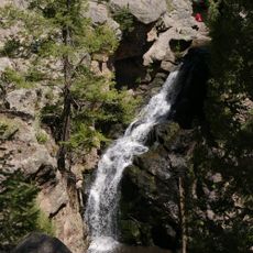
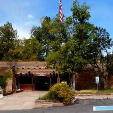
The monument is open during daylight hours with several hiking trails ranging from short walks to more demanding routes through the cone formations. Visitors should bring water and be prepared for the climate, as the region experiences temperature swings and some trails involve steep elevation changes.
The cone shapes developed through a protective mechanism where harder boulder caps shield the softer rock underneath, preserving these distinctive formations. This process shows how rocks of different hardness respond to erosion differently, creating the area's recognizable profile.
The community of curious travelers
AroundUs brings together thousands of curated places, local tips, and hidden gems, enriched daily by 60,000 contributors worldwide.