Chest opened
+${chestReward.xp} XP
Explorer
NOUVEAU ×${chestReward.collectible.quantity}
tapez pour fermer
Chest locked

Open chests in the app

Around Us is built for your phone — chests unlock when you walk, explore and capture nearby places.

Enable Location

We need your location to show you interesting places around you

Discover nearby places

Find interesting locations and hidden gems around you

Precise directions

Get accurate directions and distances to places

Your location is never shared with other users. It's only used when you tap the location button.

Log in to your account

Start exploring — it's free

Trusted by 72,925 travelers worldwide

Continue with Google
Continue with Apple
or

We will send you a code to connect

By continuing, you accept our Terms and Conditions and our Privacy Policy

Check your inbox

We've sent a pincode in your inbox. Please enter the code below.

Villanueva State Park
Discussion Reviews Photo
2.7k Popularity

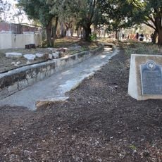
Villanueva State Park, State park along Pecos River in San Miguel County, United States

Villanueva State Park is a nature preserve along the Pecos River in northeastern New Mexico with red sandstone cliffs and cottonwood groves. The grounds offer hiking trails, picnic areas, and camping facilities for visitors exploring the rolling landscape.

The site was part of a Spanish land grant called San Miguel del Bado before becoming a state park in 1967. This conversion allowed the public to use the land for recreation.

The park sits along routes that traders and travelers once followed through the region. Visitors can still walk these old paths and see the landscape that shaped those journeys.

The site has designated camping areas with various amenities and a visitor center with information about local nature. Plan to wear sturdy footwear for trails and be prepared for changing weather depending on the season.

The rocks in the park date back to the Middle Permian period, showing reddish stone layers that hint at a long geological past. These ancient formations offer a visible window into Earth's distant history stretching back millions of years.

The community of curious travelers

AroundUs brings together thousands of curated places, local tips, and hidden gems, enriched daily by 60,000 contributors worldwide.

Start exploring
Inception
1967
GPS coordinates
35.25690,-105.36700
Latest update
December 12, 2025 14:23
Around this place
Plaza Hotel
United States of America

Plaza Hotel

39.5 km
Castañeda Hotel
United States of America

Castañeda Hotel

40.1 km
Las Vegas Plaza
United States of America

Las Vegas Plaza

39.5 km
Our Lady of Sorrows Church
United States of America

Our Lady of Sorrows Church

39.4 km
Old Town Residential Historic District
United States of America

Old Town Residential Historic District

39.4 km
St. Paul's Memorial Episcopal Church and Guild Hall
United States of America

St. Paul's Memorial Episcopal Church and Guild Hall

40.1 km
House at 913 2nd
United States of America

House at 913 2nd

40.7 km
Eldorado Hotel
United States of America

Eldorado Hotel

40 km
Adele Ilfeld Auditorium
United States of America

Adele Ilfeld Auditorium

39.9 km
Railroad Avenue Historic District (Las Vegas, New Mexico)
United States of America

Railroad Avenue Historic District (Las Vegas, New Mexico)

40 km
AT & SF Roundhouse
United States of America

AT & SF Roundhouse

39.2 km
Presbyterian Mission Church
United States of America

Presbyterian Mission Church

39.2 km
Acequia Madre
United States of America

Acequia Madre

38.7 km
Bridge Street Historic District
United States of America

Bridge Street Historic District

39.6 km
Bean-Newlee House
United States of America

Bean-Newlee House

40.6 km
Library Park Historic District
United States of America

Library Park Historic District

40.4 km
Douglas-Sixth Street Historic District
United States of America

Douglas-Sixth Street Historic District

40.4 km
House at 919 2nd
United States of America

House at 919 2nd

40.7 km
Douglas Avenue School
United States of America

Douglas Avenue School

39.8 km
Lowery Clevenger House
United States of America

Lowery Clevenger House

40.8 km
House at 1116 Columbia
United States of America

House at 1116 Columbia

39.9 km
House at 931 Prince
United States of America

House at 931 Prince

39.3 km
James Cook House
United States of America

James Cook House

40 km
House at 915 2nd
United States of America

House at 915 2nd

40.7 km
House at 16 Grand Avenue
United States of America

House at 16 Grand Avenue

39.4 km
Arturo Angel House
United States of America

Arturo Angel House

39 km
North New Town Historic District
United States of America

North New Town Historic District

40.5 km
Building at 1214 Bridge
United States of America

Building at 1214 Bridge

39.8 km
Show the full map
Reviews
Share your experience

No review yet

Discussions
Start a discussion...

No discussion yet

« Villanueva State Park - State park along Pecos River in San Miguel County, United States » is provided by Around Us (aroundus.com). Images and texts are derived from Wikimedia project under a Creative Commons license. You are allowed to copy, distribute, and modify copies of this page, under the conditions set by the license, as long as this note is clearly visible.

Discover hidden gems everywhere you go!

From secret cafés to breathtaking viewpoints, skip the crowded tourist spots and find places that match your style. Our app makes it easy with voice search, smart filtering, route optimization, and insider tips from travelers worldwide. Download now for the complete mobile experience.

Around Us App Screenshot

A unique approach to discovering new places

Le Figaro

All the places worth exploring

France Info

A tailor-made excursion in just a few clicks

20 Minutes

Around Us
Travel Guide & Maps
Download

Send to your phone

QR Code
1

Open the camera app on your mobile.

2

Point at the QR code with your camera. A notification will appear.

3

Tap the notification to open the link.