Enable Location

We need your location to show you interesting places around you

Discover nearby places

Find interesting locations and hidden gems around you

Precise directions

Get accurate directions and distances to places

Your location is never shared with other users. It's only used when you tap the location button.

Log in to your account

Start exploring — it's free

Trusted by 62,186 travelers worldwide

Continue with Google
Continue with Apple
or

We will send you a code to connect

By continuing, you accept our Terms and Conditions and our Privacy Policy

Check your inbox

We've sent a pincode in your inbox. Please enter the code below.

Bennett Peak

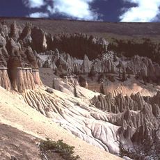
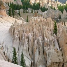
Bennett Peak, Mountain summit in San Juan Mountains, Colorado, US

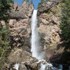
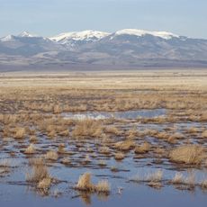
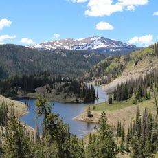
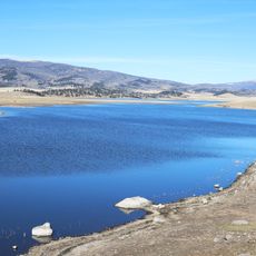
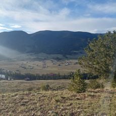
Bennett Peak is a mountain in the San Juan Mountains rising to about 13,200 feet with a broad summit dome and gentle slopes on its approaches. The peak stands above the San Luis Valley and provides wide views across the surrounding terrain from its top.

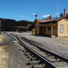
The peak was recorded during early geographical surveys of Colorado, establishing its status as the highest point in its region. These mapping efforts in the 1800s made it an important reference point for understanding the mountain terrain of the southern San Juans.

The mountain serves as a centerpiece for local outdoor activities, drawing hikers and mountaineers throughout the permitted climbing seasons.

Reaching this peak involves driving Forest Road 250 from Monte Vista to Blowout Pass at around 11,800 feet, then hiking the remaining distance. A high-clearance vehicle is recommended for the rough road, and conditions change greatly with the seasons.

Surprisingly, this mountain above 13,000 feet offers moderate climbing routes that are quite approachable despite its elevation. This makes it attractive to hikers who want to test themselves at altitude without needing extreme technical skills.

The community of curious travelers

AroundUs brings together thousands of curated places, local tips, and hidden gems, enriched daily by 60,000 contributors worldwide.

Start exploring
Location
GPS coordinates
37.48334,-106.43393
Latest update
December 12, 2025 17:48
Around this place
La Garita Caldera
United States of America

La Garita Caldera

53.6 km
Fish Canyon Tuff
United States of America

Fish Canyon Tuff

53.6 km
Rio Grande Scenic Railroad
United States of America

Rio Grande Scenic Railroad

50.3 km
Wheeler Geologic Area
United States of America

Wheeler Geologic Area

54.2 km
Pagosa hot springs
United States of America

Pagosa hot springs

57.5 km
UFO Watchtower
United States of America

UFO Watchtower

59 km
Cumbres Pass
United States of America

Cumbres Pass

51.5 km
Treasure Falls, Colorado
United States of America

Treasure Falls, Colorado

39.1 km
Monte Vista National Wildlife Refuge
United States of America

Monte Vista National Wildlife Refuge

30.2 km
Alamosa National Wildlife Refuge
United States of America

Alamosa National Wildlife Refuge

58.8 km
Conejos Peak
United States of America

Conejos Peak

24.8 km
Pike's Stockade
United States of America

Pike's Stockade

59.1 km
D&RGW 169
United States of America

D&RGW 169

50.6 km
San Luis Valley Conservation Area
United States of America

San Luis Valley Conservation Area

45 km
Terrace Reservoir
United States of America

Terrace Reservoir

18.2 km
St. Thomas Episcopal Church
United States of America

St. Thomas Episcopal Church

50.2 km
Capilla de San Juan Bautista
United States of America

Capilla de San Juan Bautista

43.2 km
Sevenmile Bridge
United States of America

Sevenmile Bridge

59.2 km
American National Bank Building
United States of America

American National Bank Building

50.3 km
Carnegie Library
United States of America

Carnegie Library

27.7 km
Palace Hotel
United States of America

Palace Hotel

58.9 km
Monte Vista Downtown Historic District
United States of America

Monte Vista Downtown Historic District

27.5 km
Alamosa County Courthouse
United States of America

Alamosa County Courthouse

50.1 km
Husung Hardware
United States of America

Husung Hardware

50.2 km
La Jara Reservoir
United States of America

La Jara Reservoir

25.1 km
Kid Gulch
United States of America

Kid Gulch

60.1 km
Sutherland Bridge
United States of America

Sutherland Bridge

23.4 km
Wheeler Bridge
United States of America

Wheeler Bridge

23.3 km
Show the full map
« Bennett Peak - Mountain summit in San Juan Mountains, Colorado, US » is provided by Around Us (aroundus.com). Images and texts are derived from Wikimedia project under a Creative Commons license. You are allowed to copy, distribute, and modify copies of this page, under the conditions set by the license, as long as this note is clearly visible.

Discover hidden gems everywhere you go!

From secret cafés to breathtaking viewpoints, skip the crowded tourist spots and find places that match your style. Our app makes it easy with voice search, smart filtering, route optimization, and insider tips from travelers worldwide. Download now for the complete mobile experience.

Around Us App Screenshot

A unique approach to discovering new places

Le Figaro

All the places worth exploring

France Info

A tailor-made excursion in just a few clicks

20 Minutes

Around Us
Travel Guide & Maps
Download

Send to your phone

QR Code
1

Open the camera app on your mobile.

2

Point at the QR code with your camera. A notification will appear.

3

Tap the notification to open the link.