Enable Location

We need your location to show you interesting places around you

Discover nearby places

Find interesting locations and hidden gems around you

Precise directions

Get accurate directions and distances to places

Your location is never shared with other users. It's only used when you tap the location button.

Trementina Base

Log in to your account

Start exploring — it's free

Trusted by 62,050 travelers worldwide

Continue with Google
Continue with Apple
or

We will send you a code to connect

By continuing, you accept our Terms and Conditions and our Privacy Policy

Check your inbox

We've sent a pincode in your inbox. Please enter the code below.

Trementina Base

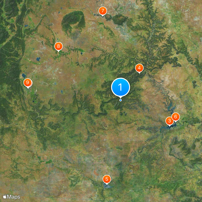
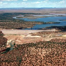
Trementina Base, Religious archival facility in San Miguel County, New Mexico.

Trementina Base is an archival facility in San Miguel County, New Mexico, featuring underground vaults that house stainless steel tablets and recordings stored in titanium capsules. The compound includes residential buildings, a private airstrip, and various security measures that restrict public access to the property.

Construction of the underground storage facility began in 1986 under the direction of the Church of Spiritual Technology. The site was designed as a long-term preservation project intended to maintain its contents across generations.

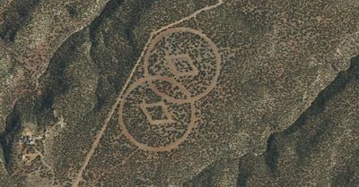
The compound features a large surface symbol visible from above, consisting of two intersecting circles with diamond shapes between them. This marking creates a distinctive visual element that shapes how the site appears from a distance.

The facility is not open to the public and is heavily secured, so visitors can only view the site from a distance or from outside the perimeter. Anyone interested in learning more should check in advance whether special tours or public access events are ever permitted.

The base stores texts engraved on metal plates designed to withstand nuclear events, powered by solar-driven turntables for audio playback. This setup demonstrates an unusual approach to preserving recorded and written information across extreme time scales.

The community of curious travelers

AroundUs brings together thousands of curated places, local tips, and hidden gems, enriched daily by 60,000 contributors worldwide.

Start exploring
Location
GPS coordinates
35.52460,-104.57200
Latest update
December 19, 2025 23:21
Around this place
Castañeda Hotel
United States of America

Castañeda Hotel

58.5 km
Conchas Lake
United States of America

Conchas Lake

34.9 km
Sabinoso Wilderness
United States of America

Sabinoso Wilderness

20.9 km
Santa Rosa Lake State Park
United States of America

Santa Rosa Lake State Park

53.5 km
Conchas Dam
United States of America

Conchas Dam

37.1 km
Wagon Mound National Historic Landmark
United States of America

Wagon Mound National Historic Landmark

54.1 km
Watrous
United States of America

Watrous

49.5 km
St. Paul's Memorial Episcopal Church and Guild Hall
United States of America

St. Paul's Memorial Episcopal Church and Guild Hall

59 km
House at 913 2nd
United States of America

House at 913 2nd

58.7 km
Eldorado Hotel
United States of America

Eldorado Hotel

58.6 km
Adele Ilfeld Auditorium
United States of America

Adele Ilfeld Auditorium

59.2 km
Railroad Avenue Historic District (Las Vegas, New Mexico)
United States of America

Railroad Avenue Historic District (Las Vegas, New Mexico)

58.5 km
AT & SF Roundhouse
United States of America

AT & SF Roundhouse

58.6 km
Acequia Madre
United States of America

Acequia Madre

59.4 km
Bean-Newlee House
United States of America

Bean-Newlee House

59.1 km
Library Park Historic District
United States of America

Library Park Historic District

58.7 km
Douglas-Sixth Street Historic District
United States of America

Douglas-Sixth Street Historic District

57.8 km
House at 919 2nd
United States of America

House at 919 2nd

58.7 km
Douglas Avenue School
United States of America

Douglas Avenue School

59 km
Lowery Clevenger House
United States of America

Lowery Clevenger House

58.7 km
House at 931 Prince
United States of America

House at 931 Prince

58.8 km
House at 915 2nd
United States of America

House at 915 2nd

58.7 km
House at 16 Grand Avenue
United States of America

House at 16 Grand Avenue

58.6 km
Arturo Angel House
United States of America

Arturo Angel House

59.3 km
North New Town Historic District
United States of America

North New Town Historic District

59.1 km
Building at 1214 Bridge
United States of America

Building at 1214 Bridge

59.4 km
Las Vegas Carnegie Public Library
United States of America

Las Vegas Carnegie Public Library

58.7 km
Variadero Bridge
United States of America

Variadero Bridge

18.2 km
Show the full map
« Trementina Base - Religious archival facility in San Miguel County, New Mexico » is provided by Around Us (aroundus.com). Images and texts are derived from Wikimedia project under a Creative Commons license. You are allowed to copy, distribute, and modify copies of this page, under the conditions set by the license, as long as this note is clearly visible.

Discover hidden gems everywhere you go!

From secret cafés to breathtaking viewpoints, skip the crowded tourist spots and find places that match your style. Our app makes it easy with voice search, smart filtering, route optimization, and insider tips from travelers worldwide. Download now for the complete mobile experience.

Around Us App Screenshot

A unique approach to discovering new places

Le Figaro

All the places worth exploring

France Info

A tailor-made excursion in just a few clicks

20 Minutes

Around Us
Travel Guide & Maps
Download

Send to your phone

QR Code
1

Open the camera app on your mobile.

2

Point at the QR code with your camera. A notification will appear.

3

Tap the notification to open the link.