Chest opened
+${chestReward.xp} XP
Explorer
NOUVEAU ×${chestReward.collectible.quantity}
tapez pour fermer

See the monuments around you in AR Open chests in the app

Around Us is built for your phone — point your camera at the streets and discover the monuments and places around you in augmented reality. Around Us is built for your phone — chests unlock when you walk, explore and capture nearby places.

Enable Location

We need your location to show you interesting places around you

Discover nearby places

Find interesting locations and hidden gems around you

Precise directions

Get accurate directions and distances to places

Your location is never shared with other users. It's only used when you tap the location button.

Conchas Lake

Log in to your account

Start exploring — it's free

Trusted by 88,071 travelers worldwide

Continue with Google
Continue with Apple
or

We will send you a code to connect

By continuing, you accept our Terms and Conditions and our Privacy Policy

Check your inbox

We've sent a pincode in your inbox. Please enter the code below.

Discussion Reviews 1 Photos
6.6k Popularity

Conchas Lake, body of water

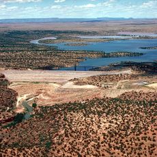
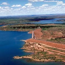
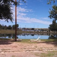
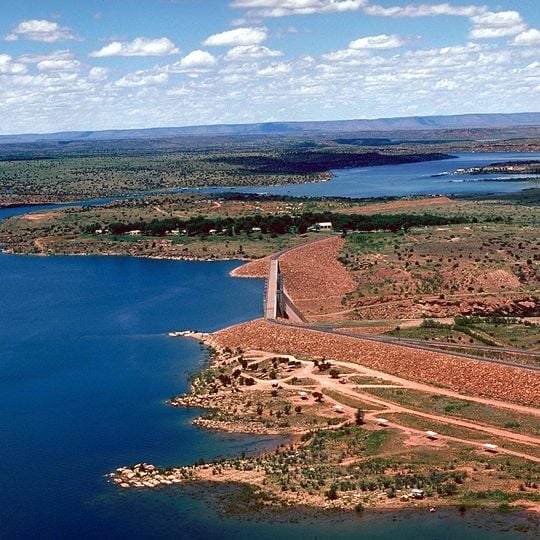
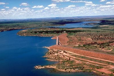
Conchas Lake is a reservoir in northeastern New Mexico, formed by a dam on the Canadian River. It sits in open terrain with low hills and reddish rock outcrops visible along much of the shoreline.

The dam was completed in 1939 during the Depression era, built to control flooding on the Canadian River and support farming in the region. It ranks among the oldest dams still in use in New Mexico.

The lake is a gathering spot for families from nearby towns, especially on summer weekends. Fishing from the shore or going out by boat are the most common ways people spend time here.

The park is divided into two sections, each with its own boat ramp, picnic areas, and camping spots. Both sides are easy to reach by car from Tucumcari, following signs northwest out of town.

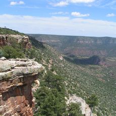
The rock layers visible around the lake belong to the Chinle Formation, which formed around 220 million years ago when the area was covered by rivers and wetlands. The colorful bands of mudstone and sandstone are easy to spot from the shore and tell a story that goes far beyond the dam itself.

The community of curious travelers

AroundUs brings together thousands of curated places, local tips, and hidden gems, enriched daily by 60,000 contributors worldwide.
Start exploring
Location
GPS coordinates
35.38426,-104.21366
Latest update
September 17, 2026 07:09
Around this place
Blue Hole
United States of America

Blue Hole

40.2 mi
Trementina Base
United States of America

Trementina Base

22.4 mi
Tucumcari Mountain
United States of America

Tucumcari Mountain

33.8 mi
Sabinoso Wilderness
United States of America

Sabinoso Wilderness

24.1 mi
Santa Rosa Lake State Park
United States of America

Santa Rosa Lake State Park

34.5 mi
Conchas Dam
United States of America

Conchas Dam

1.8 mi
Richardson Store
United States of America

Richardson Store

21.7 mi
Metropolitan Park Bathhouse and Pool Historic District
United States of America

Metropolitan Park Bathhouse and Pool Historic District

28.6 mi
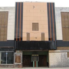
Odeon Theatre
United States of America

Odeon Theatre

30.9 mi
Baca-Goodman House
United States of America

Baca-Goodman House

30.9 mi
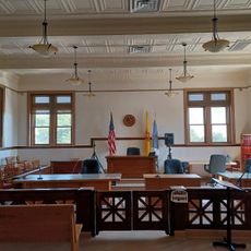
Harding County Courthouse
United States of America

Harding County Courthouse

30.6 mi
Arch Hurley Conservancy District Office Building
United States of America

Arch Hurley Conservancy District Office Building

31.1 mi
Park Lake Historic District
United States of America

Park Lake Historic District

40.4 mi
Tucumcari Railroad Museum
United States of America

Tucumcari Railroad Museum

30.9 mi
Princess Theatre
United States of America

Princess Theatre

31.4 mi
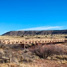
Variadero Bridge
United States of America

Variadero Bridge

13.9 mi
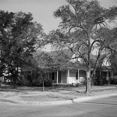
United States of America

Baca-Goodman House Historic Site

31.2 mi
United States of America

Bell Ranch Headquarters Historic Site

1.9 mi
United States of America

Quay County Courthouse Historic Site

31.2 mi
United States of America

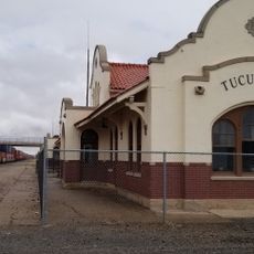
Rock Island-Southern Pacific Passenger Depot Historic Site

31.2 mi
United States of America

Tucumcari Trading Post

30.2 mi
United States of America

Tee pee curios (Tumtucari)

31.8 mi
United States of America

Tee Pee Curios

31.8 mi
United States of America

Tucumcari Trading Post

30.1 mi
United States of America

ART City

27 mi
United States of America

The Legendary Road

31.2 mi
United States of America

The Minds Eye

27.1 mi
United States of America

Waterfall

33.4 mi
Show the full map
Reviews
Share your experience

No review yet

Discussions
Start a discussion...

No discussion yet

« Conchas Lake - body of water » is provided by Around Us (aroundus.com). Images and texts are derived from Wikimedia project under a Creative Commons license. You are allowed to copy, distribute, and modify copies of this page, under the conditions set by the license, as long as this note is clearly visible.

Discover hidden gems everywhere you go!

From secret cafés to breathtaking viewpoints, skip the crowded tourist spots and find places that match your style. Our app makes it easy with voice search, smart filtering, route optimization, and insider tips from travelers worldwide. Download now for the complete mobile experience.

Around Us App Screenshot

A unique approach to discovering new places

Le Figaro

All the places worth exploring

France Info

A tailor-made excursion in just a few clicks

20 Minutes

Around Us
Travel Guide & Maps
Download

Send to your phone

QR Code
1

Open the camera app on your mobile.

2

Point at the QR code with your camera. A notification will appear.

3

Tap the notification to open the link.