Tucumcari Mountain, Mountain summit in Quay County, New Mexico, United States.
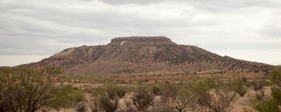
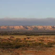
Tucumcari Mountain is a peak in Quay County that rises prominently above the surrounding plains and reaches an elevation of about 4,967 feet above sea level. Its steep rocky slopes make it a distinctive landmark visible from considerable distances.
The peak was first documented by Spanish explorers under Francisco Coronado during their travels through the region in the 1540s. It has served as a recognizable landmark for travelers crossing the area for centuries.
The mountain serves as a landmark that locals have marked with a large T painted on the north face. This tradition started with high school students in the 1940s and continues as a community practice.
Access to the summit is limited to unpaved mountain roads that become hazardous during rain or wet conditions. Plan your visit for dry weather and bring a vehicle suitable for rough terrain if you wish to reach the top.
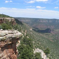
The mountain contains rock layers from the Cretaceous period, though they were initially misidentified as Jurassic by geologist Jules Marcou in the 1850s. This early geological confusion reflects how scientific understanding of the area has evolved over time.
The community of curious travelers
AroundUs brings together thousands of curated places, local tips, and hidden gems, enriched daily by 60,000 contributors worldwide.