Lower Dome Reservoir, Stausee in den Vereinigten Staaten
Location: Saguache County
GPS coordinates: 38.20528,-106.73417
Latest update: November 13, 2025 02:14
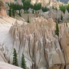
Wheeler Geologic Area
36 km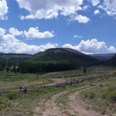
La Garita Wilderness
26.3 km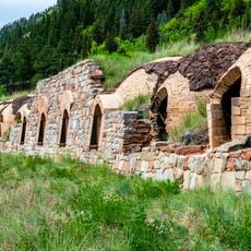
Penny Hot Springs
43.1 km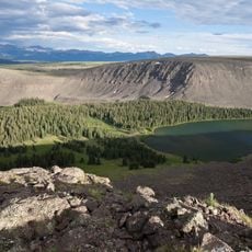
Powderhorn Wilderness
41 km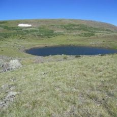
Cannibal Plateau
44.7 km
Baldy Cinco
42.6 km
Johnson Stage Station
44.6 km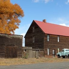
Edgerton House
41.3 km
Fisher-Zugelder House and Smith Cottage
41.9 km
Creede Underground Mining Museum
42.1 km
Creede Historical Society Museum & Library
42.7 km
Gunnison Pioneer Museum
40.9 km
Elk Creek Visitor Center
47.7 km
Box Canyon
37.7 km
Windy Point
46.9 km
Work of art
41.3 km
Limekiln
30.2 km
Creede Fork
43.2 km
Quiller Gallery
42.7 km
Creede Visitor Center
43.2 km
V Rock
13.9 km
Waunita Pass
45.9 km
Old Monarch Pass
47.7 km
Illinois Overlook
43 km
Scenic viewpoint
38.5 km
Waterfall
46.9 km
Phoenix Park Waterfall
33.7 km
Waterfall
44.8 kmReviews
Visited this place? Tap the stars to rate it and share your experience / photos with the community! Try now! You can cancel it anytime.
Discover hidden gems everywhere you go!
From secret cafés to breathtaking viewpoints, skip the crowded tourist spots and find places that match your style. Our app makes it easy with voice search, smart filtering, route optimization, and insider tips from travelers worldwide. Download now for the complete mobile experience.

A unique approach to discovering new places❞
— Le Figaro
All the places worth exploring❞
— France Info
A tailor-made excursion in just a few clicks❞
— 20 Minutes