Chest opened
+${chestReward.xp} XP
Explorer
NOUVEAU ×${chestReward.collectible.quantity}
tapez pour fermer
Chest locked

Open chests in the app

Around Us is built for your phone — chests unlock when you walk, explore and capture nearby places.

Enable Location

We need your location to show you interesting places around you

Discover nearby places

Find interesting locations and hidden gems around you

Precise directions

Get accurate directions and distances to places

Your location is never shared with other users. It's only used when you tap the location button.

Wet Mountains

Log in to your account

Start exploring — it's free

Trusted by 72,899 travelers worldwide

Continue with Google
Continue with Apple
or

We will send you a code to connect

By continuing, you accept our Terms and Conditions and our Privacy Policy

Check your inbox

We've sent a pincode in your inbox. Please enter the code below.

Wet Mountains
Discussion Reviews 1 Photos
8.8k Popularity

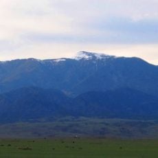
Wet Mountains, Mountain range in Custer County, Colorado.

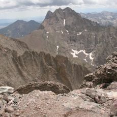
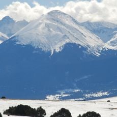
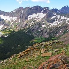
The Wet Mountains are a mountain range in southern Colorado, with Greenhorn Mountain as their highest point. The range runs roughly north to south and features an ancient granite core, with older rock layers exposed at the southern and northwestern ends.

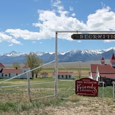
The range got its name from early settlers who noticed that it received much more snow than the surrounding lowlands. That contrast shaped how the mountains were known to the first people who moved through and around them.

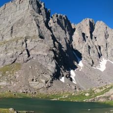
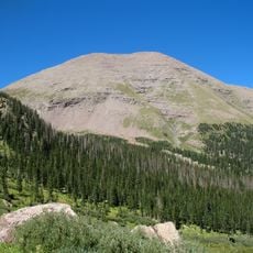
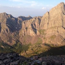
The Wet Mountains are popular with hikers who prefer open ridges and backcountry lakes away from busier trails. The area around Greenhorn Mountain draws people looking for longer day hikes with wide views over the surrounding valleys.

Main roads run along the eastern and western sides of the range, giving access to the key trailheads. Once you move into the interior, elevation changes are frequent and trails become remote fast, so carrying enough water is important.

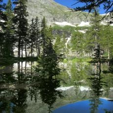
Although the range holds dozens of alpine lakes, most of them are not visible from the main trails and go unnoticed by the majority of visitors. Hikers who leave the marked routes behind can find stretches of water that see very little foot traffic.

The community of curious travelers

AroundUs brings together thousands of curated places, local tips, and hidden gems, enriched daily by 60,000 contributors worldwide.

Start exploring
Location
Elevation above the sea
3,763 m
GPS coordinates
38.17000,-105.20000
Latest update
March 3, 2026 10:11
Around this place
Royal Gorge Bridge
United States of America

Royal Gorge Bridge

34.3 km
Bishop Castle
United States of America

Bishop Castle

15.2 km
Royal Gorge
United States of America

Royal Gorge

29.7 km
Royal Gorge Route Railroad
United States of America

Royal Gorge Route Railroad

30 km
Buckskin Joe
United States of America

Buckskin Joe

35.8 km
Crestone Peak
United States of America

Crestone Peak

40.6 km
Crestone Needle
United States of America

Crestone Needle

40.1 km
Greenhorn Mountain
United States of America

Greenhorn Mountain

36.1 km
Holy Cross Abbey
United States of America

Holy Cross Abbey

31 km
Humboldt Peak
United States of America

Humboldt Peak

37.9 km
Cañon City Downtown Historic District
United States of America

Cañon City Downtown Historic District

30.4 km
Museum of Colorado Prisons
United States of America

Museum of Colorado Prisons

30.3 km
Beckwith Ranch
United States of America

Beckwith Ranch

28.3 km
Hope Lutheran Church
United States of America

Hope Lutheran Church

23.8 km
Broken Hand Peak
United States of America

Broken Hand Peak

40 km
Colony Baldy
United States of America

Colony Baldy

37.1 km
Indian Springs Trace Fossil Natural Area
United States of America

Indian Springs Trace Fossil Natural Area

36.5 km
Kennicott Cabin
United States of America

Kennicott Cabin

27.2 km
Cañon City Municipal Building
United States of America

Cañon City Municipal Building

30.3 km
Downtown Florence Historic District
United States of America

Downtown Florence Historic District

25.5 km
Colorado Women's Prison
United States of America

Colorado Women's Prison

30.2 km
Westcliff School
United States of America

Westcliff School

23.6 km
US Post Office and Federal Building–Cañon City Main
United States of America

US Post Office and Federal Building–Cañon City Main

30.4 km
Samuel H. Atwater House
United States of America

Samuel H. Atwater House

30.7 km
Royal Gorge Cabins
United States of America

Royal Gorge Cabins

37.8 km
Upper Sand Creek Lake
United States of America

Upper Sand Creek Lake

39.3 km
Lower Sand Creek Lake
United States of America

Lower Sand Creek Lake

39.6 km
CRRX Hanging Bridge
United States of America

CRRX Hanging Bridge

34.4 km
Show the full map
Reviews
Share your experience

No review yet

Discussions
Start a discussion...

No discussion yet

« Wet Mountains - Mountain range in Custer County, Colorado » is provided by Around Us (aroundus.com). Images and texts are derived from Wikimedia project under a Creative Commons license. You are allowed to copy, distribute, and modify copies of this page, under the conditions set by the license, as long as this note is clearly visible.

Discover hidden gems everywhere you go!

From secret cafés to breathtaking viewpoints, skip the crowded tourist spots and find places that match your style. Our app makes it easy with voice search, smart filtering, route optimization, and insider tips from travelers worldwide. Download now for the complete mobile experience.

Around Us App Screenshot

A unique approach to discovering new places

Le Figaro

All the places worth exploring

France Info

A tailor-made excursion in just a few clicks

20 Minutes

Around Us
Travel Guide & Maps
Download

Send to your phone

QR Code
1

Open the camera app on your mobile.

2

Point at the QR code with your camera. A notification will appear.

3

Tap the notification to open the link.