Dennis Hump, cliff in Jackson County, Colorado, United States of America
Location: Jackson County
GPS coordinates: 40.39056,-106.41944
Latest update: November 19, 2025 15:25

Great Western Loop
16.8 km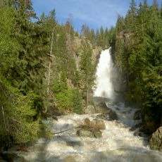
Fish Creek Falls
31.5 km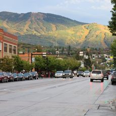
Mount Werner
28.2 km
Arapaho National Wildlife Refuge
28.7 km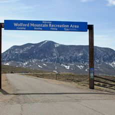
Wolford Mountain Reservoir
30.9 km
Sarvis Creek Wilderness
28.4 km
Ptarmigan Peak Wilderness
8.2 km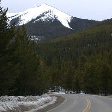
Parkview Mountain
24.9 km
Grannys Nipple
13.2 km
Mesa Schoolhouse
32.9 km
Lake Catamount
33.1 km
Red Dirt Reservoir
26.1 km
Dumont Lake
18 km
Binco Reservoir
17.6 km
Cape Horn
24.7 km
West Arapaho Reservoir
4.6 km
Seymour Lake
10.3 km
Mac Farlane Reservoir
20.7 km
Catamount Ranch & Club Golf Course
32 km
Rollingstone Ranch Golf Course
33.6 km
Fish Creek Falls
31.6 km
Parkview Pass
26.2 km
Scenic viewpoint
16.7 km
Scenic viewpoint
16.7 km
Scenic viewpoint
31.7 km
Scenic viewpoint
31.7 km
Scenic viewpoint
31.7 km
Fish Creek Upper Falls
29.6 kmReviews
Visited this place? Tap the stars to rate it and share your experience / photos with the community! Try now! You can cancel it anytime.
Discover hidden gems everywhere you go!
From secret cafés to breathtaking viewpoints, skip the crowded tourist spots and find places that match your style. Our app makes it easy with voice search, smart filtering, route optimization, and insider tips from travelers worldwide. Download now for the complete mobile experience.

A unique approach to discovering new places❞
— Le Figaro
All the places worth exploring❞
— France Info
A tailor-made excursion in just a few clicks❞
— 20 Minutes