Chest opened
+${chestReward.xp} XP
Explorer
NOUVEAU ×${chestReward.collectible.quantity}
tapez pour fermer
Chest locked

Open chests in the app

Around Us is built for your phone — chests unlock when you walk, explore and capture nearby places.

Enable Location

We need your location to show you interesting places around you

Discover nearby places

Find interesting locations and hidden gems around you

Precise directions

Get accurate directions and distances to places

Your location is never shared with other users. It's only used when you tap the location button.

Niwot

Log in to your account

Start exploring — it's free

Trusted by 72,886 travelers worldwide

Continue with Google
Continue with Apple
or

We will send you a code to connect

By continuing, you accept our Terms and Conditions and our Privacy Policy

Check your inbox

We've sent a pincode in your inbox. Please enter the code below.

Discussion Reviews 1 Photos
16.9k Popularity

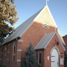
Niwot, Census-designated place in Boulder County, Colorado

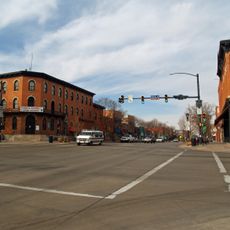
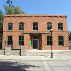
Niwot is a census-designated place in Boulder County situated between Boulder and Longmont. The area contains residential neighborhoods and a commercial zone along State Highway 119, positioned at a moderate elevation with access to surrounding mountain regions.

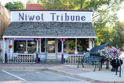
The community was founded in 1875 along the Colorado Central Railroad line. It took its name from an Arapaho leader whose identity remains tied to the transportation development that shaped this area.

The St. Vrain Valley School District manages educational facilities in Niwot, supporting academic development for local students from elementary through high school levels.

The area operates under a split postal code system, which is important to note when addressing mail or packages. Visitors should prepare for local road conditions, particularly when traveling on routes connecting to mountain areas.

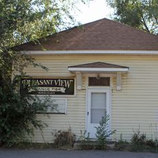
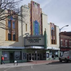
Downtown appeared as a filming location for the 2013 movie 'Dear Eleanor'. The film brought this quiet settlement to the attention of a wider audience.

The community of curious travelers

AroundUs brings together thousands of curated places, local tips, and hidden gems, enriched daily by 60,000 contributors worldwide.

Start exploring
Location
Elevation above the sea
1,553 m
GPS coordinates
40.09972,-105.16028
Latest update
December 7, 2025 19:26
Around this place
Folsom Field
United States of America

Folsom Field

13.6 km
Boulder Public Library
United States of America

Boulder Public Library

14.1 km
Hotel Boulderado
United States of America

Hotel Boulderado

13.5 km
Colorado Shakespeare Festival
United States of America

Colorado Shakespeare Festival

13.8 km
Fiske Planetarium
United States of America

Fiske Planetarium

13.8 km
University of Colorado Museum of Natural History
United States of America

University of Colorado Museum of Natural History

14.1 km
Boulder County Courthouse
United States of America

Boulder County Courthouse

13.5 km
United States of America

Left Hand Canyon

12.5 km
WOW! Children's Museum
United States of America

WOW! Children's Museum

12.8 km
Longmont Museum & Cultural Center
United States of America

Longmont Museum & Cultural Center

7.2 km
Norlin Quadrangle Historic District
United States of America

Norlin Quadrangle Historic District

14 km
Andrews Arboretum
United States of America

Andrews Arboretum

13.9 km
Carnegie Library
United States of America

Carnegie Library

13.6 km
Walden Ponds Wildlife Habitat
United States of America

Walden Ponds Wildlife Habitat

6.6 km
St. Stephen's Episcopal Church
United States of America

St. Stephen's Episcopal Church

9 km
St. Vrain Church of the Brethren
United States of America

St. Vrain Church of the Brethren

10 km
Longmont College
United States of America

Longmont College

9.4 km
Congregational Church
United States of America

Congregational Church

12.9 km
Boulder Valley Grange No. 131
United States of America

Boulder Valley Grange No. 131

7.4 km
Downtown Boulder Historic District
United States of America

Downtown Boulder Historic District

13.3 km
Centennial Lanes
United States of America

Centennial Lanes

10.2 km
Downtown Longmont Historic District
United States of America

Downtown Longmont Historic District

8.9 km
Hoverhome and Hover Farmstead
United States of America

Hoverhome and Hover Farmstead

9.5 km
Miller House
United States of America

Miller House

13 km
Ginacci House
United States of America

Ginacci House

13.4 km
Rhoades House
United States of America

Rhoades House

13.5 km
Boulder Museum of Contemporary Art
United States of America

Boulder Museum of Contemporary Art

13.7 km
Boulder Theatre
United States of America

Boulder Theatre

13.5 km
Show the full map
Reviews
Share your experience

No review yet

Discussions
Start a discussion...

No discussion yet

« Niwot - Census-designated place in Boulder County, Colorado » is provided by Around Us (aroundus.com). Images and texts are derived from Wikimedia project under a Creative Commons license. You are allowed to copy, distribute, and modify copies of this page, under the conditions set by the license, as long as this note is clearly visible.

Discover hidden gems everywhere you go!

From secret cafés to breathtaking viewpoints, skip the crowded tourist spots and find places that match your style. Our app makes it easy with voice search, smart filtering, route optimization, and insider tips from travelers worldwide. Download now for the complete mobile experience.

Around Us App Screenshot

A unique approach to discovering new places

Le Figaro

All the places worth exploring

France Info

A tailor-made excursion in just a few clicks

20 Minutes

Around Us
Travel Guide & Maps
Download

Send to your phone

QR Code
1

Open the camera app on your mobile.

2

Point at the QR code with your camera. A notification will appear.

3

Tap the notification to open the link.