Enable Location

We need your location to show you interesting places around you

Discover nearby places

Find interesting locations and hidden gems around you

Precise directions

Get accurate directions and distances to places

Your location is never shared with other users. It's only used when you tap the location button.

Fort Lapwai

Log in to your account

Start exploring — it's free

Trusted by 63,386 travelers worldwide

Continue with Google
Continue with Apple
or

We will send you a code to connect

By continuing, you accept our Terms and Conditions and our Privacy Policy

Check your inbox

We've sent a pincode in your inbox. Please enter the code below.

Fort Lapwai
Discussion Reviews 1 Photos
2.3k Popularity

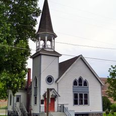
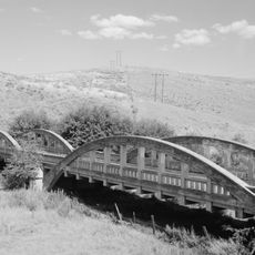
Fort Lapwai, Military fort in Nez Perce County, Idaho, US.

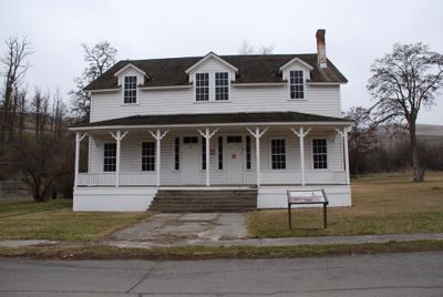
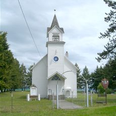
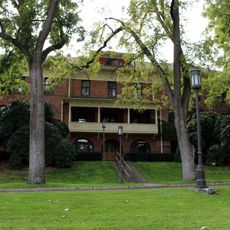
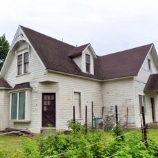
Fort Lapwai is a former military installation in Nez Perce County, Idaho, that operated from 1862 to 1884. The site contains a preserved officers quarters building completed in 1883, built as a duplex to house two military families.

The fort was established in 1862 and served as a center for military operations during conflicts with the Nez Perce tribe. Its closure in 1884 marked the end of a significant chapter in the region's military history.

The site was repurposed as the Northern Idaho Indian Agency, reflecting its ongoing importance to the Nez Perce community after its military phase. The transformation shows how the location continued to serve as a center for local governance and administration.

The site is accessible by car via Highway 95 South from Lapwai, requiring several turns to reach the grounds. Visitors should note that on-site facilities are limited and comfortable footwear is helpful for exploring the area.

The name Lapwai comes from a Nez Perce word meaning 'place of butterflies,' referring to the many insects visible during early summer months. This naming preserves part of the original connection between the location and its seasonal natural features.

The community of curious travelers

AroundUs brings together thousands of curated places, local tips, and hidden gems, enriched daily by 60,000 contributors worldwide.

Start exploring
Location
GPS coordinates
46.45000,-116.81700
Latest update
December 13, 2025 11:40
Around this place
Nez Perce National Historical Park
United States of America

Nez Perce National Historical Park

569 m
Lewiston Hill
United States of America

Lewiston Hill

12.4 km
Sternwheeler Jean
United States of America

Sternwheeler Jean

20.5 km
Full Gospel Church
United States of America

Full Gospel Church

21.6 km
St. Boniface Church, Convent and Rectory
United States of America

St. Boniface Church, Convent and Rectory

23.3 km
Interstate Highway Bridge
United States of America

Interstate Highway Bridge

17.1 km
Bethany Memorial Chapel
United States of America

Bethany Memorial Chapel

28.2 km
Cordelia Lutheran Church
United States of America

Cordelia Lutheran Church

24.2 km
American Women's League Chapter House
United States of America

American Women's League Chapter House

30.5 km
Hotel Rietmann
United States of America

Hotel Rietmann

31.9 km
Gaylord Thompson House
United States of America

Gaylord Thompson House

15.4 km
Thomas Kirby House
United States of America

Thomas Kirby House

22.5 km
First Presbyterian Church
United States of America

First Presbyterian Church

5.3 km
21 Ranchhouse
United States of America

21 Ranchhouse

25.3 km
Ridenbaugh Hall
United States of America

Ridenbaugh Hall

33.9 km
Indian Timothy Memorial Bridge
United States of America

Indian Timothy Memorial Bridge

30.7 km
Nave Apartments
United States of America

Nave Apartments

16.2 km
James Asposas House
United States of America

James Asposas House

15.6 km
Clarkston Public Library
United States of America

Clarkston Public Library

18.1 km
Frank Booth House
United States of America

Frank Booth House

15.6 km
Genesee Exchange Bank
United States of America

Genesee Exchange Bank

14 km
William and Elizabeth McLaren House
United States of America

William and Elizabeth McLaren House

15.6 km
Axel Bohman House
United States of America

Axel Bohman House

32.3 km
Kendrick Fraternal Temple
United States of America

Kendrick Fraternal Temple

22.3 km
C. C. Van Arsdol House
United States of America

C. C. Van Arsdol House

19.8 km
Ole Bohman House
United States of America

Ole Bohman House

32.3 km
Agnes M. Tamblyn House
United States of America

Agnes M. Tamblyn House

15.8 km
Temple Theatre
United States of America

Temple Theatre

16.1 km
Show the full map
Reviews
Share your experience

No review yet

Discussions
Start a discussion...

No discussion yet

« Fort Lapwai - Military fort in Nez Perce County, Idaho, US » is provided by Around Us (aroundus.com). Images and texts are derived from Wikimedia project under a Creative Commons license. You are allowed to copy, distribute, and modify copies of this page, under the conditions set by the license, as long as this note is clearly visible.

Discover hidden gems everywhere you go!

From secret cafés to breathtaking viewpoints, skip the crowded tourist spots and find places that match your style. Our app makes it easy with voice search, smart filtering, route optimization, and insider tips from travelers worldwide. Download now for the complete mobile experience.

Around Us App Screenshot

A unique approach to discovering new places

Le Figaro

All the places worth exploring

France Info

A tailor-made excursion in just a few clicks

20 Minutes

Around Us
Travel Guide & Maps
Download

Send to your phone

QR Code
1

Open the camera app on your mobile.

2

Point at the QR code with your camera. A notification will appear.

3

Tap the notification to open the link.