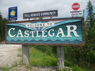
Castlegar, Mountain town in West Kootenay region, British Columbia, Canada
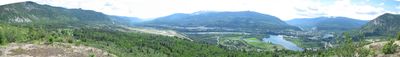
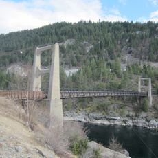
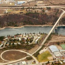
Castlegar sits where the Kootenay and Columbia Rivers meet, in a valley ringed by the Selkirk Mountains. The town spreads through this river valley with neighborhoods, homes, shops, and public buildings scattered across the landscape.
The settlement began in the late 1800s as West Waterloo, then took its current name from Edward Mahon's Irish ancestral estate. Growth accelerated when Doukhobor settlers arrived in the early 1900s, transforming the place significantly.
The Doukhobor community shaped Castlegar from the early 1900s onward, leaving marks on local traditions, building styles, and how residents live together. Russian settlers who arrived then influenced the town's character deeply, and their descendants remain part of the community today.
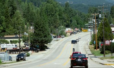
A regional airport here connects to Vancouver and beyond, making access straightforward for visitors arriving by air. The town center has schools, recreation facilities, and basic services that visitors can find easily.
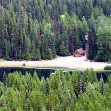
The town has many walking trails along both rivers, giving direct access to the Kootenay and Columbia waterways. Visitors can easily reach the riverbanks and explore the water landscape without needing long drives.
Location: Regional District of Central Kootenay
Inception: 1946
Shares border with: Trail
Website: https://castlegar.ca
GPS coordinates: 49.32611,-117.66472
Latest update: December 6, 2025 21:26
Kokanee Glacier Provincial Park
62.3 km
Glass House
67.5 km
Salmo-Priest Wilderness
67.8 km
Metaline Falls-Nelway Border Crossing
45 km
Corra Linn Dam
21.2 km
Valhalla Provincial Park
62.4 km
Kokanee Creek Provincial Park
49.1 km
Crawford State Park Heritage Site
42.6 km
Box Canyon Dam (Washington)
63.5 km
Laurier-Cascade Border Crossing
54.5 km
Brilliant Suspension Bridge
2.7 km
Slocan River
31.2 km
Champion Lakes Provincial Park
16 km
Lockhart Beach Provincial Park
66.7 km
Gladstone Provincial Park
42.6 km
Kinnaird Bridge
3.6 km
Metaline Falls Bridge
55.5 km
Nelson railway station
32 km
Northport Bridge
45.7 km
Orient Bridge
64.3 km
Salmo railway station
31.5 km
Box Canyon Bridge
63.5 km
Columbia River Skywalk
25.9 km
Nelson Museum Archives & Gallery
32.6 km
Nelson Bridge
34.5 km
St. Andrew's United Church (Rossland, British Columbia)
29.2 km
Rossland Court House
29.3 km
United States Border Station
45 kmVisited this place? Tap the stars to rate it and share your experience / photos with the community! Try now! You can cancel it anytime.
Discover hidden gems everywhere you go!
From secret cafés to breathtaking viewpoints, skip the crowded tourist spots and find places that match your style. Our app makes it easy with voice search, smart filtering, route optimization, and insider tips from travelers worldwide. Download now for the complete mobile experience.
A unique approach to discovering new places❞
— Le Figaro
All the places worth exploring❞
— France Info
A tailor-made excursion in just a few clicks❞
— 20 Minutes