Enable Location

We need your location to show you interesting places around you

Discover nearby places

Find interesting locations and hidden gems around you

Precise directions

Get accurate directions and distances to places

Your location is never shared with other users. It's only used when you tap the location button.

North Fork Road

Log in to your account

Start exploring — it's free

Trusted by 68,016 travelers worldwide

Continue with Google
Continue with Apple
or

We will send you a code to connect

By continuing, you accept our Terms and Conditions and our Privacy Policy

Check your inbox

We've sent a pincode in your inbox. Please enter the code below.

Discussion Reviews 1 Photos
1.6k Popularity

North Fork Road, Straße in den Vereinigten Staaten

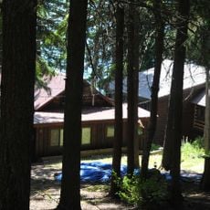
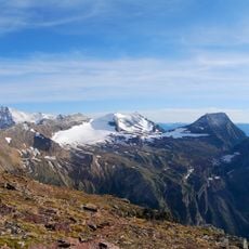
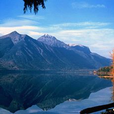
North Fork Road is a road in Flathead County that runs northward from Columbia Falls, following the river and the edge of the national park. About 12 miles along the route, the surface changes from pavement to gravel, with forests and water shaping the surrounding landscape.

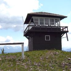
The road began as a wagon route in the early 1900s to bring settlers and resources into the valley, especially after oil was discovered near Kintla Lake. After Glacier National Park was established in 1893, many homesteads on the east side of the river fell within park boundaries, and the government later purchased these properties.

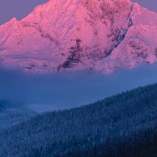
The name North Fork refers to the river that shapes this landscape. Today the road still connects places where pioneers built homesteads over a century ago, showing how early settlers adapted to and used the wilderness around them.

The gravel sections require slower driving and more careful attention than paved roads. It is wise to bring supplies and water with you, as few services are available along the way, and winter conditions can bring ice and challenging driving situations.

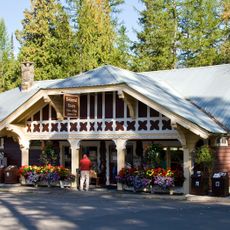
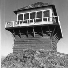
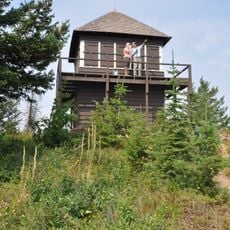
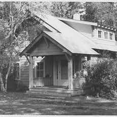
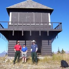
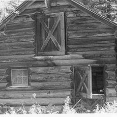
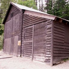
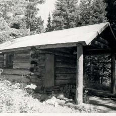
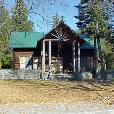
The log cabin built by Jeremiah McCarthy in 1908 still stands today as a reminder of early settler craftsmanship and remains one of the few original buildings from that era. Since 2008, historians and archaeologists have explored and documented around 40 homestead sites to preserve records of how pioneers lived here.

The community of curious travelers

AroundUs brings together thousands of curated places, local tips, and hidden gems, enriched daily by 60,000 contributors worldwide.

Start exploring
Location
Architects
National Park Service
GPS coordinates
48.54810,-113.98600
Latest update
February 9, 2026 08:19
Around this place
Sperry Chalet
United States of America

Sperry Chalet

16 km
Lake McDonald Lodge
United States of America

Lake McDonald Lodge

11 km
Mount Brown
United States of America

Mount Brown

15.9 km
Sperry Glacier
United States of America

Sperry Glacier

18.5 km
Belton Chalets
United States of America

Belton Chalets

5.8 km
Kelly's Camp Historic District
United States of America

Kelly's Camp Historic District

10.7 km
Lake McDonald Lodge Historic District
United States of America

Lake McDonald Lodge Historic District

11.2 km
United States of America

Walton Mountain

18.9 km
Mount Brown Fire Lookout
United States of America

Mount Brown Fire Lookout

14.4 km
Apgar Fire Lookout
United States of America

Apgar Fire Lookout

4.2 km
Gunsight Mountain
United States of America

Gunsight Mountain

18.9 km
United States of America

McPartland Mountain

18.2 km
Headquarters Historic District
United States of America

Headquarters Historic District

5.3 km
Huckleberry Fire Lookout
United States of America

Huckleberry Fire Lookout

12.4 km
Edwards Mountain
United States of America

Edwards Mountain

16.9 km
Mount Vaught
United States of America

Mount Vaught

16.9 km
Upper Lake McDonald Ranger Station Historic District
United States of America

Upper Lake McDonald Ranger Station Historic District

13.1 km
Loneman Fire Lookout
United States of America

Loneman Fire Lookout

17.3 km
West Entrance Station
United States of America

West Entrance Station

4.6 km
Nyack Ranger Station Historic District
United States of America

Nyack Ranger Station Historic District

18.4 km
Amazing Fun Center
United States of America

Amazing Fun Center

14.4 km
Glacier Distilling Company - The Whiskey Barn
United States of America

Glacier Distilling Company - The Whiskey Barn

14.6 km
Fish Creek Bay Boathouse
United States of America

Fish Creek Bay Boathouse

528 m
Burton and Lulu Wheeler Cabin
United States of America

Burton and Lulu Wheeler Cabin

13 km
Harrison Lake Patrol Cabin
United States of America

Harrison Lake Patrol Cabin

17.1 km
Wheeler Camp
United States of America

Wheeler Camp

13 km
Apgar Visitor Center
United States of America

Apgar Visitor Center

2.8 km
Fish Creek Campground Amphitheater
United States of America

Fish Creek Campground Amphitheater

194 m
Show the full map
Reviews
Share your experience

No review yet

Discussions
Start a discussion...

No discussion yet

« North Fork Road - Straße in den Vereinigten Staaten » is provided by Around Us (aroundus.com). Images and texts are derived from Wikimedia project under a Creative Commons license. You are allowed to copy, distribute, and modify copies of this page, under the conditions set by the license, as long as this note is clearly visible.

Discover hidden gems everywhere you go!

From secret cafés to breathtaking viewpoints, skip the crowded tourist spots and find places that match your style. Our app makes it easy with voice search, smart filtering, route optimization, and insider tips from travelers worldwide. Download now for the complete mobile experience.

Around Us App Screenshot

A unique approach to discovering new places

Le Figaro

All the places worth exploring

France Info

A tailor-made excursion in just a few clicks

20 Minutes

Around Us
Travel Guide & Maps
Download

Send to your phone

QR Code
1

Open the camera app on your mobile.

2

Point at the QR code with your camera. A notification will appear.

3

Tap the notification to open the link.