Enable Location

We need your location to show you interesting places around you

Discover nearby places

Find interesting locations and hidden gems around you

Precise directions

Get accurate directions and distances to places

Your location is never shared with other users. It's only used when you tap the location button.

Deadwood

Log in to your account

Start exploring — it's free

Trusted by 61,944 travelers worldwide

Continue with Google
Continue with Apple
or

We will send you a code to connect

By continuing, you accept our Terms and Conditions and our Privacy Policy

Check your inbox

We've sent a pincode in your inbox. Please enter the code below.

Deadwood, Mining town in South Dakota, US

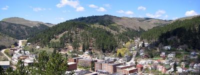
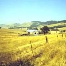
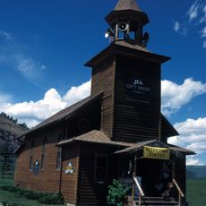
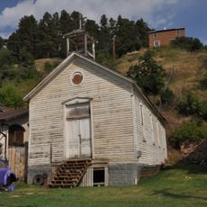
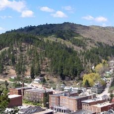
Deadwood is a county seat in Lawrence County, South Dakota, sitting at an elevation of about 1380 meters (4530 feet) in the Black Hills. The compact town stretches along a narrow valley surrounded by forested hills and historic buildings from the late 1800s that give the downtown area a distinctive appearance.

The discovery of gold in 1876 turned this area into a settlement that drew thousands of prospectors and became a key location during the Black Hills Gold Rush. Over the following decades, the town evolved from a rough mining camp into an established community with organized government and infrastructure.

Local saloons and theaters reenact the 19th-century mining culture through costumes and shows that immerse visitors in the atmosphere of that era. Many residents regularly take part in historical reenactments and wear pioneer-era clothing during public events, giving the streets a theatrical and lively character.

Guided tours and historical demonstrations run throughout the year and help visitors navigate the downtown area and understand the mining-era buildings. Lodging and gaming venues are available across the downtown core and are easy to reach on foot, making longer stays comfortable.

In 1883, the town became one of the first communities in the Dakota Territory to introduce electric lighting for commercial use. This early adoption of modern technology contrasted with the rough frontier setting and showed the desire for progress despite the remote location.

The community of curious travelers

AroundUs brings together thousands of curated places, local tips, and hidden gems, enriched daily by 60,000 contributors worldwide.

Start exploring
Location
Inception
1876
Elevation above the sea
1,381 m
Shares border with
Belle Fourche
GPS coordinates
44.37667,-103.72917
Latest update
December 14, 2025 20:24
Around this place
Spearfish Canyon
United States of America

Spearfish Canyon

14.8 km
United States of America

Old Style Saloon No. 10

1.3 km
United States of America

Adams Museum & House

97 m
Mount Theodore Roosevelt Monument
United States of America

Mount Theodore Roosevelt Monument

3.4 km
Frawley Ranch
United States of America

Frawley Ranch

11 km
Old Finnish Lutheran Church
United States of America

Old Finnish Lutheran Church

3.9 km
St. Lawrence O'Toole Catholic Church
United States of America

St. Lawrence O'Toole Catholic Church

3 km
Tomahawk Lake Country Club
United States of America

Tomahawk Lake Country Club

10.2 km
United States of America

John Hill Ranch-Keltomaki

11.7 km
Termesphere Gallery
United States of America

Termesphere Gallery

11.8 km
Deadwood Historic District
United States of America

Deadwood Historic District

622 m
United States of America

Galena Creek Schoolhouse

8.5 km
United States of America

Tomahawk Lake Country Club

10.4 km
United States of America

Deadwood 1876 Theater

233 m
United States of America

Elkhorn Ridge Golf Club

11.5 km
United States of America

Seth Bullock's Grave

515 m
United States of America

Broken Boot Gold Mine

1.3 km
United States of America

Wild Bill Hickok & Calamity Jane Canary's Graves

305 m
United States of America

Tatanka Story of Bison

2.7 km
United States of America

Spearfish Canyon Country Club

14.5 km
United States of America

Scenic viewpoint

12.9 km
United States of America

Scenic viewpoint

14.1 km
United States of America

Scenic viewpoint

13.6 km
United States of America

Scenic viewpoint

13.2 km
United States of America

Scenic viewpoint

13.5 km
United States of America

Scenic viewpoint

13.8 km
United States of America

Scenic viewpoint

9.4 km
United States of America

Bridal Veil Falls

12.8 km
Show the full map
« Deadwood - Mining town in South Dakota, US » is provided by Around Us (aroundus.com). Images and texts are derived from Wikimedia project under a Creative Commons license. You are allowed to copy, distribute, and modify copies of this page, under the conditions set by the license, as long as this note is clearly visible.

Discover hidden gems everywhere you go!

From secret cafés to breathtaking viewpoints, skip the crowded tourist spots and find places that match your style. Our app makes it easy with voice search, smart filtering, route optimization, and insider tips from travelers worldwide. Download now for the complete mobile experience.

Around Us App Screenshot

A unique approach to discovering new places

Le Figaro

All the places worth exploring

France Info

A tailor-made excursion in just a few clicks

20 Minutes

Around Us
Travel Guide & Maps
Download

Send to your phone

QR Code
1

Open the camera app on your mobile.

2

Point at the QR code with your camera. A notification will appear.

3

Tap the notification to open the link.