Beaver Hills, Biosphere reserve in central Alberta, Canada
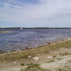
Beaver Hills is a 1,572-square-kilometre upland of knob-and-kettle terrain in central Alberta, about 30 kilometres east of Edmonton. It lies partly within Strathcona, Leduc, Beaver, Lamont and Camrose counties and is protected in part by Elk Island National Park, Cooking Lake–Blackfoot Provincial Recreation Area, Ministik Lake Game Bird Sanctuary and Miquelon Lake Provincial Park.
The Beaver Hills were set aside as a forest reserve by the federal Department of the Interior in 1892, and formalized as the Cooking Lake Forest Reserve in 1899, the first such reserve in Canada. In 1906 part of it became Elk Park, later Elk Island National Park. Crown lands passed to Alberta in 1930, and UNESCO named the area a biosphere reserve in 2016.
The Cree name amiskwaciy, meaning "beaver hills", gave the region its later French and English names. The Sarcee are the first group recorded in the area after European contact; Cree people moving from the east displaced them before 1800. The Cree trapped and traded with fur companies and adopted buffalo pounds from plains peoples. Two trails, the Victoria Trail to the north and the Battle River Trail to the south, border the hills.
The reserve offers visitors different ways to explore the landscape and learn about its ecosystems through trails and programs. Wear sturdy footwear and prepare for changing weather, as conditions shift quickly in the region.
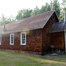
The Beaver Hills were not ploughed under like the surrounding farmland, so archaeological traces survive: Parks Canada has recorded 227 Indigenous sites within Elk Island National Park alone. The hills also form a dark sky preserve, recognized by the Royal Astronomical Society of Canada in 2006.
The community of curious travelers
AroundUs brings together thousands of curated places, local tips, and hidden gems, enriched daily by 92,633 contributors worldwide.