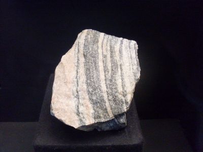
Acasta Gneiss, Ancient rock formation in Northwest Territories, Canada
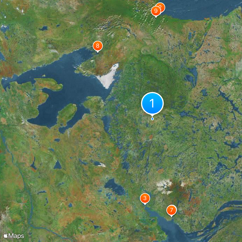
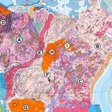
Acasta Gneiss is an ancient rock formation in the Northwest Territories composed of different types of gneiss alongside mafic and ultramafic rocks. It spreads across a large area southeast of Great Bear Lake in the Canadian Shield region.
The formation was discovered in 1983 by geologist Janet King and named after the nearby Acasta River during a mapping program. This find made it a key reference point for understanding Earth's early history.
Scientists worldwide reference the Acasta Gneiss when studying Earth's early geological processes, making it a cornerstone of planetary research and education.
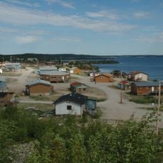
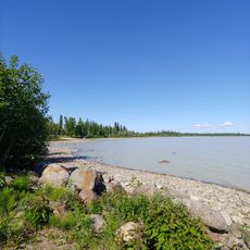
The remote location southeast of Great Bear Lake is only accessible by aircraft, limiting visits to specialized research expeditions. Preparation for arctic conditions is essential for anyone wanting to explore this region.
Zircons within the formation have been dated to roughly 4 billion years old, making it Earth's oldest known rock formation. This age provides unique insight into how the early planet was composed and evolved.
Location: Northwest Territories
Made from material: gneiss
GPS coordinates: 65.16660,-115.58200
Latest update: December 6, 2025 22:09
Kugluktuk
296.8 km
Behchokǫ̀
264.1 km
The Wildcat Cafe
306.6 km
Northwest Territories Legislative Building
307.1 km
Greenstone Building
307.8 km
Canadian Forces Northern Area Headquarters Yellowknife
307.5 km
Fort Confidence, Northwest Territories
247.8 km
Bloody Fall
287 km
Prince of Wales Northern Heritage Centre
307.4 km
Kugluk/Bloody Falls Territorial Park
286.6 km
Saoyú-ʔehdacho
258.4 km
Yellowknife Post Office
307.7 km
Fireweed Studio
307.7 km
Weaver & Devore Trading
306.8 km
Back Bay Cemetery
306.2 km
Fred Henne Territorial Park
305.5 km
Log School House
307.9 km
Hudson's Bay Warehouse
306.6 km
Sutherland's Drug Store
307.7 km
Bank of Toronto building
306.3 km
Great Bear Magmatic Zone
55.2 km
Canadian Pacific Airlines floatbase
306.5 km
Wekweètì
127.5 km
Madeline Lake Territorial Park
300.8 km
Pontoon Lake Territorial Park
300.8 km
Prosperous Lake Territorial Park
301 km
Yellowknife River Territorial Park
301.2 km
Kugluktuk A
296 kmVisited this place? Tap the stars to rate it and share your experience / photos with the community! Try now! You can cancel it anytime.
Discover hidden gems everywhere you go!
From secret cafés to breathtaking viewpoints, skip the crowded tourist spots and find places that match your style. Our app makes it easy with voice search, smart filtering, route optimization, and insider tips from travelers worldwide. Download now for the complete mobile experience.
A unique approach to discovering new places❞
— Le Figaro
All the places worth exploring❞
— France Info
A tailor-made excursion in just a few clicks❞
— 20 Minutes