Enable Location

We need your location to show you interesting places around you

Discover nearby places

Find interesting locations and hidden gems around you

Precise directions

Get accurate directions and distances to places

Your location is never shared with other users. It's only used when you tap the location button.

Lipscomb County

Log in to your account

Start exploring — it's free

Trusted by 64,527 travelers worldwide

Continue with Google
Continue with Apple
or

We will send you a code to connect

By continuing, you accept our Terms and Conditions and our Privacy Policy

Check your inbox

We've sent a pincode in your inbox. Please enter the code below.

Discussion Reviews 1 Photos
10.5k Popularity

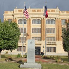
Lipscomb County, Administrative county in northeastern Texas Panhandle, United States

Lipscomb County is an administrative county in the far northeastern corner of the Texas Panhandle, bordering Oklahoma to the east and Kansas to the north. The terrain is mostly flat to gently rolling, with sandy loam soils in the west and darker earth toward the east.

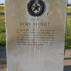
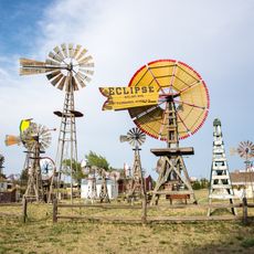
The area was carved out as a county by the Texas legislature in 1876 from what was then the Bexar District. Cattle ranchers were among the first to settle here, gradually drawing more permanent residents to this remote corner of the Panhandle.

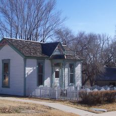
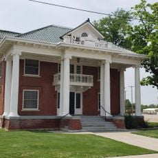
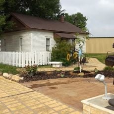
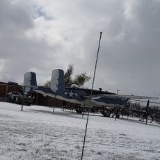
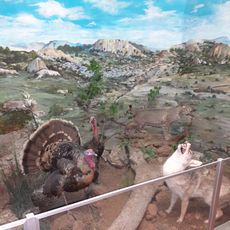
The Wolf Creek Heritage Museum in Higgins displays everyday objects tied to early ranch life in this part of the Panhandle. Walking through it gives a clear sense of how settlers organized their daily routines in a remote and open landscape.

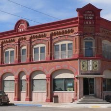
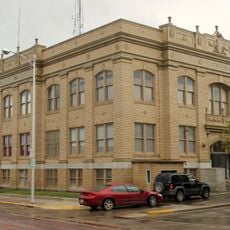
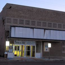
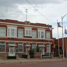
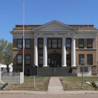
Exploring the county is most practical by car, since public transportation is not available in this part of Texas. The small towns are connected by paved roads, and Higgins, the county seat, is a convenient starting point for getting oriented.

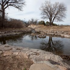
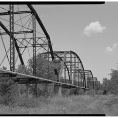
Wolf Creek, which flows through the eastern part of the county and continues into Oklahoma, runs year-round rather than drying up in summer like most streams in this part of the Panhandle. This makes it a rare and steady source of water in an otherwise dry and open landscape.

The community of curious travelers

AroundUs brings together thousands of curated places, local tips, and hidden gems, enriched daily by 60,000 contributors worldwide.

Start exploring
Location
Inception
1887
Capital city
Lipscomb
Shares border with
Beaver County, Hemphill County, Ochiltree County, Ellis County, Roberts County
GPS coordinates
36.28000,-100.27000
Latest update
March 3, 2026 08:21
Around this place
Alabaster Caverns State Park
United States of America

Alabaster Caverns State Park

110.8 km
Boiling Springs State Park
United States of America

Boiling Springs State Park

89.2 km
Dalton Gang Hideout and Museum
United States of America

Dalton Gang Hideout and Museum

111.5 km
Big Basin Prairie Preserve
United States of America

Big Basin Prairie Preserve

109.6 km
Fort Supply
United States of America

Fort Supply

71.6 km
Fort Elliott
United States of America

Fort Elliott

86.5 km
L. L. Stine House
United States of America

L. L. Stine House

80.5 km
Dorothy's House and Land of Oz
United States of America

Dorothy's House and Land of Oz

101.7 km
Stockgrowers State Bank
United States of America

Stockgrowers State Bank

110.6 km
Roberts County Courthouse
United States of America

Roberts County Courthouse

73.2 km
Stein House
United States of America

Stein House

111.1 km
Hooker Woodframe Grain Elevator
United States of America

Hooker Woodframe Grain Elevator

106.5 km
Girl Scout Little House
United States of America

Girl Scout Little House

110.7 km
Lipscomb County Courthouse
United States of America

Lipscomb County Courthouse

5.1 km
Ashland Grade School
United States of America

Ashland Grade School

110.7 km
Ellis County Courthouse
United States of America

Ellis County Courthouse

47.7 km
Harper County Courthouse
United States of America

Harper County Courthouse

84.2 km
Gray County Courthouse
United States of America

Gray County Courthouse

103.7 km
Pampa City Hall
United States of America

Pampa City Hall

103.8 km
Freedom Museum USA
United States of America

Freedom Museum USA

104 km
Ellis Theatre
United States of America

Ellis Theatre

49.5 km
Palace Theatre
United States of America

Palace Theatre

42 km
Lyric Cinema
United States of America

Lyric Cinema

83.5 km
White Deer Land Company Building
United States of America

White Deer Land Company Building

103.7 km
Boiling Springs State Park Pool Bathhouse
United States of America

Boiling Springs State Park Pool Bathhouse

88.9 km
Shattuck Windmill Museum
United States of America

Shattuck Windmill Museum

34.9 km
Roberts County Museum
United States of America

Roberts County Museum

73.4 km
Canadian River Wagon Bridge
United States of America

Canadian River Wagon Bridge

39.7 km
Show the full map
Reviews
Share your experience

No review yet

Discussions
Start a discussion...

No discussion yet

Administrative divisions
« Lipscomb County - Administrative county in northeastern Texas Panhandle, United States » is provided by Around Us (aroundus.com). Images and texts are derived from Wikimedia project under a Creative Commons license. You are allowed to copy, distribute, and modify copies of this page, under the conditions set by the license, as long as this note is clearly visible.

Discover hidden gems everywhere you go!

From secret cafés to breathtaking viewpoints, skip the crowded tourist spots and find places that match your style. Our app makes it easy with voice search, smart filtering, route optimization, and insider tips from travelers worldwide. Download now for the complete mobile experience.

Around Us App Screenshot

A unique approach to discovering new places

Le Figaro

All the places worth exploring

France Info

A tailor-made excursion in just a few clicks

20 Minutes

Around Us
Travel Guide & Maps
Download

Send to your phone

QR Code
1

Open the camera app on your mobile.

2

Point at the QR code with your camera. A notification will appear.

3

Tap the notification to open the link.