Enable Location

We need your location to show you interesting places around you

Discover nearby places

Find interesting locations and hidden gems around you

Precise directions

Get accurate directions and distances to places

Your location is never shared with other users. It's only used when you tap the location button.

Kay County

Log in to your account

Start exploring — it's free

Trusted by 61,532 travelers worldwide

Continue with Google
Continue with Apple
or

We will send you a code to connect

By continuing, you accept our Terms and Conditions and our Privacy Policy

Check your inbox

We've sent a pincode in your inbox. Please enter the code below.

Kay County

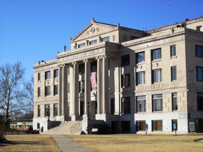
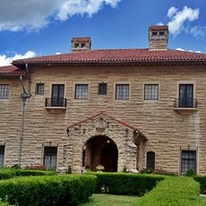
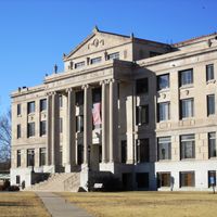
Kay County, County administrative center in northern Oklahoma, United States.

Description

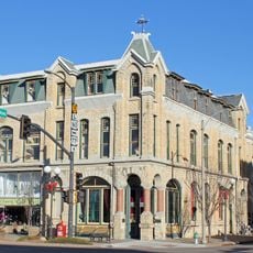
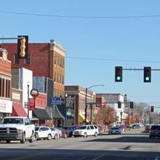
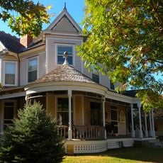
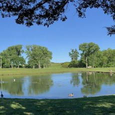
Kay County spans grasslands and prairie landscapes across northern Oklahoma, encompassing several communities with Newkirk as the county seat. The region features gently rolling terrain and a mix of farmland and small town centers throughout its territory.

History

The county formed in 1895 from Cherokee Strip territories following major land runs that brought settlers to Oklahoma. The region experienced rapid settlement through these expansion movements of the late 1800s.

Culture

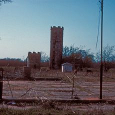
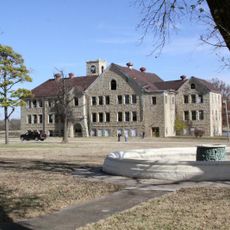
The Chilocco Indian Agricultural School north of Newkirk functioned as an educational center for Native American students from 1884 through 1980.

Practical

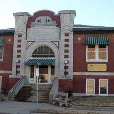
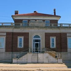
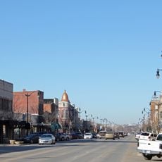
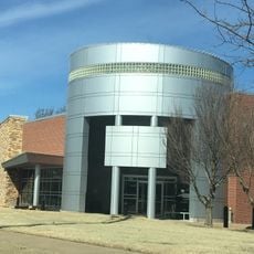
The county clerk's office in Newkirk handles public records and administrative matters during weekday business hours. Visitors can find assistance with official documents and local government information at the administrative center.

Did you know?

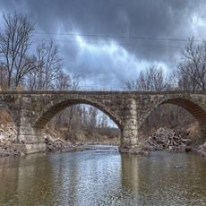
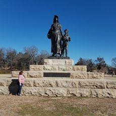
Along the Arkansas River lie remains of two large 18th-century Wichita villages, the Deer Creek and Bryson Paddock Sites. These archaeological sites reveal earlier Native American settlement patterns before later European expansion.

Location
Inception
1895
Capital city
Newkirk
Shares border with
Cowley County, Noble County, Osage County, Garfield County, Grant County, Sumner County
GPS coordinates
36.81000,-97.14000
Latest update
December 7, 2025 20:22

AroundUs brings together thousands of curated places, local tips, and hidden gems, enriched daily by 60,000 contributors worldwide. Discover all places nearby (Oklahoma).

Around this place
Miller Brothers 101 Ranch
United States of America

Miller Brothers 101 Ranch

21.7 km
Pioneer Woman
United States of America

Pioneer Woman

13 km
Chilocco Indian Agricultural School
United States of America

Chilocco Indian Agricultural School

20.7 km
E. W. Marland Mansion
United States of America

E. W. Marland Mansion

12.6 km
Kaw Lake
United States of America

Kaw Lake

27.7 km
Poncan Theatre
United States of America

Poncan Theatre

12.9 km
Old Arkansas City High School
United States of America

Old Arkansas City High School

29.4 km
Electric Park Pavilion
United States of America

Electric Park Pavilion

12.7 km
United States of America

Ponca City Milling Company Elevator

12.9 km
Cowley County National Bank Building
United States of America

Cowley County National Bank Building

49.6 km
Downtown Ponca City Historic District
United States of America

Downtown Ponca City Historic District

12.9 km
First Presbyterian Church of Tonkawa
United States of America

First Presbyterian Church of Tonkawa

20.8 km
East Badger Creek Culvert
United States of America

East Badger Creek Culvert

49.6 km
Winfield Public Carnegie Library
United States of America

Winfield Public Carnegie Library

49.4 km
Pilgrim Congregational Church
United States of America

Pilgrim Congregational Church

29.4 km
Esch's Spur Bridge
United States of America

Esch's Spur Bridge

48.3 km
Daniel J. Donahoe House
United States of America

Daniel J. Donahoe House

13.4 km
W. P. Hackney House
United States of America

W. P. Hackney House

49.6 km
Winfield National Bank Building
United States of America

Winfield National Bank Building

49.5 km
Tonkawa Lodge No. 157 A.F. & A.M.
United States of America

Tonkawa Lodge No. 157 A.F. & A.M.

20.9 km
W. H. Coffin House
United States of America

W. H. Coffin House

49.5 km
Arkansas City Commercial Historic District
United States of America

Arkansas City Commercial Historic District

29.3 km
Sun 'n Fun Water Park
United States of America

Sun 'n Fun Water Park

20.9 km
Pioneer Woman Monument
United States of America

Pioneer Woman Monument

12.9 km
Pioneer Woman Museum
United States of America

Pioneer Woman Museum

13 km
Conoco Museum
United States of America

Conoco Museum

13.5 km
Lake Ponca Beach
United States of America

Lake Ponca Beach

14.1 km
Lake Ponca Duck Pond Historic District
United States of America

Lake Ponca Duck Pond Historic District

14.3 km
Show the full map
Administrative divisions
« Kay County - County administrative center in northern Oklahoma, United States » is provided by Around Us (aroundus.com). Images and texts are derived from Wikimedia project under a Creative Commons license. You are allowed to copy, distribute, and modify copies of this page, under the conditions set by the license, as long as this note is clearly visible.

Discover hidden gems everywhere you go!

From secret cafés to breathtaking viewpoints, skip the crowded tourist spots and find places that match your style. Our app makes it easy with voice search, smart filtering, route optimization, and insider tips from travelers worldwide. Download now for the complete mobile experience.

Around Us App Screenshot

A unique approach to discovering new places

Le Figaro

All the places worth exploring

France Info

A tailor-made excursion in just a few clicks

20 Minutes

Around Us
Travel Guide & Maps
Download

Send to your phone

QR Code
1

Open the camera app on your mobile.

2

Point at the QR code with your camera. A notification will appear.

3

Tap the notification to open the link.