Chest opened
+${chestReward.xp} XP
Explorer
NOUVEAU ×${chestReward.collectible.quantity}
tapez pour fermer
Chest locked

Open chests in the app

Around Us is built for your phone — chests unlock when you walk, explore and capture nearby places.

Enable Location

We need your location to show you interesting places around you

Discover nearby places

Find interesting locations and hidden gems around you

Precise directions

Get accurate directions and distances to places

Your location is never shared with other users. It's only used when you tap the location button.

Geography of Bhutan

Log in to your account

Start exploring — it's free

Trusted by 73,068 travelers worldwide

Continue with Google
Continue with Apple
or

We will send you a code to connect

By continuing, you accept our Terms and Conditions and our Privacy Policy

Check your inbox

We've sent a pincode in your inbox. Please enter the code below.

Geography of Bhutan
Discussion Reviews 1 Photos
30.5k Popularity

Geography of Bhutan, Landlocked mountain nation in South Asia

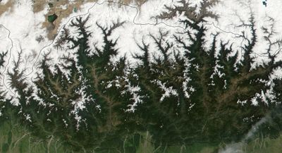
The geography of Bhutan covers a mountainous territory stretching from the Himalayan peaks in the north to subtropical lowlands in the south. Four major rivers flow southward through the country before merging with India's Brahmaputra River system.

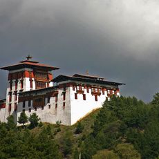
In the 16th century, Zhabdrung Ngawang Namgyel unified the region under central authority and organized it into administrative districts. This consolidation formed the political foundation for the nation as it exists today.

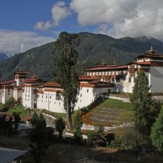
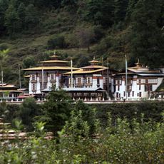
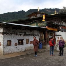
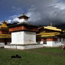
Buddhism shapes daily life across all three regions, with spiritual practices woven into how people interact with their surroundings and communities. Local beliefs connect the landscape to religious meaning, influencing everything from settlement patterns to land use in the valleys and highlands.

The mountainous terrain with significant elevation changes requires careful planning for visitors, as climate and conditions vary greatly between regions. The best time to explore is typically May through September, when trails are passable and weather is more stable.

The northern reaches contain Gangkhar Puensum, a peak rising above 7,500 meters that has never been summited despite numerous attempts. This uncommon distinction makes it one of the last major unclimbed mountains on Earth.

The community of curious travelers

AroundUs brings together thousands of curated places, local tips, and hidden gems, enriched daily by 60,000 contributors worldwide.

Start exploring
GPS coordinates
27.50000,90.50000
Latest update
December 20, 2025 02:15
Reviews
Share your experience

No review yet

Discussions
Start a discussion...

No discussion yet

« Geography of Bhutan - Landlocked mountain nation in South Asia » is provided by Around Us (aroundus.com). Images and texts are derived from Wikimedia project under a Creative Commons license. You are allowed to copy, distribute, and modify copies of this page, under the conditions set by the license, as long as this note is clearly visible.

Discover hidden gems everywhere you go!

From secret cafés to breathtaking viewpoints, skip the crowded tourist spots and find places that match your style. Our app makes it easy with voice search, smart filtering, route optimization, and insider tips from travelers worldwide. Download now for the complete mobile experience.

Around Us App Screenshot

A unique approach to discovering new places

Le Figaro

All the places worth exploring

France Info

A tailor-made excursion in just a few clicks

20 Minutes

Around Us
Travel Guide & Maps
Download

Send to your phone

QR Code
1

Open the camera app on your mobile.

2

Point at the QR code with your camera. A notification will appear.

3

Tap the notification to open the link.