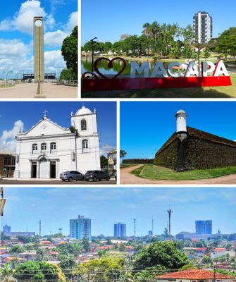
Macapá, Capital city in Amapá state, Brazil
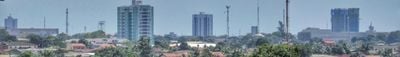
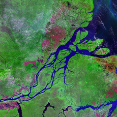
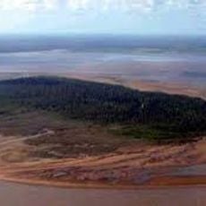
Macapá is a state capital in northern Brazil, positioned where the Amazon River meets the Atlantic Ocean. The city spreads across a low plateau that slopes gently toward the river, with streets organized in a grid pattern near the historic center.
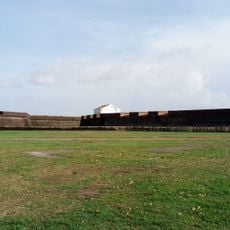
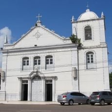
Portuguese settlers founded the settlement in the 18th century as a military outpost protecting the Amazon mouth. The fortress took two decades to complete and marked the northern boundary of Portuguese control in South America.
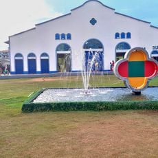
The name comes from a Tupi term meaning 'place of many bacaba palms', trees still found across neighborhoods today. Residents gather at riverside markets where vendors sell açaí bowls and regional fish prepared with manioc flour.
The airport connects the city with other Brazilian regions through daily flights to Belém and Brasília. Most points of interest sit within walking distance in the compact historic center near the riverfront.
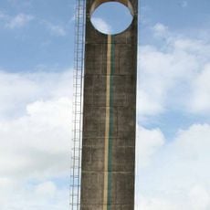
The equator passes through town and is marked by a monument with a stadium where visitors can stand in both hemispheres at once. The warm weather remains steady year-round, typical for equatorial regions.
Location: Amapá
Inception: February 4, 1758
Elevation above the sea: 19 m
Shares border with: Amapá, Santana, Afuá, Chaves, Cutias, Ferreira Gomes, Itaubal, Porto Grande
Website: http://prefeiturademacapa.ap.gov.br
GPS coordinates: 0.03296,-51.06531
Latest update: December 4, 2025 19:05
Milton de Souza Corrêa Stadium
4 km
Amazon Reef
253.9 km
Fortaleza de São José de Macapá
1.8 km
Marco Zero
3.9 km
Tumucumaque National Park
326.8 km
Parque Arqueológico do Solstício
272.1 km
Museu Sacaca
545 m
Caviana
119.5 km
Macapá Central Market
1.6 km
Caxiuanã National Forest
207.3 km
Trapiche Eliezer Levy
1.8 km
Chalé Senador José Porfírio
323.5 km
Fort of Saint Antony of Gurupá
172.3 km
Rio Cajari Extractive Reserve
147.6 km
Marajó Archipelago Environmental Protection Area
171.1 km
Jari Ecological Station
191 km
Igreja da Madre de Deus
339.8 km
Lago Piratuba Biological Reserve
205.1 km
Charapucu State Park
75.2 km
Parazinho Biological Reserve
152.4 km
Soure Marine Extractive Reserve
292.7 km
Reserva de Desenvolvimento Sustentável Itatupã-Baquiá
75.7 km
Joanes Lighthouse
303.2 km
Monumento Matriz
261.2 km
Marco do Sesquicentenário de Cachoeira do Arari
261.4 km
Igreja Matriz Nossa Senhora da Conceição
261.2 km
Parish Church of Saint Joseph of Macapá
1.5 km
Museu Histórico Joaquim Caetano da Silva
1.5 kmReviews
Visited this place? Tap the stars to rate it and share your experience / photos with the community! Try now! You can cancel it anytime.
Discover hidden gems everywhere you go!
From secret cafés to breathtaking viewpoints, skip the crowded tourist spots and find places that match your style. Our app makes it easy with voice search, smart filtering, route optimization, and insider tips from travelers worldwide. Download now for the complete mobile experience.
A unique approach to discovering new places❞
— Le Figaro
All the places worth exploring❞
— France Info
A tailor-made excursion in just a few clicks❞
— 20 Minutes