Enable Location

We need your location to show you interesting places around you

Discover nearby places

Find interesting locations and hidden gems around you

Precise directions

Get accurate directions and distances to places

Your location is never shared with other users. It's only used when you tap the location button.

Duitama

Log in to your account

Start exploring — it's free

Trusted by 61,891 travelers worldwide

Continue with Google
Continue with Apple
or

We will send you a code to connect

By continuing, you accept our Terms and Conditions and our Privacy Policy

Check your inbox

We've sent a pincode in your inbox. Please enter the code below.

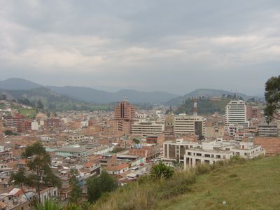
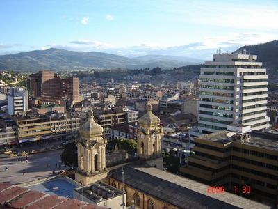
Duitama, Administrative center in Boyacá Department, Colombia

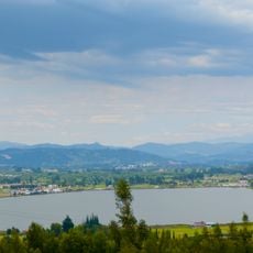
Duitama lies in the Cordillera Oriental mountains at about 2,530 meters (8,300 feet) elevation along the Chicamocha River. Streets run through several neighborhoods, while the center is organized around the main square.

Cacique Tundama ruled the territory until Spanish forces took control in 1539. The settlement grew over the centuries into an important trading point between the high mountains and the lowlands.

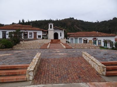
The Pueblito Boyacense recreates old regional buildings and shows construction methods from past centuries. Visitors walk through reconstructed lanes and courtyards and see how villages in Boyacá used to look.

The Pan-American Highway connects the town with other cities and buses run regularly to the region and to Bogotá. The altitude may affect travelers at first, so it helps to take the first days slowly.

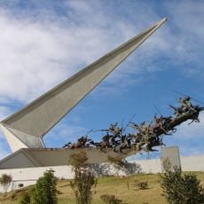
In 1995, the UCI Road World Championships took place here, the first major cycling event of this kind in South America. The hilly landscape around it and the thin air presented many riders with great challenges at the time.

The community of curious travelers

AroundUs brings together thousands of curated places, local tips, and hidden gems, enriched daily by 60,000 contributors worldwide.

Start exploring
Location
Inception
July 27, 1819
Elevation above the sea
2,530 m
Subject
Duitama
GPS coordinates
5.82194,-73.02972
Latest update
December 13, 2025 18:49
« Duitama - Administrative center in Boyacá Department, Colombia » is provided by Around Us (aroundus.com). Images and texts are derived from Wikimedia project under a Creative Commons license. You are allowed to copy, distribute, and modify copies of this page, under the conditions set by the license, as long as this note is clearly visible.

Discover hidden gems everywhere you go!

From secret cafés to breathtaking viewpoints, skip the crowded tourist spots and find places that match your style. Our app makes it easy with voice search, smart filtering, route optimization, and insider tips from travelers worldwide. Download now for the complete mobile experience.

Around Us App Screenshot

A unique approach to discovering new places

Le Figaro

All the places worth exploring

France Info

A tailor-made excursion in just a few clicks

20 Minutes

Around Us
Travel Guide & Maps
Download

Send to your phone

QR Code
1

Open the camera app on your mobile.

2

Point at the QR code with your camera. A notification will appear.

3

Tap the notification to open the link.