Boyacá Department, Administrative department in eastern Colombia
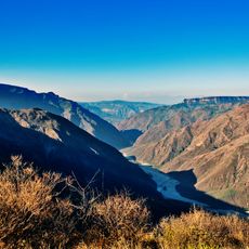
Boyacá Department is an administrative region in eastern Colombia that spreads across the Eastern Cordillera mountain range and includes valleys and high plateaus. The territory connects over one hundred municipalities and is governed from Tunja, which serves as its political and economic center.
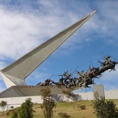
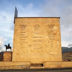
The Battle of Boyacá in 1819 brought independence to much of South America when Simón Bolívar defeated Spanish troops here. This confrontation took place near the bridge of Boyacá and changed the course of colonial history fundamentally.
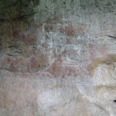
The Department preserves the heritage of the ancient Muisca civilization through archaeological sites, traditional crafts, and indigenous language influences in local names.
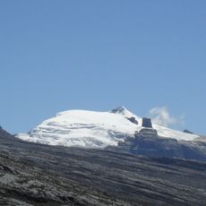
Roads connect the various towns and settlements, with main routes passing through Tunja and providing access to remote areas. The terrain can be cool at higher elevations, so warm clothing is advisable for visits to the mountains.
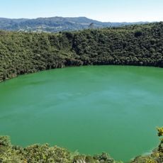
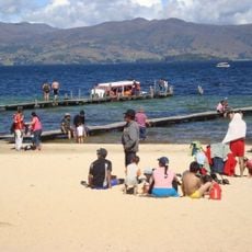
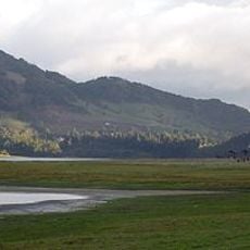
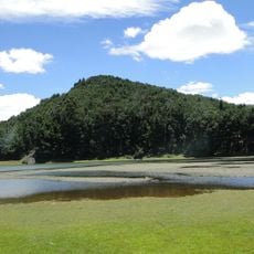
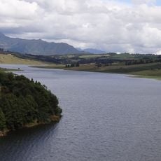
Lake Tota sits at more than 3000 meters (about 10,000 feet) above sea level and is the largest natural lake in Colombia. Fishermen use traditional reed boats that have navigated the cold waters of this Andean lake for centuries.
Location: Colombia
Inception: 1858
Capital city: Tunja
Elevation above the sea: 2,427 m
Reference: BOY
Shares border with: Casanare Department, Antioquia, Santander Department, Norte de Santander Department, Arauca Department, Cundinamarca Department, Caldas Department, Apure
Website: http://boyaca.gov.co
GPS coordinates: 5.75000,-73.10000
Latest update: December 15, 2025 03:45
Salt Cathedral of Zipaquirá
129.5 km
El Cocuy National Park
118.1 km
Jaime Duque
130.9 km
Lake Guatavita
114 km
Puente de Boyacá
49.5 km
Simon Bolivar Park
164.1 km
Chicamocha Canyon
119.1 km
Bogotá Botanical Garden
163.7 km
Playa Blanca
30.3 km
Vargas Swamp Lancers
3.1 km
Chicamocha National Park
116.2 km
Salitre Magico
163 km
Coliseo Live
160.5 km
Forest Reserve Thomas van der Hammen
154.8 km
Cárcel de Cómbita
20.1 km
Terminal Puente Aéreo
164.2 km
Embalse del Neusa
118.5 km
Pisba National Natural Park
60.7 km
Biblioteca Pública Virgilio Barco
163.8 km
Castillo Marroquín
142.4 km
Gimnasio Moderno
161.1 km
Piedras del Tunjo Archaeological Park
172.8 km
Represa del Sisga
101.7 km
Candelaria Desert
58 km
Parque Mirador de los Nevados
156.1 km
North Point Building
152.7 km
Humedal Juan Amarillo
159.4 km
Monumento a Los Héroes
160.9 kmVisited this place? Tap the stars to rate it and share your experience / photos with the community! Try now! You can cancel it anytime.
Discover hidden gems everywhere you go!
From secret cafés to breathtaking viewpoints, skip the crowded tourist spots and find places that match your style. Our app makes it easy with voice search, smart filtering, route optimization, and insider tips from travelers worldwide. Download now for the complete mobile experience.
A unique approach to discovering new places❞
— Le Figaro
All the places worth exploring❞
— France Info
A tailor-made excursion in just a few clicks❞
— 20 Minutes