Chest opened
+${chestReward.xp} XP
Explorer
NOUVEAU ×${chestReward.collectible.quantity}
tapez pour fermer

See the monuments around you in AR Open chests in the app

Around Us is built for your phone — point your camera at the streets and discover the monuments and places around you in augmented reality. Around Us is built for your phone — chests unlock when you walk, explore and capture nearby places.

•

Enable Location

We need your location to show you interesting places around you

Discover nearby places

Find interesting locations and hidden gems around you

Precise directions

Get accurate directions and distances to places

Your location is never shared with other users. It's only used when you tap the location button.

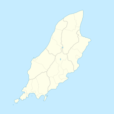
Gooseneck, Isle of Man

Log in to your account

Start exploring — it's free

Trusted by 94,481 travelers worldwide

Continue with Google
Continue with Apple
or

We will send you a code to connect

By continuing, you accept our Terms and Conditions and our Privacy Policy

Check your inbox

We've sent a pincode in your inbox. Please enter the code below.

Gooseneck, Isle of Man

Gooseneck, Isle of Man, Racing road curve on Snaefell Mountain Course, Isle of Man

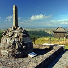
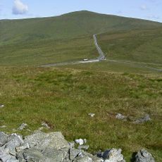
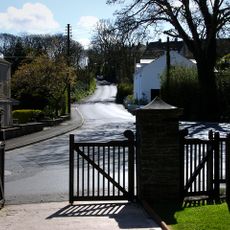
Gooseneck is an uphill right-hand bend on the Snaefell Mountain Road racing circuit on the Isle of Man. The curve sits between established landmark markers along the route that climbs through open moorland terrain.

The curve originated as part of earlier racing courses on the island before becoming established on the current Snaefell Mountain route. It has remained a key section of the TT racing circuit since the races began in 1911.

Riders' own back-up crews stand at the exit of the bend to show signal boards, one of the few points on the course where machines slow enough to read them. Joey Dunlop said he raised his head above the fairing only once a lap, here; his team sometimes warmed themselves with strong drink, and he more than once had to read his board upside down. Mick Grant's wife Carol signalled with a rub of thumb and forefinger when prize money was needed.

Check race schedules before visiting, as access to the curve may be restricted during events due to racing traffic management. On regular days, the road remains open to visitors exploring the moorland surroundings.

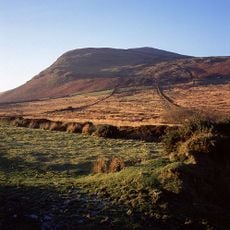
The Gooseneck marks the end of the tree-line on the climb from Ramsey and the start of the Mountain section, at 550 feet (168 m) above sea level. Its Manx name, Roan, means "the reddish land", referring to the surrounding moorland of Park Mooar, the Rhowin and North Barrule.

The community of curious travelers

AroundUs brings together thousands of curated places, local tips, and hidden gems, enriched daily by 94,481 contributors worldwide.

Start exploring
GPS coordinates
54.30527,-4.38162
Latest update
October 26, 2026 02:50
Reviews
Share your experience

No review yet

Discussions
Start a discussion...

No discussion yet

« Gooseneck, Isle of Man - Racing road curve on Snaefell Mountain Course, Isle of Man » is provided by Around Us (aroundus.com). Images and texts are derived from Wikimedia project under a Creative Commons license. You are allowed to copy, distribute, and modify copies of this page, under the conditions set by the license, as long as this note is clearly visible.

Discover hidden gems everywhere you go!

From secret cafés to breathtaking viewpoints, skip the crowded tourist spots and find places that match your style. Our app makes it easy with voice search, smart filtering, route optimization, and insider tips from travelers worldwide. Download now for the complete mobile experience.

Around Us App Screenshot
❝

A unique approach to discovering new places❞

— Le Figaro

❝

All the places worth exploring❞

— France Info

❝

A tailor-made excursion in just a few clicks❞

— 20 Minutes

Around Us
Travel Guide & Maps
Download

Send to your phone

QR Code
1

Open the camera app on your mobile.

2

Point at the QR code with your camera. A notification will appear.

3

Tap the notification to open the link.