Wologizi Mountain Range, Mountain range in Lofa County, Liberia
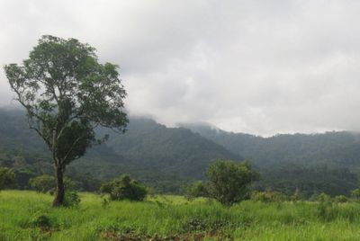
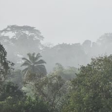
The Wologizi Mountain Range is a series of peaks in Lofa County, Liberia, characterized by steep terrain and numerous cliff faces. The slopes support different forest types at varying elevations, creating distinct ecological zones as you move upward.
Indigenous groups established settlements near this range centuries ago, relying on its resources to sustain their way of life. The mountains have remained central to the region's history and the survival of traditional practices.
Local communities gather medicinal plants from these slopes that grow nowhere else, maintaining practices passed down through generations. This connection to the land shapes how people in the region understand their environment and their place in it.
Hiking these mountains requires guidance from someone who knows the area, as trails are often unmarked and weather shifts rapidly. Plan your visit during drier months when the terrain is easier to traverse.
As you climb higher, the forests change noticeably from lowland species like Lophira and Pycnanthus trees to shorter Parinari trees at greater elevations. This visible transformation happens gradually, showing how altitude shapes the plant life.
Address: Wologizi Mountain Range, Liberia
GPS coordinates: 8.11000,-9.92778
Latest update: December 6, 2025 22:12
Liberia offers a range of places where history, nature, and culture come together. The country has a unique heritage as a settlement for formerly enslaved people who gained their freedom, which is reflected in its towns and landmarks. The landscape spans from tropical forests and waterfalls to coastal areas and wildlife reserves. In Monrovia, the capital, visitors can explore colonial architecture, museums, and beaches. The interior draws people with national parks like Sapo and Gola Forest, where rare animal species live. The coastal regions offer small villages, beaches, and chances to learn about local ways of life. This collection includes natural sites like Kpatawee Waterfalls and Blue Lake, as well as cultural places such as the National Museum and traditional markets. Each location tells a story about Liberia's past and natural variety.
Mount Wuteve
3.9 km
Gola National Park
128.5 km
Ziama Strict Nature Reserve
65.6 km
Lofa-Mano National Park
60.5 km
Tingi Hills Forest Reserve
130.1 km
Sankan Biriwa
130.2 km
Kissidougou Ethnology Museum
121.4 km
Wonegizi Nature Conservation Unit
45.4 km
Musée Préfectoral de Kissidougou
121.5 km
Grab von Kapitän Lendy
121.5 km
Musée préfectoral de N'zérékoré
122.1 km
Kpatawee Waterfall
114.4 km
Jojima
57.2 km
Guma Falls
95.9 km
Gori
104.8 km
Kondewa
126 km
Saiama
109.2 km
Kpatawe waterfall
114.4 km
Hangar de madame Djenebou Barry
66.8 km
Suna's
92 km
Resort Hut
73.5 km
Hangar de madame Djenebou Baldé
66.8 km
Resettlement
127.3 km
Scenic viewpoint
126.9 km
PONT
62.7 km
Place des Martyrs
128.7 km
Chateau d'eau
119.2 km
Waterfall
93.3 kmReviews
Visited this place? Tap the stars to rate it and share your experience / photos with the community! Try now! You can cancel it anytime.
Discover hidden gems everywhere you go!
From secret cafés to breathtaking viewpoints, skip the crowded tourist spots and find places that match your style. Our app makes it easy with voice search, smart filtering, route optimization, and insider tips from travelers worldwide. Download now for the complete mobile experience.
A unique approach to discovering new places❞
— Le Figaro
All the places worth exploring❞
— France Info
A tailor-made excursion in just a few clicks❞
— 20 Minutes