Westliche Karwendelspitze, Mountain summit in the Karwendel range, Scharnitz and Mittenwald, Austria and Germany
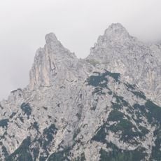
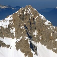
Westliche Karwendelspitze is a 2385 m summit in the Northern Karwendel chain, on the border between Bavaria and North Tyrol, rising above Mittenwald. A partly cable-secured path leads from the Karwendelbahn mountain station to the top in about 20 minutes. The Mittenwalder Höhenweg begins at the summit, and the Heinrich-Noe-Weg branches off in the saddle toward the Nördliche Linderspitze.
In 1931, the Mittenwald residents Hermann Lanzl and Matthias Krinner made the first direct descent from the Westliche Karwendelspitze via the Wanne down to Mittenwald. The summit is the northern end of the Mittenwalder Höhenweg, whose start is often wrongly placed elsewhere. The Heinrich-Noe-Weg to the Brunnsteinhütte begins in the saddle toward the Nördliche Linderspitze.
The mountain connects Bavaria and North Tyrol, forming the natural boundary between German and Austrian alpine regions. It remains an important landmark for people on both sides of the border.
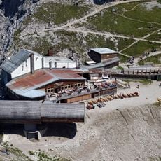
A cable car from Mittenwald reaches the mountain station at 2244 meters, significantly shortening the final ascent to the summit. Visitors should prepare for changing weather conditions and bring appropriate gear.
The Dammkar area beneath the summit holds Germany's longest freeride skiing descent, attracting winter sports enthusiasts from around the world. This slope is particularly popular with experienced riders.
The community of curious travelers
AroundUs brings together thousands of curated places, local tips, and hidden gems, enriched daily by 94,366 contributors worldwide.