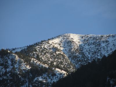
Hoher Fraßen, Mountain summit in Vorarlberg, Austria
Hoher Fraßen is a mountain summit reaching 1,979 meters elevation and marking the westernmost point of the Lechquellen Mountains. The peak is bordered by the Ill, Lutz, and Marulbach river valleys, which shape the surrounding landscape.
For centuries, the mountain was part of the region's grazing systems and used by local communities to reach high pastures and manage wildlife. These traditional uses shaped the paths that hikers still follow today.
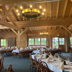
The Fraßenhütte at 1,725 meters is a gathering place where hikers experience Austrian mountain hospitality and regional food. Visitors can taste local dishes prepared according to traditional recipes here.
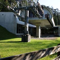
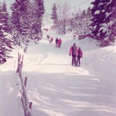
The hike starts at the Muttersbergbahn mountain station at 1,401 meters and covers nearly 10 kilometers with about 700 meters of elevation gain. The ascent takes around four hours and requires decent fitness and proper hiking boots.
The route offers two descent options: you can return the same way you came or take an alternative path via Tiefenseesattel. This choice lets hikers experience different terrain on the way down.
Location: Vorarlberg
Elevation above the sea: 1,979 m
GPS coordinates: 47.19202,9.83375
Latest update: December 14, 2025 09:45
Benediktinerpropstei Sankt Gerold
3.2 km
Muttersbergseilbahn
2.9 km
Burgruine Sonnenberg
3.1 km
Muttersbergbahn
2.2 km
Pfarrkirche hll. Viktor und Markus, (Nüziders)
3.2 km
Fatima church, Bludenz
3.5 km
Vineriuskirche
3.5 km
Pfarrkirche Blons
3.5 km
Kuratienkirche Hl. Katharina
2.3 km
Puppenmuseum Blons
3.5 km
Mariä Heimsuchung, Nüziders
2.3 km
Alte Pfarrkirche hl. Martin (Ludesch)
3.1 km
Bludenz Evangelischer Friedhof
3.5 km
Mariahilfkapelle
1.9 km
Lourdeschapel Plazera
3.1 km
Skilift Bovel
3.5 km
Lasanggabrücke, Raggal
2.5 km
Pfarrhof
3.5 km
Kriegerdenkmal
3.2 km
Nüziders Tschannhaus
3.5 km
Gemeindeamt & Volksschule Sankt Gerold
3.5 km
Bildstock Unteres Bild am Muttersberg
2.7 km
Ludescherberg 2/3
2.1 km
Bludenz Sonnenbergstraße Pfarrhof
3.5 km
Gasthaus zum Schwarzen Adler
3.1 km
Ehemaliges Gemeindehaus
3.5 km
Ludescherberg 1
2.4 km
Chapel "Oberes Bild am Muttersberg"
1.9 kmVisited this place? Tap the stars to rate it and share your experience / photos with the community! Try now! You can cancel it anytime.
Discover hidden gems everywhere you go!
From secret cafés to breathtaking viewpoints, skip the crowded tourist spots and find places that match your style. Our app makes it easy with voice search, smart filtering, route optimization, and insider tips from travelers worldwide. Download now for the complete mobile experience.
A unique approach to discovering new places❞
— Le Figaro
All the places worth exploring❞
— France Info
A tailor-made excursion in just a few clicks❞
— 20 Minutes