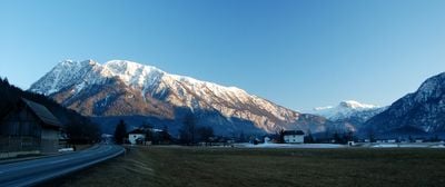
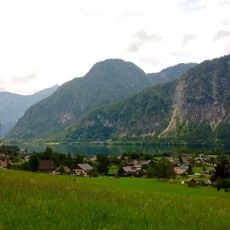
Sarstein, Mountain peak in Salzkammergut, Austria.
Description
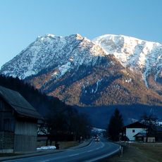
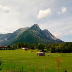
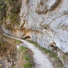
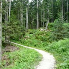
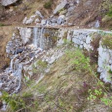
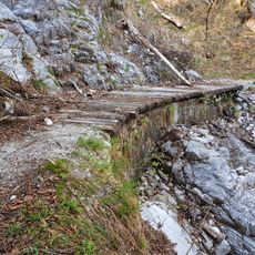
Sarstein is a mountain peak located along the border between Upper Austria and Styria, featuring a long ridge with dramatic rock formations and steep sections. The terrain rises significantly with winding paths that cross through exposed rocky ground and technical passages.
History
The mountain has long served as a natural border between the two regions and has been crossed by generations of hikers. Over time the ridge became an established hiking route connecting communities throughout the Salzkammergut area.
Culture
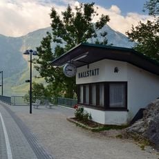
Local residents maintain traditional Alpine hiking routes across Sarstein, connecting communities from Lake Hallstatt to Bad Aussee.
Practical
The route is long and tiring, with marked paths and some secured sections on steeper stretches. Good hiking boots and plenty of water are essential since there is little shade and weather can change quickly in the mountains.
Did you know?
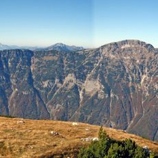
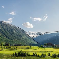
On clear days the summit offers far-reaching views across the surrounding landscape, looking out toward the Dachstein massif and Lake Hallstatt. These panoramic views are one of the main reasons why experienced hikers undertake this demanding route.
AroundUs brings together thousands of curated places, local tips, and hidden gems, enriched daily by 60,000 contributors worldwide. Discover all places nearby (Styria).
Koppenbrühlerhöhle
3.9 km
Ruine Pflindsberg
5 km
Seeklause Steeg
5.1 km
Gosauzwang
3.9 km
Wasnerin
4.6 km
Evangelisches Bethaus Obertraun
5 km
Pfarrkirche Obertraun
5.1 km
Kalvarienbergkirche hl. Agatha
4.8 km
Wehrgrabenbrücke
4.4 km
Hallstatt railway station
4.8 km
Schwarzkogel
976 m
Soleleitung, Gosauzwang-Brücke
3.9 km
Niederer Sarstein
681 m
Hoher Sarstein
70 m
Soleleitung, Bogenbrücke (Hangbrücke) beim Kalkofengraben
4.6 km
Retaining Wall near Gosauzwang
3.9 km
Golf Club Ausseerland
4.8 km
Solestube beim Gosauzwang
3.9 km
Teichschlössl
5.1 km
Agathawirt
4.7 km
Soleleitung, Gosauzwang-Brücke
3.9 km
Römerzeitliche Wegtrasse und Siedlung Michlhallberg
4.5 km
Soleleitung, Stützmauer beim Steingraben
5 km
Soleleitung, Stützmauer beim großen Hundsortgraben
4.3 km
Gosaueck
5 km
Wohnhaus, Ehem. Benefiziatenwohnhaus
5 km
Haus Seeaugut, ehem. Freisitz Gut Seeau
4.9 km
Wohnhaus, ehem. kath. Privatschule
4.6 kmDiscover hidden gems everywhere you go!
From secret cafés to breathtaking viewpoints, skip the crowded tourist spots and find places that match your style. Our app makes it easy with voice search, smart filtering, route optimization, and insider tips from travelers worldwide. Download now for the complete mobile experience.
A unique approach to discovering new places❞
— Le Figaro
All the places worth exploring❞
— France Info
A tailor-made excursion in just a few clicks❞
— 20 Minutes