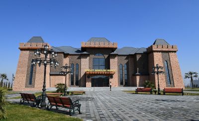
Tovuz District, Administrative district in northwestern Azerbaijan
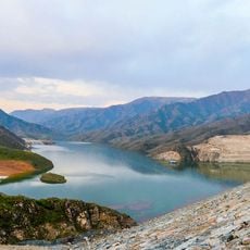
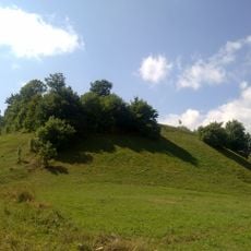
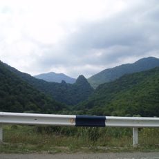
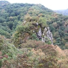
Tovuz is an administrative district in northwestern Azerbaijan covering nearly 2,000 square kilometers of land that transitions from dry lowlands to cooler mountain regions of the Lesser Caucasus. The area comprises around 20 villages organized under Tovuz city, which serves as the main administrative center.
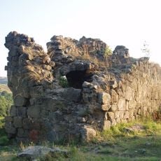
The district was established in 1930 and quickly developed into a wine region. German settlers introduced vineyard cultivation methods that shaped agricultural development for decades to come.
Wine production shapes daily life and local celebrations throughout the district. This heritage appears in village cellars and harvest festivals that bring together people from across the region.
The best time to visit is spring through autumn when weather is mild and the wine harvest happens. Bring layers since the climate changes quickly as you move between lower and higher elevations.
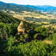
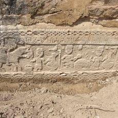
The Goytepe archaeological site reveals that people have lived here since the Neolithic period and practiced early forms of wine production. These discoveries show that this region's wine culture has roots far deeper than its modern history.
Inception: August 8, 1930
Capital city: Tovuz
Elevation above the sea: 337 m
Website: http://tovuz-ih.gov.az
GPS coordinates: 40.99220,45.62890
Latest update: December 22, 2025 12:18
Khoranashat
14.9 km
Qarğalar tepesi
14.8 kmÇaparlı məbədi
42.7 km
Takhti-Tepha Natural Monument
33.5 km
Şəmkirçay su anbarı
48.4 kmShamkir Fortress
45.3 km
Лютеранская церковь (Шамкир)
37.6 km
Saint Hripsime Church, Aygedzor
19.3 kmՍուրբ Հովհաննես եկեղեցի
19.2 kmՇահ Աբասի մզկիթ
17.1 km
İrmaşlı Church
29 kmHistory Museum of Verin Karmiraghbyur
19.8 km
Saint George Church (Movses)
15.2 kmՍուրբ Մինաս եկեղեցի (Արծվաշեն)
41.1 kmDasno Monastery
48.8 kmШахпекарский монастырь
24.6 kmMonastery of the Holy Archangels
50.7 km
Norashen Cyclopean Fortress
19.9 kmМонастырь Всеспасителя (Нукзар)
51.3 km
Monument to the fallen in World War II in the village of Norashen, Tavush region, Armenia
19.8 kmԱրծվաշենի ջրամբար
41.4 km
Ахчкакар
23.1 kmQaradağ
44.8 kmGora Shakarbek
40.5 kmEldar Şamı Qoruğ
50.6 km
Aghjkaberd fortress near Aygedzor village
22.4 kmGora Maskhit
42 kmMentesh Tepe
20.4 kmVisited this place? Tap the stars to rate it and share your experience / photos with the community! Try now! You can cancel it anytime.
Discover hidden gems everywhere you go!
From secret cafés to breathtaking viewpoints, skip the crowded tourist spots and find places that match your style. Our app makes it easy with voice search, smart filtering, route optimization, and insider tips from travelers worldwide. Download now for the complete mobile experience.
A unique approach to discovering new places❞
— Le Figaro
All the places worth exploring❞
— France Info
A tailor-made excursion in just a few clicks❞
— 20 Minutes