Chest opened
+${chestReward.xp} XP
Explorer
NOUVEAU ×${chestReward.collectible.quantity}
tapez pour fermer
Chest locked

Open chests in the app

Around Us is built for your phone — chests unlock when you walk, explore and capture nearby places.

Enable Location

We need your location to show you interesting places around you

Discover nearby places

Find interesting locations and hidden gems around you

Precise directions

Get accurate directions and distances to places

Your location is never shared with other users. It's only used when you tap the location button.

Bugojno

Log in to your account

Start exploring — it's free

Trusted by 72,890 travelers worldwide

Continue with Google
Continue with Apple
or

We will send you a code to connect

By continuing, you accept our Terms and Conditions and our Privacy Policy

Check your inbox

We've sent a pincode in your inbox. Please enter the code below.

Discussion Reviews 1 Photos
35.7k Popularity

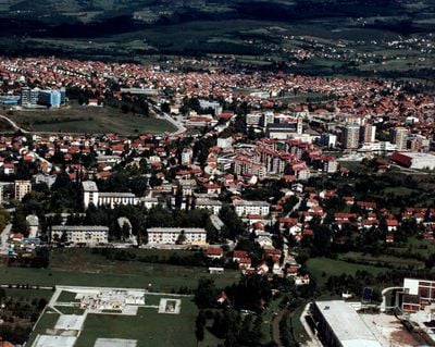
Bugojno, Administrative center in Central Bosnia Canton, Bosnia and Herzegovina

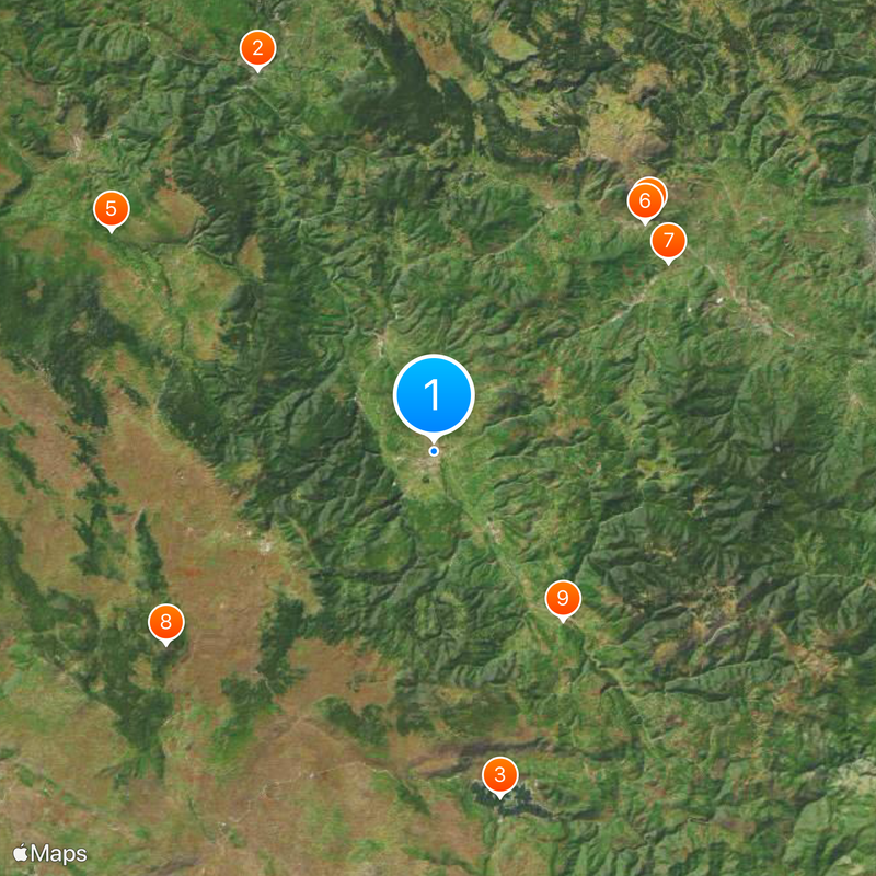
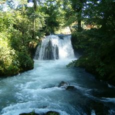
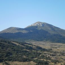
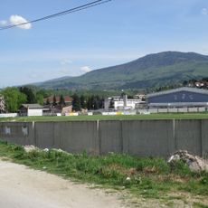
Bugojno is an administrative center in Central Bosnia Canton situated at 548 meters elevation along the Vrbas River, surrounded by mountain peaks including Stožer, Kalin, and Rudina. The town serves as the economic and administrative hub of a region shaped by its river valley and mountain setting.

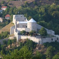
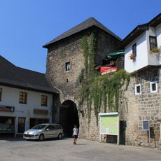
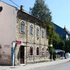
Bugojno developed during Ottoman times and later became an important administrative center under Austro-Hungarian rule. The modern town structure emerged in the 20th century through significant demographic shifts and social transformations.

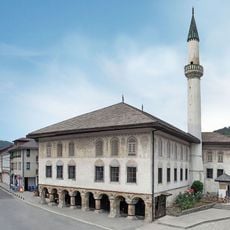
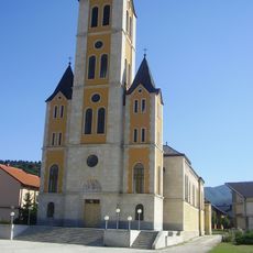
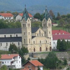
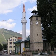
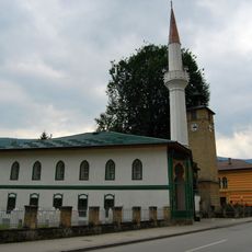
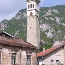
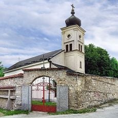
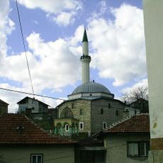
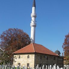
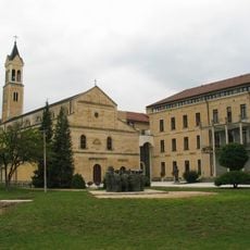
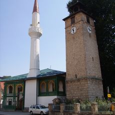
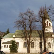
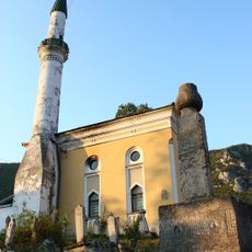
The town displays religious diversity through its houses of worship: the Princess Gevher Mosque, Sultan Ahmed Mosque, and Saint Anthony of Padua Church stand as reminders of different faith traditions that have shaped community life here.

The region experiences warm summers with temperatures above 30°C and cold winters with frost, which affects planning outdoor visits. Visitors should dress accordingly and expect that outdoor activities vary significantly depending on the season.

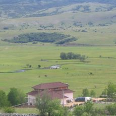
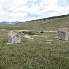
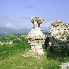
The surrounding forests of Duboka Valley and Kalin Mountain contain hunting grounds that form part of the local recreational heritage. These wooded landscapes contribute to the region's connection to traditional outdoor pursuits and its wilder character.

The community of curious travelers

AroundUs brings together thousands of curated places, local tips, and hidden gems, enriched daily by 60,000 contributors worldwide.

Start exploring
Elevation above the sea
548 m
GPS coordinates
44.05722,17.45083
Latest update
March 4, 2026 16:15
Around this place
Pliva Waterfall
Bosnia and Herzegovina

Pliva Waterfall

34.4 km
Rama Lake
Bosnia and Herzegovina

Rama Lake

28.8 km
Travnik Castle
Bosnia and Herzegovina

Travnik Castle

26.1 km
Janjske Otoke
Bosnia and Herzegovina

Janjske Otoke

32 km
Mosque Sulejmanija
Bosnia and Herzegovina

Mosque Sulejmanija

25.5 km
Necropolis for the victims of Fascism
Bosnia and Herzegovina

Necropolis for the victims of Fascism

24.7 km
Malovan
Bosnia and Herzegovina

Malovan

27 km
Church of the Assumption of the Blessed Virgin Mary, Uskoplje
Bosnia and Herzegovina

Church of the Assumption of the Blessed Virgin Mary, Uskoplje

17.4 km
Guča Gora Monastery
Bosnia and Herzegovina

Guča Gora Monastery

30.3 km
Saint Anthony of Padua church in Bugojno
Bosnia and Herzegovina

Saint Anthony of Padua church in Bugojno

540 m
Gradski Stadion Vitez
Bosnia and Herzegovina

Gradski Stadion Vitez

29 km
Clock tower in Gornja Čaršija (Travnik)
Bosnia and Herzegovina

Clock tower in Gornja Čaršija (Travnik)

25.1 km
Hacı Ali Bey Mosque, Travnik
Bosnia and Herzegovina

Hacı Ali Bey Mosque, Travnik

25.2 km
Clock tower in Musala (Travnik)
Bosnia and Herzegovina

Clock tower in Musala (Travnik)

24.5 km
Crkva Uspenja presvete Bogorodice u Travniku
Bosnia and Herzegovina

Crkva Uspenja presvete Bogorodice u Travniku

25.2 km
Yeni mosque
Bosnia and Herzegovina

Yeni mosque

24.5 km
Ahmed-aga mosque
Bosnia and Herzegovina

Ahmed-aga mosque

29.2 km
Galečka Ćuprija
Bosnia and Herzegovina

Galečka Ćuprija

33.8 km
Šćit
Bosnia and Herzegovina

Šćit

29.1 km
Hacı Ali Bey Camii, Travnik
Bosnia and Herzegovina

Hacı Ali Bey Camii, Travnik

24.5 km
Necropolis of Ravanjska Vrata
Bosnia and Herzegovina

Necropolis of Ravanjska Vrata

24.3 km
Clock Tower of Donji Vakuf
Bosnia and Herzegovina

Clock Tower of Donji Vakuf

10.5 km
Roman Catholic St.John the Baptist church in Travnik
Bosnia and Herzegovina

Roman Catholic St.John the Baptist church in Travnik

25.6 km
Fortress of Prusac
Bosnia and Herzegovina

Fortress of Prusac

7.1 km
Travnik Gate
Bosnia and Herzegovina

Travnik Gate

34.5 km
Hafizadićův dům
Bosnia and Herzegovina

Hafizadićův dům

25.4 km
Lončarica mosque
Bosnia and Herzegovina

Lončarica mosque

25.8 km

Show the full map
Reviews
Share your experience

No review yet

Discussions
Start a discussion...

No discussion yet

« Bugojno - Administrative center in Central Bosnia Canton, Bosnia and Herzegovina » is provided by Around Us (aroundus.com). Images and texts are derived from Wikimedia project under a Creative Commons license. You are allowed to copy, distribute, and modify copies of this page, under the conditions set by the license, as long as this note is clearly visible.

Discover hidden gems everywhere you go!

From secret cafés to breathtaking viewpoints, skip the crowded tourist spots and find places that match your style. Our app makes it easy with voice search, smart filtering, route optimization, and insider tips from travelers worldwide. Download now for the complete mobile experience.

Around Us App Screenshot

A unique approach to discovering new places

Le Figaro

All the places worth exploring

France Info

A tailor-made excursion in just a few clicks

20 Minutes

Around Us
Travel Guide & Maps
Download

Send to your phone

QR Code
1

Open the camera app on your mobile.

2

Point at the QR code with your camera. A notification will appear.

3

Tap the notification to open the link.