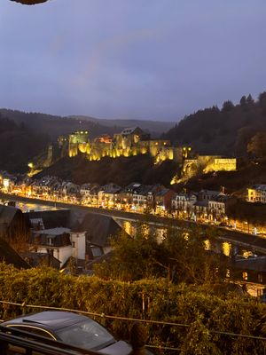
Bouillon, Medieval fortress town in Ardennes, Belgium.
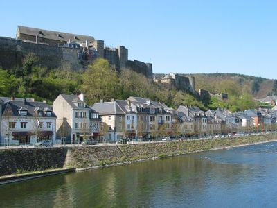
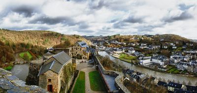
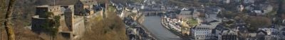
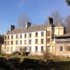
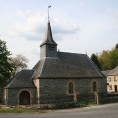
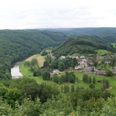
Bouillon is a town in the Belgian Ardennes situated along the Semois River, with several villages spread across its territory. The castle sits on a rocky outcrop above the valley, and the town has grown around this natural stronghold.
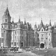
The town served as an important stronghold from the 8th century onward and underwent major change in the 1600s when French forces took control. Following this conquest, it became an independent duchy with its own government.
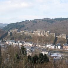
Bouillon Castle dominates the townscape and draws visitors who want to see the steep stone walls rising above the river valley. The fortress remains the central landmark that defines how locals and travelers understand this place today.
Spring and fall are the best times to visit, when temperatures are comfortable and crowds are smaller. The town sits near the French border and paths along the Semois River are accessible for walking and exploring the riverside landscape.
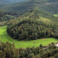
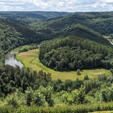
The river forms a sharp loop around the town that once aided defense and still shapes how the place is laid out. This natural curve is so pronounced that it becomes especially visible from the heights surrounding Bouillon.
Location: Arrondissement of Neufchâteau
Capital city: Bouillon
Elevation above the sea: 221 m
Operator: Ville de Bouillon
Part of: Police Zone Semois et Lesse, Emergency zone Luxembourg
Shares border with: Florenville, Bertrix, Paliseul, Bièvre, Vresse-sur-Semois, Fleigneux, Illy, La Chapelle, Villers-Cernay, Francheval, Pouru-aux-Bois, Escombres-et-le-Chesnois, Bazeilles
Address: Bouillon, Belgium
Phone: +3261467411
Email: commune@bouillon.be
Website: https://bouillon.be
GPS coordinates: 49.79556,5.06806
Latest update: December 7, 2025 09:22
Chateau des Amerois
7.9 km
Bouillon Castle
294 m
Tombeau du Géant
2.7 km
Château d'Olly
8.7 km
Abbey of Cordemois
1.5 km
Vallée de la Semois National Park
11.9 km
Château d'Herbeumont
12 km
Château de Lamecourt
13.1 km
Église Saint-Firmin de Rochehaut
6.7 km
Pont Saint-Lambert
12.6 km
Église de Floing
12.9 km
Chapelle Saint-Roch de Paliseul
13.2 km
Chapelle Saint-Monon de Cornimont
9 km
Saint-Lambert church
13 km
Église des Saints-Pierre-et-Paul
38 m
Saint-Agatha church
12.4 km
Église Notre-Dame de La Moncelle
13.3 km
Église Notre-Dame de Fleigneux
10.1 km
Église Saint-Remi de Givonne
10 km
Saint Hubertus church of Mortehan
10.2 km
Église Saint-Pierre d'Illy
10.2 km
Église Saint-Memmie de Saint-Menges
12 km
Église Notre-Dame d'Escombres-et-le-Chesnois
12 km
Église Saint-Remi de Rubécourt-et-Lamécourt
12.3 km
Église Saint-Étienne de Fond de Givonne
12.7 km
Église Saint-Mathieu de La Chapelle
7.2 km
Château d'Olly
8.6 km
Meander of the Semois river at Frahan
6.7 kmVisited this place? Tap the stars to rate it and share your experience / photos with the community! Try now! You can cancel it anytime.
Discover hidden gems everywhere you go!
From secret cafés to breathtaking viewpoints, skip the crowded tourist spots and find places that match your style. Our app makes it easy with voice search, smart filtering, route optimization, and insider tips from travelers worldwide. Download now for the complete mobile experience.
A unique approach to discovering new places❞
— Le Figaro
All the places worth exploring❞
— France Info
A tailor-made excursion in just a few clicks❞
— 20 Minutes