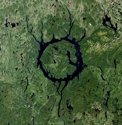
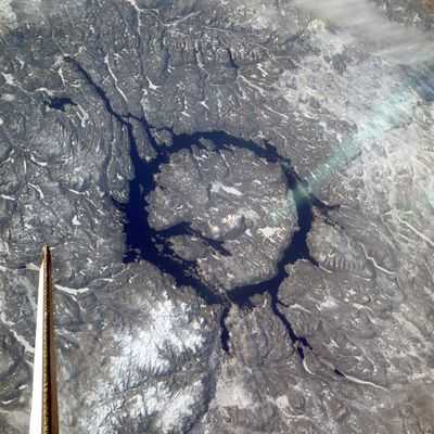
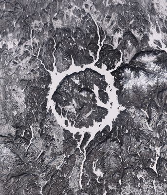
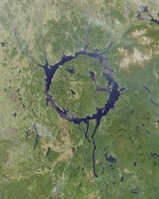
Manicouagan Reservoir, Circular reservoir in Quebec, Canada.
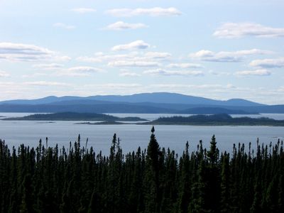
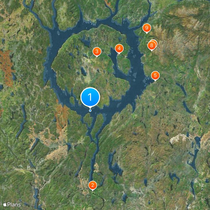
Manicouagan Reservoir is a ring-shaped body of water covering 1,942 square kilometers (750 square miles) in Quebec, Canada, encircling Île René-Levasseur at its center. Mount Babel rises on this central island, reaching a height of 952 meters (3,123 feet) above sea level, while the water surface surrounds the mainland in a wide arc.
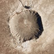
A meteorite impact 214 million years ago created a crater that filled with water over time and became a lake. The construction of the Daniel Johnson Dam in 1971 enlarged the natural water body and shaped it into its present form by damming the Manicouagan River.
The name comes from the Innu language and refers to tree bark used in traditional canoe building, showing the connection to the indigenous culture of this region. This linguistic origin recalls the long presence of native peoples in this part of Quebec, long before the reservoir was created.
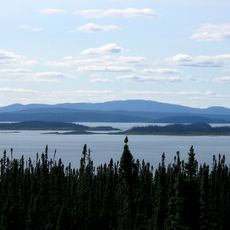
The Daniel Johnson Dam regulates water levels and generates electricity through several power stations along the river. The area is remote, and access roads mainly lead to the power generation facilities and a few viewpoints along the shore.
The circular shape forms a ring of water visible from space and has become known as the Eye of Quebec. Satellite images show the nearly perfect round structure created by the ancient meteorite crater.
Location: Manicouagan
Location: Caniapiscau Regional County Municipality
Elevation above the sea: 346 m
GPS coordinates: 51.12722,-68.74722
Latest update: December 4, 2025 23:04
Daniel-Johnson Dam
53.5 km
Louis-Babel Ecological Reserve
36.2 km
Réservoir Pipmuacan
195.7 km
Clarke City
181.9 km
Manicouagan Uapishka Biosphere Reserve
214.5 km
Rivière-Pentecôte
186.9 km
Matamec Ecological Reserve
217.7 km
Port-Cartier–Sept-Îles Wildlife Reserve
121.5 km
Uapishka Biodiversity Reserve
72.1 km
Lake Sainte-Anne
126 km
Church of St Amelia
216.7 km
Vieux Poste de Sept-Îles
194.3 km
Sainte-Félicité Church
267.5 km
Pointe-des-Monts Lighthouse
223.3 km
St. John Eudes Cathedral, Baie-Comeau
218.4 km
Matane Lighthouse
267.6 km
Cap-Chat Lighthouse
268.3 km
Phare de l'Île aux Œufs
201.3 km
Réservoir Manic 2
182.7 km
Church of St Norbert
269.6 km
Sculptures de fer et sentiers en forêt
189.2 km
Secteur institutionnel de l'Église-Saint-Édouard
268.2 km
Saint-Jérôme Church
268.2 km
Les-Saints-Sept-Frères Church
268.3 km
Saint-Édouard Church
268.1 km
Pont Touzel
285.5 km
Batture aux Outardes
233.8 km
Les Saints-Sept-Frères
268.3 kmReviews
Visited this place? Tap the stars to rate it and share your experience / photos with the community! Try now! You can cancel it anytime.
Discover hidden gems everywhere you go!
From secret cafés to breathtaking viewpoints, skip the crowded tourist spots and find places that match your style. Our app makes it easy with voice search, smart filtering, route optimization, and insider tips from travelers worldwide. Download now for the complete mobile experience.
A unique approach to discovering new places❞
— Le Figaro
All the places worth exploring❞
— France Info
A tailor-made excursion in just a few clicks❞
— 20 Minutes