Coffre ${chestReward.rarityLabel}
+${chestReward.xp} XP
Explorer
NOUVEAU ×${chestReward.collectible.quantity}
tapez pour fermer
Chest locked

Open chests in the app

Around Us is built for your phone — chests unlock when you walk, explore and capture nearby places.

Enable Location

We need your location to show you interesting places around you

Discover nearby places

Find interesting locations and hidden gems around you

Precise directions

Get accurate directions and distances to places

Your location is never shared with other users. It's only used when you tap the location button.

Mississippi River drainage basin

Log in to your account

Start exploring — it's free

Trusted by 72,060 travelers worldwide

Continue with Google
Continue with Apple
or

We will send you a code to connect

By continuing, you accept our Terms and Conditions and our Privacy Policy

Check your inbox

We've sent a pincode in your inbox. Please enter the code below.

Mississippi River drainage basin
Discussion Reviews 1 Photos
78.6k Popularity

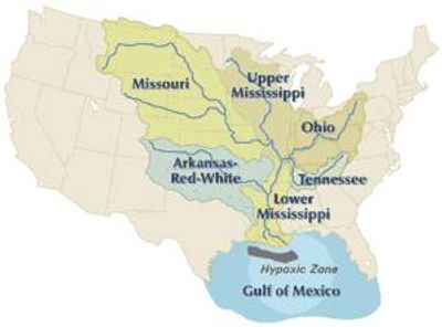
Mississippi River drainage basin, Drainage basin in central North America.

The Mississippi River drainage basin is a drainage system in central North America that gathers water from the Rocky Mountains to the Appalachian range through a network of rivers feeding into the main channel. Major tributaries including the Missouri, Ohio, and Arkansas flow into the Mississippi, forming a branching system that eventually empties into the Gulf of Mexico.

Indigenous groups used the waterways for thousands of years as routes for trade and travel between different regions. European explorers mapped the system starting in the 16th century, and later settlements grew along the banks, depending on access to the water.

The basin connects diverse agricultural communities, from Minnesota's grain fields to Louisiana's cotton plantations, fostering regional trade and economic interdependence.

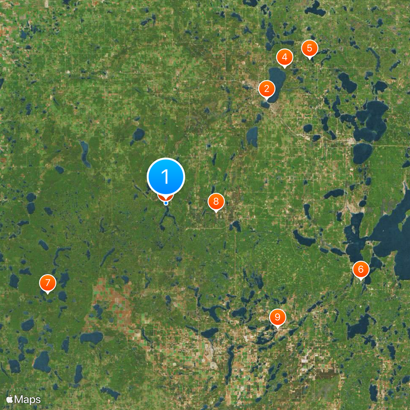
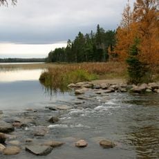
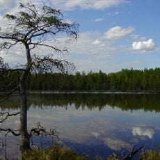
The system can be experienced at different points, from riverside paths in cities to overlooks in rural areas, with water levels varying by season and rainfall. Information about access points and conditions is available at visitor centers along the main rivers.

The basin provides drinking water to around 18 million people and irrigates farmland across several climate zones. The width of the waterway varies greatly, from narrow channels in the upper reaches to wide sections near the mouth.

The community of curious travelers

AroundUs brings together thousands of curated places, local tips, and hidden gems, enriched daily by 60,000 contributors worldwide.

Start exploring
Location
Part of
Gulf of Mexico Basin
Shares border with
Rio Grande basin, Colorado River drainage basin, Columbia Basin, Nelson river basin, Saint Lawrence River basin
GPS coordinates
47.23972,-95.20750
Latest update
December 13, 2025 16:47
Around this place
Paul Bunyan and Babe the Blue Ox
United States of America

Paul Bunyan and Babe the Blue Ox

35.7 km
Itasca State Park
United States of America

Itasca State Park

2 m
Lake Bemidji State Park
United States of America

Lake Bemidji State Park

44.4 km
Waldsee
United States of America

Waldsee

50.1 km
Minnesota State Sanatorium for Consumptives
United States of America

Minnesota State Sanatorium for Consumptives

51.7 km
Tamarac National Wildlife Refuge
United States of America

Tamarac National Wildlife Refuge

36.6 km
Paul Bunyan State Forest
United States of America

Paul Bunyan State Forest

12.5 km
Nevis Tiger Muskie
United States of America

Nevis Tiger Muskie

41.3 km
Bemidji Carnegie Library
United States of America

Bemidji Carnegie Library

35.9 km
Beltrami County Courthouse
United States of America

Beltrami County Courthouse

35.8 km
Nymore Bridge
United States of America

Nymore Bridge

35.4 km
David Park House
United States of America

David Park House

36.9 km
Gran Evangelical Lutheran Church
United States of America

Gran Evangelical Lutheran Church

39.7 km
Hubbard County Courthouse
United States of America

Hubbard County Courthouse

37.2 km
Diamond Point Beach
United States of America

Diamond Point Beach

37.3 km
White Earth State Forest
United States of America

White Earth State Forest

21.3 km
Smoky Hills State Forest
United States of America

Smoky Hills State Forest

36.2 km
Lake Bemidji State Park CCC/NYA/Rustic Style Historic Resources
United States of America

Lake Bemidji State Park CCC/NYA/Rustic Style Historic Resources

43.5 km
Sandtrap Golf Course
United States of America

Sandtrap Golf Course

46.4 km
Norway Beach Swimming Area
United States of America

Norway Beach Swimming Area

54 km
Height of Land Lookout Tower
United States of America

Height of Land Lookout Tower

22.4 km
Schoolcraft Fire Tower
United States of America

Schoolcraft Fire Tower

21.1 km
Aiton Heights Fire Tower
United States of America

Aiton Heights Fire Tower

6.2 km
Nymore Beach
United States of America

Nymore Beach

36 km
Tulaby Lookout Tower
United States of America

Tulaby Lookout Tower

33.4 km
Kabekona Lookout Tower
United States of America

Kabekona Lookout Tower

25.1 km
Smoky Hills Lookout Tower
United States of America

Smoky Hills Lookout Tower

34.4 km
Pinewood Fire Tower
United States of America

Pinewood Fire Tower

40.9 km
Show the full map
Reviews
Share your experience

No review yet

Discussions
Start a discussion...

No discussion yet

« Mississippi River drainage basin - Drainage basin in central North America » is provided by Around Us (aroundus.com). Images and texts are derived from Wikimedia project under a Creative Commons license. You are allowed to copy, distribute, and modify copies of this page, under the conditions set by the license, as long as this note is clearly visible.

Discover hidden gems everywhere you go!

From secret cafés to breathtaking viewpoints, skip the crowded tourist spots and find places that match your style. Our app makes it easy with voice search, smart filtering, route optimization, and insider tips from travelers worldwide. Download now for the complete mobile experience.

Around Us App Screenshot

A unique approach to discovering new places

Le Figaro

All the places worth exploring

France Info

A tailor-made excursion in just a few clicks

20 Minutes

Around Us
Travel Guide & Maps
Download

Send to your phone

QR Code
1

Open the camera app on your mobile.

2

Point at the QR code with your camera. A notification will appear.

3

Tap the notification to open the link.