Pancake Bay Provincial Park, Provincial park on Lake Superior in Ontario, Canada
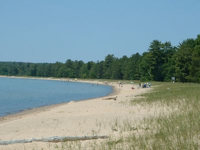
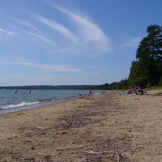
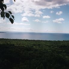
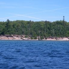
Pancake Bay Provincial Park is a protected area on the north shore of Lake Superior in Ontario featuring a broad sand beach. The park provides campsites, day-use areas, hiking trails, and water access for swimming and boating.
The area was established as a stopping point during the fur trade era when routes crossed the region. It was designated as a provincial park to protect the shoreline and natural landscape for public use.
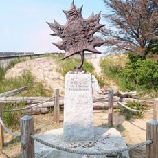
The name comes from fur trading days when travelers stopped here to cook pancakes during their journeys. This story remains part of the place's identity and visitors enjoy learning about this practical tradition.
The park is most active during warm months from late spring through early fall when swimming conditions are best. Parking areas, restroom facilities with showers, and a small store on-site help make visits comfortable and convenient.
The beach has fine sand and shallow waters that warm up faster than other areas of Lake Superior on sunny days. This makes the bay particularly appealing to families looking for more comfortable swimming conditions.
Location: Unorganized North Algoma District
Inception: 1968
Website: https://ontarioparks.com/park/pancakebay/fr
GPS coordinates: 46.96972,-84.69194
Latest update: December 9, 2025 18:47
Agawa Canyon
56.2 km
Great Lakes Shipwreck Museum
30 km
Whitefish Point Underwater Preserve
29.1 km
Whitefish Point Light
30 km
Point Iroquois Light
54.2 km
Crisp Point Light
49.3 km
SS John Mitchell
33.2 km
Whitefish Point Bird Observatory
30 km
Batchawana Bay Provincial Park
10.6 km
Ile Parisienne Light
36.2 km
Gros Cap Reefs Light
51.3 km
Sandy Islands Provincial Park
17.3 km
Sault Ste. Marie Canal office building
57.1 km
Ile Parisienne Conservation Reserve
31.2 km
Edmund Fitzgerald Memorial
29.9 km
The Machine Shop
56.9 km
Whitefish Point Lighthouse Historical Marker
29.9 km
Post Office Historical Marker
32.7 km
Whitefish Township Community Library
47.8 km
Lower Falls
56.6 km
Red River Expedition plaque
56.7 km
Sault Ste. Marie Canal superintendent's house
56.9 km
General Office Building of the Consolidated Lake Superior Company/Abiti-Price Head Office
56.9 km
Barnes Block
57 km
North West Company Lock
56.9 km
Great War of 1914-1918 Veteran's War Memorial
56.8 km
Algoma Central Engine House
55.6 km
Buchan House
52.3 kmVisited this place? Tap the stars to rate it and share your experience / photos with the community! Try now! You can cancel it anytime.
Discover hidden gems everywhere you go!
From secret cafés to breathtaking viewpoints, skip the crowded tourist spots and find places that match your style. Our app makes it easy with voice search, smart filtering, route optimization, and insider tips from travelers worldwide. Download now for the complete mobile experience.
A unique approach to discovering new places❞
— Le Figaro
All the places worth exploring❞
— France Info
A tailor-made excursion in just a few clicks❞
— 20 Minutes