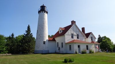
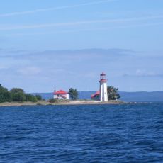
Point Iroquois Light, Lighthouse in Bay Mills Township, Michigan
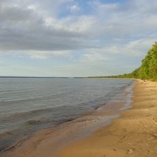
Point Iroquois Light is a white brick tower situated on a bluff marking the boundary between Whitefish Bay and the western end of the St. Marys River. The structure houses a museum displaying period artifacts, navigational equipment, and the original fourth-order Fresnel lens that once projected light across Lake Superior.
A wooden lighthouse was built in 1856 and operated until 1870, when the current white brick structure was constructed to better guide vessels through these waters. The replacement reflected growing shipping traffic on the Great Lakes and the need for more reliable light signaling technology.
The name references the Iroquois people who inhabited these Great Lakes waters, connecting this lighthouse to the region's indigenous heritage. Today, visitors experience how this structure has become woven into the local identity and sense of place along Lake Superior.
The site is accessible from May through October, and visitors should know that the stairs are steep and narrow, particularly when multiple people are climbing at once. Wearing comfortable shoes and allowing time for the climb and viewing from the top is recommended.
Visitors often spot a family of black bears near the site, as they roam the wooded areas of this coastal region regularly. These wildlife encounters add an unexpected element of nature to the visit and remind people of the wild setting beyond the tower.
The community of curious travelers
AroundUs brings together thousands of curated places, local tips, and hidden gems, enriched daily by 60,000 contributors worldwide.