Brimley State Park, State park in Brimley, Michigan, US
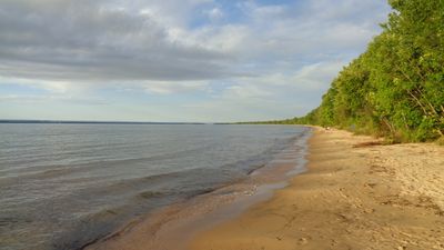
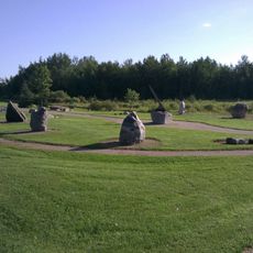
Brimley State Park is a 160-acre property stretching along Whitefish Bay on Lake Superior's shore in Michigan. The park features a sandy beach, boat launch facilities, and designated camping areas for overnight stays.
The park came into existence in 1923 when the Village of Brimley transferred the original land to the state's Department of Natural Resources. This action made it one of the first state parks in the Upper Peninsula and part of Michigan's early conservation movement.
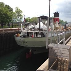
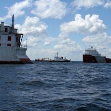
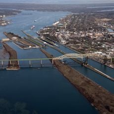
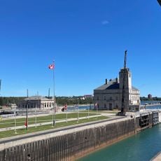
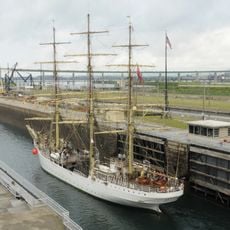
The location on Whitefish Bay draws visitors to watch large cargo ships passing through the waterway while taking in views across Lake Superior toward Canada. This working landscape shows how people continue to use the shore for both recreation and commerce.
Vehicle entry requires a Recreation Passport, and the park maintains quiet hours from 10 PM to 8 AM in camping areas to protect the setting for all guests. Planning your visit around these guidelines helps ensure a pleasant experience whether you camp or day-visit.
Several trout streams run through the surrounding bays and rivers within the Hiawatha National Forest, lying just a short drive from the park's boundaries. These hidden waterways attract anglers looking for quieter fishing opportunities away from the main lake.
Location: Michigan
Inception: 1923
Website: http://michigandnr.com/parksandtrails/Details.aspx?id=414&type=SPRK
GPS coordinates: 46.41610,-84.55640
Latest update: December 12, 2025 07:55
Soo Locks
18.6 km
Point Iroquois Light
9.6 km
Fort Brady
18.8 km
Holy Name of Mary Pro-Cathedral
18.9 km
Whitefish Island
18.8 km
Delirium Wilderness
16.9 km
Gros Cap Reefs Light
11.6 km
Old Federal Building
18.8 km
International Bridge Walk
18.1 km
Chippewa County Courthouse
18.6 km
First United Presbyterian Church
18.3 km
Soo Lock Visitors Center
18.4 km
Adams Building
18.4 km
Poe Lock
18.5 km
Soo Theatre
18.3 km
New Fort Brady Historical Marker
17.3 km
Saint Mary's Pro-Cathedral Historical Marker
18.9 km
War Memorial Hospital
18.3 km
Ronald J. Calery Community Action Center
18.3 km
W.F.G. (Bud) Weber Park
18.2 km
Washington Elementary School
17.2 km
Sault Ste. Marie Canal superintendent's house
18.9 km
Superior District Library
18.2 km
Lake Superior State College Historical Marker
17.1 km
New Fort Brady
17.4 km
Central Methodist Church Historical Marker
17.9 km
Sault Area Middle School
17.6 km
Natural Science Park
17.7 kmVisited this place? Tap the stars to rate it and share your experience / photos with the community! Try now! You can cancel it anytime.
Discover hidden gems everywhere you go!
From secret cafés to breathtaking viewpoints, skip the crowded tourist spots and find places that match your style. Our app makes it easy with voice search, smart filtering, route optimization, and insider tips from travelers worldwide. Download now for the complete mobile experience.
A unique approach to discovering new places❞
— Le Figaro
All the places worth exploring❞
— France Info
A tailor-made excursion in just a few clicks❞
— 20 Minutes