Enable Location

We need your location to show you interesting places around you

Discover nearby places

Find interesting locations and hidden gems around you

Precise directions

Get accurate directions and distances to places

Your location is never shared with other users. It's only used when you tap the location button.

Delirium Wilderness

Log in to your account

Start exploring — it's free

Trusted by 61,366 travelers worldwide

Continue with Google
Continue with Apple
or

We will send you a code to connect

By continuing, you accept our Terms and Conditions and our Privacy Policy

Check your inbox

We've sent a pincode in your inbox. Please enter the code below.

Delirium Wilderness

Delirium Wilderness, Protected wilderness area in Chippewa County, Michigan.

Description

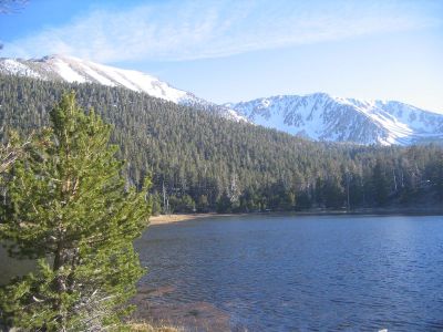
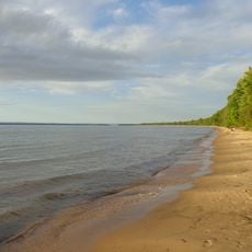
Delirium Wilderness is a protected conservation area in Chippewa County covering 11,870 acres of flat to rolling terrain dominated by dense swamp forests. The landscape supports a range of wildlife including black bears, deer, and numerous bird species throughout the year.

History

The Michigan Wilderness Act of 1987 designated this area as protected land, converting former logging operations into a conservation zone. Since then, the forest has recovered naturally without human intervention or development.

Culture

The Great Lakes Indian Fish & Wildlife Commission and the U.S. Forest Service work together to manage these lands, reflecting the region's indigenous heritage and ongoing conservation efforts. This collaboration shapes how the wilderness is protected and valued by local communities today.

Practical

This wilderness has no marked trails and visitors need both digital and paper maps to navigate the challenging wetland terrain. You should prepare for difficult conditions with water and dense vegetation throughout the area.

Did you know?

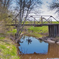
The area contains Delirium Pond and Sylvester Pond along with the headwaters of both the Pine and Waiska Rivers, forming a complex water system. These river sources are crucial for the water flows that sustain the broader regional ecosystem.

Location
GPS coordinates
46.30080,-84.69940
Latest update
December 14, 2025 09:45

AroundUs brings together thousands of curated places, local tips, and hidden gems, enriched daily by 60,000 contributors worldwide. Discover all places nearby (Michigan).

Around this place
Soo Locks
United States of America

Soo Locks

35 km
Point Iroquois Light
United States of America

Point Iroquois Light

21.1 km
Fort Brady
United States of America

Fort Brady

35.2 km
Brimley State Park
United States of America

Brimley State Park

16.9 km
Gros Cap Reefs Light
Canada

Gros Cap Reefs Light

24.4 km
Old Federal Building
United States of America

Old Federal Building

35.2 km
International Bridge Walk
United States of America

International Bridge Walk

34.6 km
Chippewa County Courthouse
United States of America

Chippewa County Courthouse

34.9 km
M-28–Tahquamenon River Bridge
United States of America

M-28–Tahquamenon River Bridge

20.6 km
First United Presbyterian Church
United States of America

First United Presbyterian Church

34.6 km
Mackinac Trail – Carp River Bridge
United States of America

Mackinac Trail – Carp River Bridge

31.5 km
Soo Lock Visitors Center
United States of America

Soo Lock Visitors Center

34.9 km
Adams Building
United States of America

Adams Building

34.8 km
Lipsett Hardware Building
United States of America

Lipsett Hardware Building

30.5 km
Parker Road–Charlotte River Bridge
United States of America

Parker Road–Charlotte River Bridge

32.2 km
Poe Lock
United States of America

Poe Lock

34.9 km
Soo Theatre
United States of America

Soo Theatre

34.6 km
Ronald J. Calery Community Action Center
United States of America

Ronald J. Calery Community Action Center

34.7 km
New Fort Brady Historical Marker
United States of America

New Fort Brady Historical Marker

33.7 km
War Memorial Hospital
United States of America

War Memorial Hospital

34.7 km
Washington Elementary School
United States of America

Washington Elementary School

33.6 km
W.F.G. (Bud) Weber Park
United States of America

W.F.G. (Bud) Weber Park

34.5 km
New Fort Brady
United States of America

New Fort Brady

33.8 km
Superior District Library
United States of America

Superior District Library

34.6 km
Lake Superior State College Historical Marker
United States of America

Lake Superior State College Historical Marker

33.5 km
Central Methodist Church Historical Marker
United States of America

Central Methodist Church Historical Marker

34.1 km
Sault Area Middle School
United States of America

Sault Area Middle School

33.6 km
Natural Science Park
United States of America

Natural Science Park

33.7 km
Show the full map
« Delirium Wilderness - Protected wilderness area in Chippewa County, Michigan » is provided by Around Us (aroundus.com). Images and texts are derived from Wikimedia project under a Creative Commons license. You are allowed to copy, distribute, and modify copies of this page, under the conditions set by the license, as long as this note is clearly visible.

Discover hidden gems everywhere you go!

From secret cafés to breathtaking viewpoints, skip the crowded tourist spots and find places that match your style. Our app makes it easy with voice search, smart filtering, route optimization, and insider tips from travelers worldwide. Download now for the complete mobile experience.

Around Us App Screenshot

A unique approach to discovering new places

Le Figaro

All the places worth exploring

France Info

A tailor-made excursion in just a few clicks

20 Minutes

Around Us
Travel Guide & Maps
Download

Send to your phone

QR Code
1

Open the camera app on your mobile.

2

Point at the QR code with your camera. A notification will appear.

3

Tap the notification to open the link.