Enable Location

We need your location to show you interesting places around you

Discover nearby places

Find interesting locations and hidden gems around you

Precise directions

Get accurate directions and distances to places

Your location is never shared with other users. It's only used when you tap the location button.

West Toronto RailPath

Log in to your account

Start exploring — it's free

Trusted by 62,299 travelers worldwide

Continue with Google
Continue with Apple
or

We will send you a code to connect

By continuing, you accept our Terms and Conditions and our Privacy Policy

Check your inbox

We've sent a pincode in your inbox. Please enter the code below.

West Toronto RailPath

West Toronto RailPath, multi-use trail in Toronto, Canada

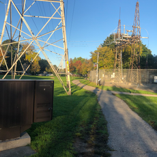
The West Toronto RailPath is an asphalt trail stretching about 2.1 kilometers along a former rail corridor used for walking, running, and cycling. The flat route has nine access points and passes alongside GO train tracks while connecting different neighborhoods throughout the city.

The trail follows a former railway line that once cut through the area's industrial core, carrying goods and passengers for the region. The first section opened in 2009, with expansions later planned to extend from Dundas Street West toward Liberty Village.

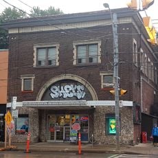
The trail runs through the Junction Triangle, a neighborhood deeply shaped by its railway history and industrial past. Street art by local artists covers the walls and barriers, reflecting the community's creative spirit and changing character.

The trail has bike share stations located at several points and features level access from Bloor Station via ramps and stairs leading directly to the path. The asphalt surface works well for bikes, strollers, and wheelchairs, and the trail stays open year-round.

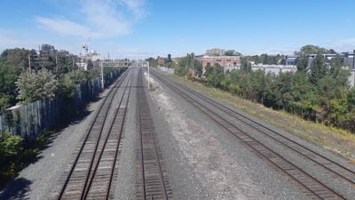
The Wallace Avenue footbridge from 1907 is a rare protected heritage structure that was originally meant to be temporary but has survived for over a century. The bridge offers a clear view of passing trains and serves as a popular spot for photos and connecting with the area's railway history.

The community of curious travelers

AroundUs brings together thousands of curated places, local tips, and hidden gems, enriched daily by 60,000 contributors worldwide.

Start exploring
Location
GPS coordinates
43.66120,-79.45380
Latest update
February 7, 2026 11:01
« West Toronto RailPath - multi-use trail in Toronto, Canada » is provided by Around Us (aroundus.com). Images and texts are derived from Wikimedia project under a Creative Commons license. You are allowed to copy, distribute, and modify copies of this page, under the conditions set by the license, as long as this note is clearly visible.

Discover hidden gems everywhere you go!

From secret cafés to breathtaking viewpoints, skip the crowded tourist spots and find places that match your style. Our app makes it easy with voice search, smart filtering, route optimization, and insider tips from travelers worldwide. Download now for the complete mobile experience.

Around Us App Screenshot

A unique approach to discovering new places

Le Figaro

All the places worth exploring

France Info

A tailor-made excursion in just a few clicks

20 Minutes

Around Us
Travel Guide & Maps
Download

Send to your phone

QR Code
1

Open the camera app on your mobile.

2

Point at the QR code with your camera. A notification will appear.

3

Tap the notification to open the link.