Chest opened
+${chestReward.xp} XP
Explorer
NOUVEAU ×${chestReward.collectible.quantity}
tapez pour fermer
Chest locked

Open chests in the app

Around Us is built for your phone — chests unlock when you walk, explore and capture nearby places.

Enable Location

We need your location to show you interesting places around you

Discover nearby places

Find interesting locations and hidden gems around you

Precise directions

Get accurate directions and distances to places

Your location is never shared with other users. It's only used when you tap the location button.

Log in to your account

Start exploring — it's free

Trusted by 73,023 travelers worldwide

Continue with Google
Continue with Apple
or

We will send you a code to connect

By continuing, you accept our Terms and Conditions and our Privacy Policy

Check your inbox

We've sent a pincode in your inbox. Please enter the code below.

5e arrondissement de Bangui
Discussion Reviews Photo
1.6k Popularity

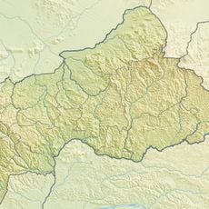
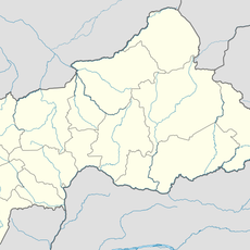
5e arrondissement de Bangui, Administrative district in Bangui, Central African Republic.

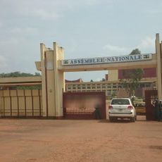
The 5th district is an administrative area in Bangui located along Avenue des Martyrs and bordered by Bangui-Mpoko Airport. It is divided into 27 distinct neighborhoods spread across a central-western section of the city.

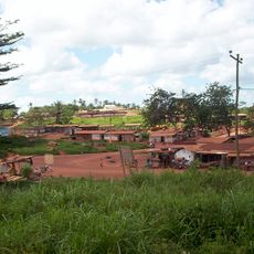
The district grew into the most populated area of Bangui through major urban expansion in the late 20th century. This development period shaped how the neighborhood is structured and organized today.

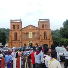
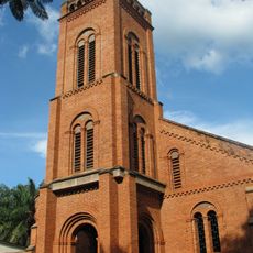
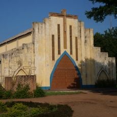
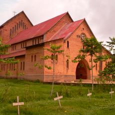
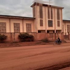
Religious buildings like Saint Michel de Bazanga Church and ELIM Bangui-Mpoko Church are central gathering places for different communities in the district. These structures shape the spiritual life of residents and form important landmarks in the neighborhood.

A community hospital on Avenue des Martyrs serves as one of the main medical centers in the city. This makes the area a practical destination for basic healthcare needs for residents and visitors.

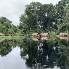
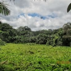
The Sapek Canal cuts through the district from north to south in a path that locals cross regularly. This waterway is notable for how it divides the area and affects everyday movement patterns of residents.

The community of curious travelers

AroundUs brings together thousands of curated places, local tips, and hidden gems, enriched daily by 60,000 contributors worldwide.

Start exploring
GPS coordinates
4.39222,18.54806
Latest update
December 14, 2025 13:00
Around this place
Cameroon

Lom Pangar Dam

569.1 km
Nouabalé-Ndoki National Park
Congo

Nouabalé-Ndoki National Park

310.1 km
Dzanga-Sangha Special Reserve
Central African Republic

Dzanga-Sangha Special Reserve

268.1 km
Dzanga-Ndoki National Park
Central African Republic

Dzanga-Ndoki National Park

338.2 km
Cathédrale Notre-Dame
Central African Republic

Cathédrale Notre-Dame

4.1 km
Mbeli Bai
Congo

Mbeli Bai

335.8 km
Lobéké National Park
Cameroon

Lobéké National Park

391.9 km
Odzala National Park
Congo

Odzala National Park

567 km
Manovo-Gounda St. Floris National Park
Central African Republic

Manovo-Gounda St. Floris National Park

561.8 km
Sangha Trinational
Central African Republic

Sangha Trinational

312.2 km
Jardin Botanique d'Eala
Congo, Democratic Republic of the

Jardin Botanique d'Eala

483.5 km
Central African Republic

Mont Ngaoui

476.4 km
Ntokou-Pikounda National Park
Congo

Ntokou-Pikounda National Park

501.8 km
Chutes de Boali
Central African Republic

Chutes de Boali

77.2 km
St. Peter Claver Cathedral, Bangassou
Central African Republic

St. Peter Claver Cathedral, Bangassou

474.5 km
Mbaéré Bodingué National Park
Central African Republic

Mbaéré Bodingué National Park

165.5 km
Mbéré Valley National Park
Cameroon

Mbéré Valley National Park

506.6 km
Ngoyla Faunal Reserve
Cameroon

Ngoyla Faunal Reserve

567.2 km
Sacred Heart Cathedral, Moundou
Chad

Sacred Heart Cathedral, Moundou

538.2 km
Sts. Peter and Paul Cathedral, Basankusu
Congo, Democratic Republic of the

Sts. Peter and Paul Cathedral, Basankusu

379.4 km
Chutes de Lancrenon
Central African Republic

Chutes de Lancrenon

478.2 km
Gribingui Bamingui Faunal Reserve
Central African Republic

Gribingui Bamingui Faunal Reserve

386.7 km
Bouar megaliths
Central African Republic

Bouar megaliths

401.9 km
Bouar Sub-Prefecture
Central African Republic

Bouar Sub-Prefecture

386.1 km
Chutes de Djamila
Central African Republic

Chutes de Djamila

125.2 km
National Assembly of the Central African Republic building
Central African Republic

National Assembly of the Central African Republic building

1.6 km
Ville de Lomié
Cameroon

Ville de Lomié

564.5 km
Cathedral of Our Lady of the Immaculate Conception, Batouri
Cameroon

Cathedral of Our Lady of the Immaculate Conception, Batouri

464.2 km
Show the full map
Reviews
Share your experience

No review yet

Discussions
Start a discussion...

No discussion yet

« 5e arrondissement de Bangui - Administrative district in Bangui, Central African Republic » is provided by Around Us (aroundus.com). Images and texts are derived from Wikimedia project under a Creative Commons license. You are allowed to copy, distribute, and modify copies of this page, under the conditions set by the license, as long as this note is clearly visible.

Discover hidden gems everywhere you go!

From secret cafés to breathtaking viewpoints, skip the crowded tourist spots and find places that match your style. Our app makes it easy with voice search, smart filtering, route optimization, and insider tips from travelers worldwide. Download now for the complete mobile experience.

Around Us App Screenshot

A unique approach to discovering new places

Le Figaro

All the places worth exploring

France Info

A tailor-made excursion in just a few clicks

20 Minutes

Around Us
Travel Guide & Maps
Download

Send to your phone

QR Code
1

Open the camera app on your mobile.

2

Point at the QR code with your camera. A notification will appear.

3

Tap the notification to open the link.