Altberg, Mountain summit in Zürich, Switzerland
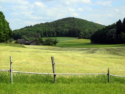
Altberg is a mountain summit situated between the Limmattal and Furttal valleys, reaching 631 meters in elevation with multiple hiking paths crossing its slopes. The hillsides offer open views across the Zurich region and remain accessible to walkers of different abilities.
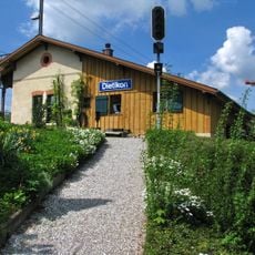
The mountain was originally part of the Alemannic settlement of Tano, which later developed into Dänikon and became divided among monasteries and noble families. These early ownership patterns continue to shape land use in the region today.
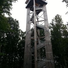
The construction of observation towers on Altberg since the 19th century reflects the local population's interest in appreciating the regional landscape views.
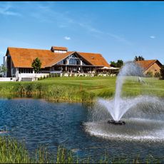
Several marked hiking trails cross the mountain, offering different route lengths depending on fitness level. A restaurant at the summit provides refreshment and traditional Swiss food for visitors.
A modern observation tower of about 30 meters stands on the ridge, providing panoramic views over the surrounding region. This recent structure has become a popular destination for visitors seeking elevated vantage points of the landscape.
Location: Zürich
Elevation above the sea: 631 m
GPS coordinates: 47.43366,8.42063
Latest update: December 14, 2025 14:21
Obere Kirche
3.2 km
Altberg Observation Tower
989 m
Festung Dietikon
3.3 km
Reformierte Kirche Regensdorf
3.4 km
Saint John catholic church
1.4 km
Roman manor with cryptoporticus
3.3 km
Weiningen
1.8 km
Guard house with waiting hall of the first station
3.1 km
Golfpark Otelfingen
2.5 km
Reformed church with rectory
1.9 km
Grien-Insel-Brücke (Kraftwerk Unterwasserkanal)
2.6 km
Reformierte Kirche Dällikon
1.6 km
Geroldswil
1.6 km
Karl-Heid-Strasse-Brücke (Kraftwerk Unterwasserkanal)
2.7 km
Oberwasserkanalbrücke (Kraftwerk Oberwasserkanal)
3 km
Moosweg, Neolithic grave
2.7 km
EWZ-Insel-Brücke (Kraftwerk Unterwasserkanal)
2.7 km
Reppisch-Spitz-Steg (Kraftwerk Unterwasserkanal)
2.3 km
Dotierkraftwerk Dietikon-Steg
3.1 km
Gemeindemuseum Regensdorf
3.3 km
Limmatbrücke (Ueberlandstrasse)
3 km
Weiningerstrasse-Brücke
3.4 km
Mutschellenstrasse-Brücke
2.6 km
A1/A3 Autobahnbrücken
1.9 km
Schachen-Steg
1.9 km
Sparrenberg country house with outbuildings
3 km
Schloss, ehemaliges Schulhaus
1.8 km
Strohdachhaus Hüttikon
2.9 kmVisited this place? Tap the stars to rate it and share your experience / photos with the community! Try now! You can cancel it anytime.
Discover hidden gems everywhere you go!
From secret cafés to breathtaking viewpoints, skip the crowded tourist spots and find places that match your style. Our app makes it easy with voice search, smart filtering, route optimization, and insider tips from travelers worldwide. Download now for the complete mobile experience.
A unique approach to discovering new places❞
— Le Figaro
All the places worth exploring❞
— France Info
A tailor-made excursion in just a few clicks❞
— 20 Minutes