Piz Lischana, Alpine summit in Grisons, Switzerland
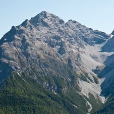
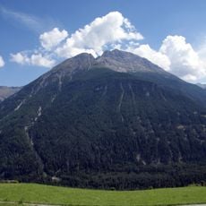
Piz Lischana is a 3,105-metre summit in the Sesvenna Range above Scuol, the highest point of the range north of the Fuorcla Sesvenna (2,819 m). Its south-east ridge rises from the Fuorcla de Rims (2,940 m) past an intermediate top at 3,044 m, and the summit pyramid lost about 2,000 cubic metres of rock in a 2011 collapse.
On 31 July 2011 about 2,000 cubic metres of rock broke from the eastern side of the summit tower and fell into the Val de Triazza; a party that had just left the summit filmed the collapse. Fearing further falls, the authorities closed the summit area until 2016 and re-routed the path from the saddle below the summit, marking it with red dots.
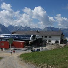
The Chamanna Lischana, a hut of the Swiss Alpine Club at 2,500 m, is the usual starting point for the normal route, which continues over the Fuorcla de Rims (2,940 m) and the south-east ridge. Its Vallader name is Chamonna Lischana, and the path up from San Jon, above Scuol on the far side of the Inn, passes it.
The normal route leaves Chamanna Lischana (about 2,500 m) for the Fuorcla de Rims at 2,940 m, then follows the South-East ridge over the intermediate summit at pt. 3044. It is graded T3+ or T4 on the Swiss Hiking Scale, so sure footwork is needed. The final section was re-routed with red dot marks after the 2011 rockfall. Longer approaches come from S-charl via Fora dal'Aua or Val d'Uina.
The plateau between Piz Lischana and the Lai da Rims once held the 4 km² Vadret de Lischana glacier. Only two relics remain: the Vadret de Triazza below the south-east ridge and the ice patch still called Vadret Lischana above the Chamanna Lischana.
The community of curious travelers
AroundUs brings together thousands of curated places, local tips, and hidden gems, enriched daily by 92,926 contributors worldwide.